Forecast for the Moab Area Mountains

Issued by Eric Trenbeath for
Saturday, December 19, 2015
Saturday, December 19, 2015
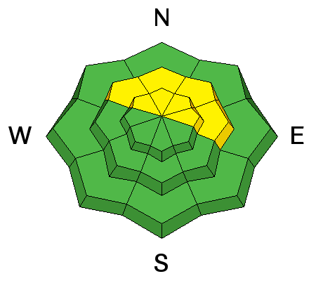
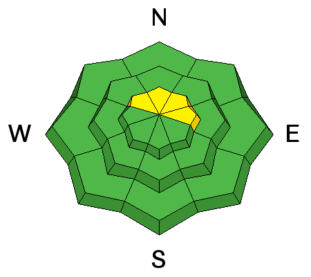
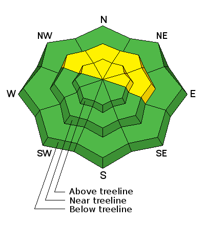
A MODERATE and very tricky avalanche danger exists on slopes steeper than 35 degrees that face NW-N-E due to the presence of buried persistent weak layers in the snowpack. These areas are best avoided due to the very real potential for triggering a dangerous persistent slab avalanche. Also be alert to a rising MODERATE danger for recently deposited wind slabs in upper elevation, wind exposed terrain primarily on the lee sides of ridge crests that face N-NE-E.
Low
Moderate
Considerable
High
Extreme
Learn how to read the forecast here