Observation Date
12/17/2015
Observer Name
Ted Scroggin, Eric McCwen
Region
Uintas » Bear River Ranger District » Whitney Basin » Double Hill
Location Name or Route
Whitney Basin-Double Hill
Weather
Sky
Few
Wind Direction
Southwest
Wind Speed
Light
Weather Comments
Chilly on the north slope today, single digits this morning and one of the colder days riding that I can remember. Mostly sunny till late afternoon with high thin clouds moving in and light ridgetop winds from the southwest.
Snow Characteristics
New Snow Depth
4"
New Snow Density
Low
Snow Surface Conditions
Powder
Wind Crust
Snow Characteristics Comments
The recent storm put down about 14-16" new snow and another few inches overnight have really helped the Whitney area look a little better for riding and turning. We were finding the riding and trail breaking a bit tough with all the new snow.
Red Flags
Red Flags
Recent Avalanches
Wind Loading
Cracking
Poor Snowpack Structure
Red Flags Comments
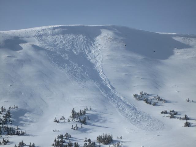
Plenty of recent natural avalanche activity to observe with one fairly fresh slide on a northeast aspect on Double Hill that ran several hundred feet. We did experience one collapse on a small test slope, that was also northeast facing. The Uintas did not come unglued with this first big storm, but many slopes might just need a trigger to get things going?
Avalanche Problem #1
Problem
Wind Drifted Snow
Trend
Same
Problem #1 Comments
Although winds today were fairly light, we could see the cold low density snow being blown around and continue to load many north through east facing slopes.
Avalanche Problem #2
Problem
Persistent Weak Layer
Trend
Same
Problem #2 Comments
Many slopes might just need a trigger to overload the weak snowpack.
Comments
This natural avalanche on Double Hill was likely the result of strong south winds that overloaded this northeast facing slope.
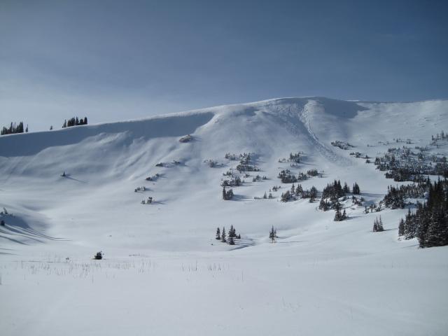
There was plenty of signs that the area went through a decent natural avalanche cycle, many of the slides have been filled back in from wind and new snow.
Today's Observed Danger Rating
Considerable
Tomorrows Estimated Danger Rating
Considerable