Observation: Cardiff Pass

Observation Date
12/15/2015
Observer Name
Tyler Falk
Region
Salt Lake » Little Cottonwood Canyon » Cardiff Pass
Location Name or Route
Cardiff Pass
Weather
Sky
Obscured
Precipitation
Light Snowfall
Wind Direction
Northwest
Wind Speed
Light
Weather Comments
Cold day with wind from the Northwest.
Snow Characteristics
New Snow Depth
20"
New Snow Density
Low
Snow Surface Conditions
Powder
Snow Characteristics Comments

Seams like some variability in distribution of the storm snow. In my travels I saw a range of depths of the new snow.

Red Flags
Red Flags
Heavy Snowfall
Wind Loading
Collapsing
Poor Snowpack Structure
Red Flags Comments
Loading seamed to continue into the evening. It was still snowing and blowing available snow around durring my late exit in upper LCC.
Avalanche Problem #1
Problem
Persistent Weak Layer
Problem #1 Comments

Weak snowpack structure out there.

Avalanche Problem #2
Problem
New Snow
Problem #2 Comments

Lots of new snow but did not seam like a huge weight in SWE. Around 40 to 50 cm of new snow above 9k in upper LCC.

Comments

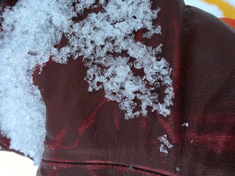
In traveling around Cardiff Pass this afternoon I found height of snow ranging from 70 cm at 9k on south aspects to 125 cm on North aspects just above 10k. Saw large depth hoar (3-4mm) on North aspects at 10k. (see picture below) Ski penetration is punchy and you can break through into old snow on shady aspects. East seams to be getting loaded. New snow was light as mentioned in the advisory this AM. A few quick tests on SW aspects around 10k failed on two different weak layers. ECTP17 Q2 (Resistant Planar) 10cm off ground on facets. Other results nearby, CT18 Q3 just below the storm snow, 40cm down. HS around 70 cm in this area on SW aspects. A few collapses with some cracking but not as much as expected. Picture is depth hoar on a North aspect at 10k.

Today's Observed Danger Rating
Considerable
Tomorrows Estimated Danger Rating
Considerable