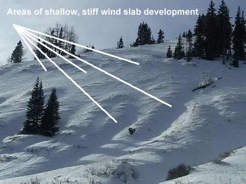
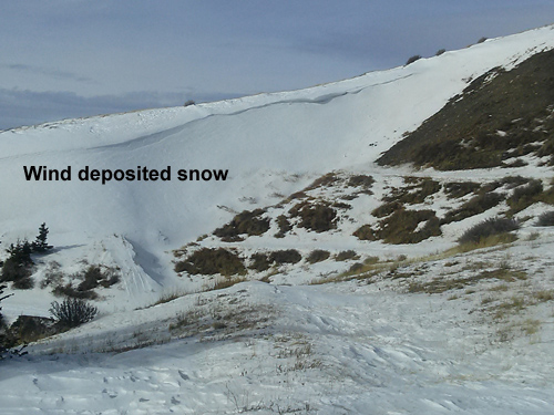
The mountains may pick up a couple of inches of snow today before the system moves off to the east. Winds will be on the increase shifting to the northwest, and high temps at 10,000' will be in the mid 20's. We'll see mostly sunny skies on Sunday as a brief ridge builds ahead of the next similar storm system that will affect our area on Monday.
Today
Snow likely, mainly before 11am. Mostly cloudy, with a high near 24. Windy, with a north northwest wind 10 to 20 mph increasing to 25 to 35 mph. Winds could gust as high as 45 mph. Chance of precipitation is 70%. Total daytime snow accumulation of 1 to 2 inches possible.
Tonight
A 20 percent chance of snow before 10pm. Partly cloudy, with a low around 11. Wind chill values as low as -10. Windy, with a north wind 30 to 35 mph, with gusts as high as 55 mph.
Sunday
A 10 percent chance of snow after 4pm. Mostly sunny, with a high near 28. Wind chill values as low as -10. Blustery, with a north northwest wind 15 to 25 mph becoming west in the afternoon. Winds could gust as high as 40 mph.
Sunday Night
A 20 percent chance of snow after 11pm. Mostly cloudy, with a low around 15. Windy, with a south southwest wind 15 to 20 mph increasing to 25 to 30 mph after midnight. Winds could gust as high as 45 mph.
Monday
Snow. High near 22. Windy, with a south southwest wind 30 to 35 mph becoming west northwest 20 to 25 mph in the afternoon. Winds could gust as high as 45 mph. Chance of precipitation is 80%.