With spring conditions in full effect, this advisory will be updated on Monday and Friday barring a significant change in the weather and or avalanche conditions. Conditions are generally predictable at this time with daytime heating increasing the danger for wet slide activity. Timing is everything and it is important to be off of steep slopes as they become wet and sloppy.The presence of an overnight freeze helps to stabilize conditions each day. The lack of a re-freeze constitutes a trend of continued instability. Check the weather links under current conditions for current and overnight temperatures.
La Sal Mountains
Though we continue to have solid overnight freezes, it is getting more difficult to find a slope that has snow on it for good corn skiing. Most slopes that have a southeast through westerly component to them are nearly all melted off. East through northerly facing slopes still have plenty of snow, but they are a mixed bag of dry, re-crystallized "powder," and wind affected snow at upper elevations, and sun crusted, unconsolidated glop at lower elevations.
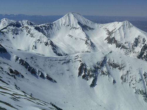
Northerly facing slopes still have plenty of snow. It is going to take awhile before they turn to corn however.
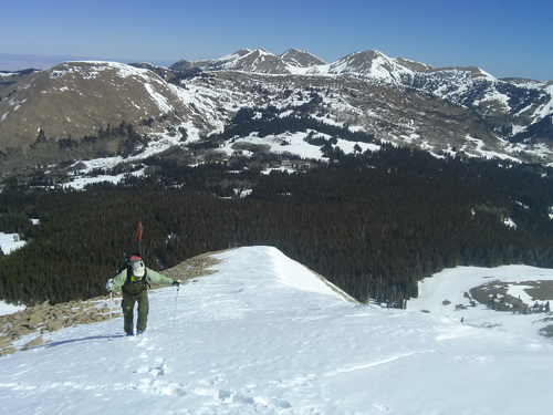
Weather station guru Ed Grote heading up the NW ridge of Mount Mellenthin. Bare south faces of the North Group in the distance.
La Sal Weather Data
Wind speeds and temperature at 11,700' on Pre-Laurel Peak.
New snow totals and temperature at Geyser Pass Trailhead.
New snow totals and temperature in Gold Basin.
Abajo / Blue Mountains
Spring conditions and overall low coverage remain the order in the Abajos.
Abajo / Blue Mountains Current Weather
Winds and temperature on Abajo Peak.
Snow total at Buckboard Flat.