31st Annual Backcountry Benefit - September 12th - Tickets Available Here!

Forecast for the Logan Area Mountains

Toby Weed
Issued by Toby Weed on
Friday morning, February 27, 2015

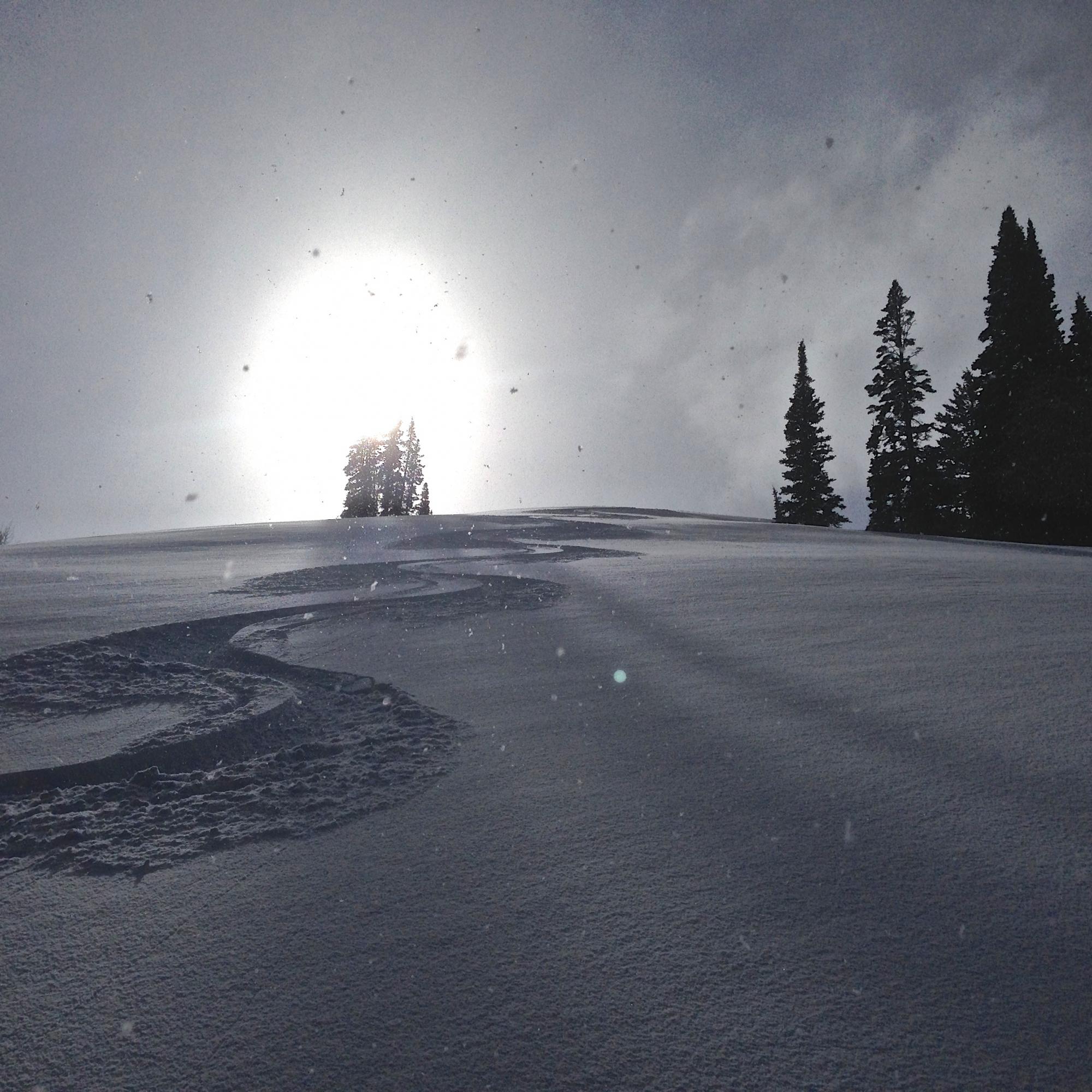
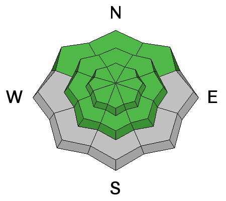
You'll find nice shallow powder and dust-on-crust at upper elevations, stable snow conditions, and a LOW (Level 1) avalanche danger in the backcountry. Perhaps of more concern than avalanches is potential for sliding falls and loss of control on slick, rock-hard snow at lower elevations and underlying a dusting of light powder on many slopes up higher.

  • Use normal caution
  • Stay in the habit of using safe travel protocols
  • Practice companion rescue with your riding partners

Low
Moderate
Considerable
High
Extreme
Learn how to read the forecast here
Special Announcements

****Special thanks to Buttar's of Tremonton and ArcticCat for hooking us up with the light and powerful M8000,

which is featured in UAC Logan's Practicing Companion Rescue video........HERE

Weather and Snow

The Tony Grove Snotel reports a couple inches of very light new snow in the last 24 hours. There's 69 inches of total snow containing 94% of average water for the date, and it's 16 degrees at 8400'. The UDOT Hwy 89 Logan Summit weather station also reports a little light new snow, 10 degrees, and light easterly winds overnight. There's some nice shallow powder in sheltered north facing terrain, but it's more dust-on-crust in most places. The snow is rock hard and slick at lower elevations and also on many slopes where the recent snow has been scoured off by winds. Don't be fooled by a couple inches of powder, backcountry riders risk sliding falls and loss of control in these conditions, and I'd recommend using an ice-ax and crampons on many mountain ascents this weekend.


Even just a little bit of snow helps. Sun and snow made for fine shallow powder conditions in White Pine Canyon yesterday. 2-26-2015


Recent Avalanches

No avalanches were reported locally since the first week of February, but I've noticed some small natural wind slabs at upper elevations and wet sluffs on sunny slopes that are more recent.


***Visit our Backcountry Observations Page for more local information and from across the state.

Ad
Avalanche Problem #1
Wind Drifted Snow
Type
Location
Likelihood
Size
Description

Although unlikely, triggered wind slab avalanches are possible in some drifted upper elevation terrain. Avoid stiffer, wind deposited snow on the lee side of ridges, in and around terrain features like gullies and cliff bands, and areas where snow is vertically cross-loaded near sub-ridges, roll-overs, or scoops lower on the slope.

Additional Information

It'll be mostly cloudy today, with moderate north winds, a high around 25 degrees, and a 40% chance of a little snow. The weather pattern looks active, heading into the weekend, but most of the energy looks to be heading south.... Better potential exists for significant snow in our neck of the woods early next week.

***Check out our one-stop weather page........HERE

General Announcements

***Advisories by email for the Logan Zone. Go here for details.

*** Utah Avalanche Center mobile app

Discount lift tickets are now available at Backcountry.com. Thanks to Ski Utah and the Utah Resorts. All proceeds go towards paying for Utah Avalanche Center avalanche and mountain weather advisories.

Benefit the Utah Avalanche Center when you shop from Backcountry.com or REI: Click this link for Backcountry.com or this link to REI, shop, and they will donate a percent of your purchase price to the UAC. Both offer free shipping (with some conditions) so this costs you nothing!


***Please submit snow and avalanche observations from your ventures in the backcountry HERE. You can call us at 801-524-5304 or email HERE, or include #utavy in your Instagram or Tweet us @UAClogan. To report avalanche activity in the Logan Area or to contact the local avalanche forecaster call me, Toby, at 435-757-7578.


I'll regularly update this advisory on Monday, Wednesday, Friday, and Saturday mornings by about 7:30. This advisory is produced by the U.S.D.A. Forest Service, which is solely responsible for its content. It describes only general avalanche conditions and local variations always exist.