

First tour into Porter Fork. Plenty of tracks, so others have been in this drainage as well. Was not expecting much in the way of coverage, here are approximate snow depths with respect to elevations:
< 7.5 K: 5-15 cms (2-6")
7.5 K - 8 K: 15-30 cms (6-12")
8K - 9K: 30-60 cms (12-24")
9K - 9.5K: 60-75 cms (24-30")
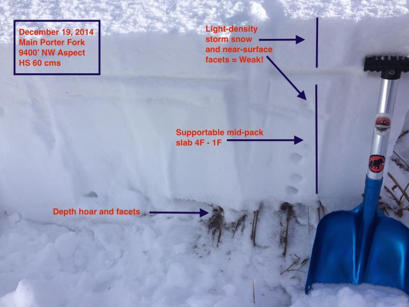
Overall was finding a generally weak snowpack. The mid-pack slab that is solid 1F rounds in deeper snowpack areas of the upper Cottonwoods ranges from 4F - 1F, and rounding facets in Porter. What was somewhat interesting is that the only variability in the snowpack is with respect to elevation (as what we expect.) whereas I am finding wide spatial variability in the Cottonwoods at similar elevations and aspects. There are two temperature crusts in the top 15-20 cms (6-8") that are decomposing due to faceting, and my guess is the snowpack in Millcreek has continued to weaken over time.
The mid-pack slab is still supportable (ski pens 10-15 cms) so it has not completely rotted out.
Hopefully this warm, windy, and very wet storm will come in as advertised as our snowpack can use a good thumping. There is plenty of weak snow to be found throughout the central Wasatch - in deeper snowpack areas the weakest snow is in the upper third of the snowpack (10-30 cms), in thinner snowpack areas outside of upper LCC and BCC, (as well as slopes in these canyons that had slid earlier in the season) much of the entire snowpack is weak and faceted.
I also noted what appears to be a layer of preserved RR crystals in a south aspect at 9400 that is not buried underneath the snow from the past 6 days. It is unlikely this is widespread, but something worth noting.