Observation: Salt Lake

Observation Date
12/12/2014
Observer Name
Evelyn
Region
Salt Lake
Location Name or Route
Upper Little and Big Cottonwoods
Weather
Sky
Overcast
Wind Direction
South
Wind Speed
Moderate
Weather Comments
Out Thursday and Friday. Similar weather both days, though the wind seemed stronger Thursday, and blowing and drifting more snow than this afternoon. Drifting was occuring well off ridgelines. Between the wind and clouds, not much heating above 9,000', with the snow surface staying cold or frozen on all aspects.
Snow Characteristics
Snow Surface Conditions
Faceted Loose
Wind Crust
Melt-Freeze Crust
Damp
Snow Characteristics Comments

Damp snow surface below about 9,000' on Thursday. Above about 9,000', the snow surface is staying cold and loose on northerly facing slopes. Widespread near surface facets on all northerly facing slopes, anywhere from a couple of inches to the the entire pack faceted and unsupportable in very shallow areas.

Red Flags
Red Flags
Wind Loading
Cracking
Poor Snowpack Structure
Avalanche Problem #1
Problem
New Snow
Trend
Increasing Danger
Problem #1 Comments

Main avalanche issue will be wind slabs sitting on the near surface facets, especially widespread on northwest through easterly facing slopes, at both mid and upper elevations. Wind slabs from Thursday/Friday are hard slabs, soft slabs may form with the forecast snow and wind along the ridge lines tonight and tomorrow.

Avalanche Problem #2
Problem
Wet Snow
Trend
Increasing Danger
Problem #2 Comments

In wind sheltered areas, the new snow may not bond well to the old snow surfaces, and sluffing may become possible on steep slopes.

Comments

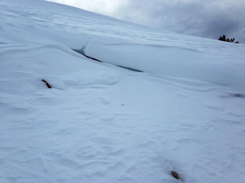
Went from Brighton to Sunset on Thursday, Alta to Patsy Marley today, specifically to look at the two old bed surfaces from slides that both were remotely triggered on November 26th. As expected, both were filled in with a shallow layer of very weak faceted snow. The Patsy Marley slide was capped with a 2" wind crust. Photos below from Patsy Marley. Expect repeaters - slopes that have already slid once to be some of the first slopes to slide again once we get a good load. Pros from the Park City side made a similar comment Wednesday night - that the snow on the old slide paths was super weak, and could fail again once loaded.

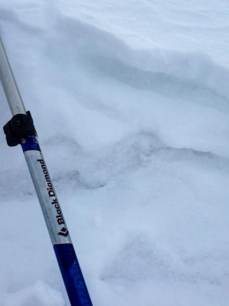
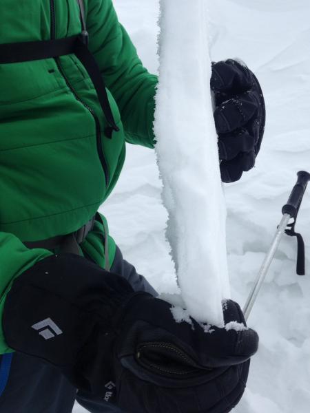
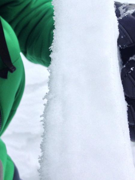
Wind slabs created yesterday were hard - supportable in some places, breakable in others. Below is a piece of wind slab - in most spots I saw they were only a few inches thick. Second photo is of wind slab with preserved surface hoar sticking out on the under side. Most wind slabs seemed to be sitting on the weak, sugary near surface facets, and I saw no other surface hoar.

Today's Observed Danger Rating
Moderate
Tomorrows Estimated Danger Rating
Moderate