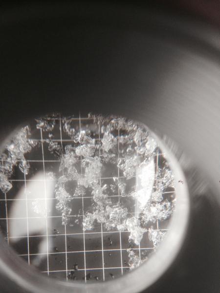
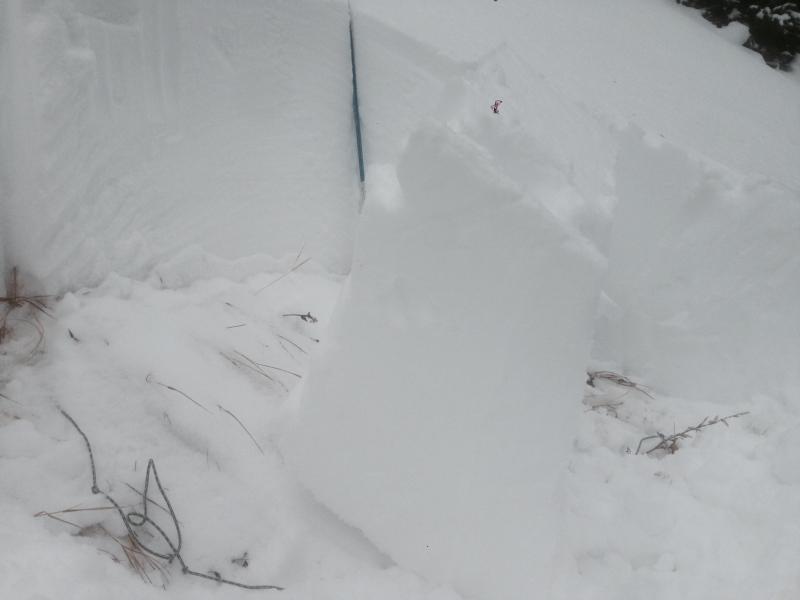
Went for a walk up white pine to redpine today looking to dig on some north aspects. Found very wet snow on all aspects that eventually transitioned to moist snow around Red Pine Lake. Above Red Pine Lake dry snow was found on shady aspects. On my pit below the lake at 9500' I found weaker structure and more energy than in a pit higher up at 10,100' on a similar aspect. Found larger facets on the ground at the lower elevation pit, around 3mm. (pic below) Test results were, ECTP19 Q2, PST35/100Arr, and CT13 Q2 all failing on the 3mm facets @7cm off the ground. Total depth of snow there was 74cm. This pit had what I would call moist snow throughout. Little surprised how much energy there was in that location.
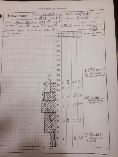
Higher up at 10,100 above Red Pine Lake I found 2mm facets on the ground which appeared to be rounding. Defnitily not as large or angular as down a little lower. Test results at that location were CT12 Q2 @10 cm, STM @82cm and ECTX a few times. I suspect the depth of the weak layer of concern is now out of range (around 1m) for ECT's and this might be why I was getting X's. Deep tap test might have been a better choice. Although I do believe the snow pack is gaining strength at that elevation I am not 100% convinced and am assuming these slopes are still guilty and could produce a large avalanche for now. It does seam like there is a fair bit of spacial variability out there right now. Second and Third picture from the lower elevation pit below Red Pine Lake. Pic #2 is 3mm grid.