Observation Date
4/7/2014
Observer Name
Jason Konigsberg
Region
Salt Lake » Big Cottonwood Canyon » Cardiff Fork
Location Name or Route
Days, Cardiff
Weather
Sky
Clear
Wind Direction
Northwest
Wind Speed
Light
Snow Characteristics
New Snow Depth
6"
New Snow Density
High
Snow Surface Conditions
Dense Loose
Wind Crust
Melt-Freeze Crust
Damp
Snow Characteristics Comments
New snow was dense and contained graupel. New snow amounts ranged from 3-6". Areas of wind slab were up to 10" deep. Strong winds yesterday created some different loading patterns with areas of Days headwall crossloaded from east to west. Northerly and westerly start zones were scoured to old tracks in places. Once down off the ridge snow was less wind affected.
Red Flags
Red Flags
Recent Avalanches
Wind Loading
Rapid Warming
Red Flags Comments
Initially these three red flags were thought about at start of tour. Recent avalanches were all wet loose observed on south face of superior on drive up.
Avalanche Problem #1
Problem
Wet Snow
Trend
Decreasing Danger
Problem #1 Comments
Wet avalanches normally wouldn't be a big problem with low snow amounts but it seems there was possibly some faceting on top of the melt freeze crust that are allowing wet avalanches to run longer and wet loose avalanches are able to trigger slab on this snowpack setup.
Avalanche Problem #2
Problem
Persistent Weak Layer
Trend
Decreasing Danger
Problem #2 Comments
Isolated pockets of hard wind slab on upper elevation aspects lee to the northwest and west.
Comments
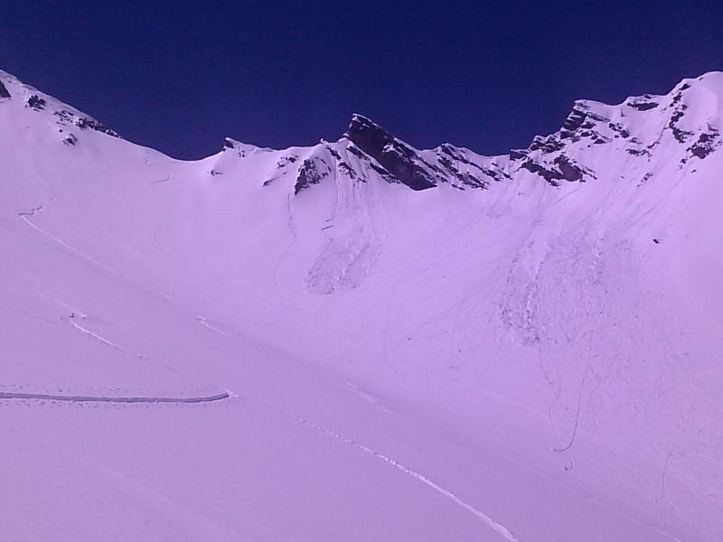
Travelling around it seemed wind slabs were unreactive. Not really the case...see avalanche ob. Quick handpits on north and northeast showed new snow to be bonded well to old snow. Activity was mostly limited to small point releases initiating out of rocky areas. One small point release triggered a small slab (see attached photo).
Today's Observed Danger Rating
Moderate
Tomorrows Estimated Danger Rating
Moderate