Observation Date
3/29/2014
Observer Name
Brackelsberg / Paradis
Region
Salt Lake » Little Cottonwood Canyon » Maybird Gulch
Location Name or Route
Red Pine / Maybird / Hogum
Weather
Sky
Scattered
Wind Direction
Southwest
Wind Speed
Strong
Weather Comments
Very windy up high. The drainages had vortexing winds from all direcitons. Snow plumes could be observed on most of the high peaks and ridges. The wind and clouds slowed the warming of the snow.
Snow Characteristics
New Snow Depth
12"
New Snow Density
Medium
Snow Surface Conditions
Dense Loose
Wind Crust
Melt-Freeze Crust
Snow Characteristics Comments
The new snow from the storm on Friday had consolidated considerably. Due to all of the wind transport the snow ranged from a couple inches to 18".
We saw a wide variety of snow conditions
Lower elevations in the morning were refrozen sun crusts
Higher elevations were a mix of powder in sheltered areas, dense packed powder in somewhat protected areas, and breakable crusts in the open areas.
We saw a lot of very wind damaged snow on east and west aspects.
The west aspects had a lot of roller balls from Friday's warming.
Red Flags
Red Flags
Wind Loading
Rapid Warming
Red Flags Comments
There was a considerably amount of snow being transported by the wind. We avoided the northly aspects that were loading from the strong winds but did find wind slabs up high on east aspects. These wind slabs ranged from 1-3" thick, but were mostly non-reactive. We could get the slabs to break away in chunks, but they were not propagating or picking up additional snow.
The wind appeared to be slowing down the snow warming above 9,000'. Below 9,000' the slopes exposed to the sun were getting set on our exit around 1:30 pm.
Avalanche Problem #1
Problem
Persistent Weak Layer
Trend
Increasing Danger
Problem #1 Comments
I would expect the wind slabs to be very sensitive tomorrow morning. There was a significant amount of snow being transported.
Avalanche Problem #2
Problem
New Snow
Trend
Increasing Danger
Problem #2 Comments
With the approaching storm I would be concerned about how well the new snow will bond to either the sun crusts or to the wind slabs.
Comments
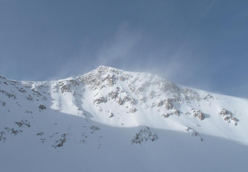
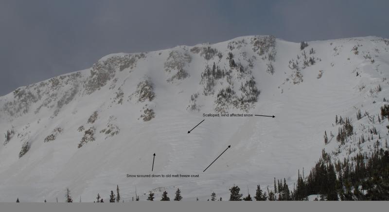
The first photo shows the wind plumes off the ridgeline between Pfiefferhorn and Chipman Peak. The second photo shows the wind damaged snow off of Hogum Hogback.
Today's Observed Danger Rating
Low
Tomorrows Estimated Danger Rating
Moderate