We are enjoying a period of stable conditions with some refresh of new snow. Given totals were on the lean side, we are fortunate it is dense and it skis quite well on a soft, spongy surface. Apart from one wind slab on a South aspect I triggered with a cornice kick just at the top of Pole Line Pass, I was unable to find any weaknesses in the storm snow, and the snowpack is fairly deep and quickly goes to 1F hardness. In my travels in the upper Cottonwoods since about Feb 17, I have seen a very stable snowpack that has effectively bridged any deeper facets and depth hoar down near the ground. There have been a few isolated incidents that were reported last week, and I suspect there are some outlying areas in very steep, rocky areas where there is a thin snowpack where you could trigger a deeper hard slab, but I think this type of terrain is rapidly shrinking.
Mostly Low danger this morning (though will call it Moderate as I was able to trigger a fresh wind slab), and Saturday's concerns will be warming from the sun.
Am guessing all East through Northwest aspects aspects will be still be soft on Saturday morning, and it's even likely south and west may have only a minor zipper crust. Any reports from those who were out later on Friday afternoon will give us a much better sense of that.
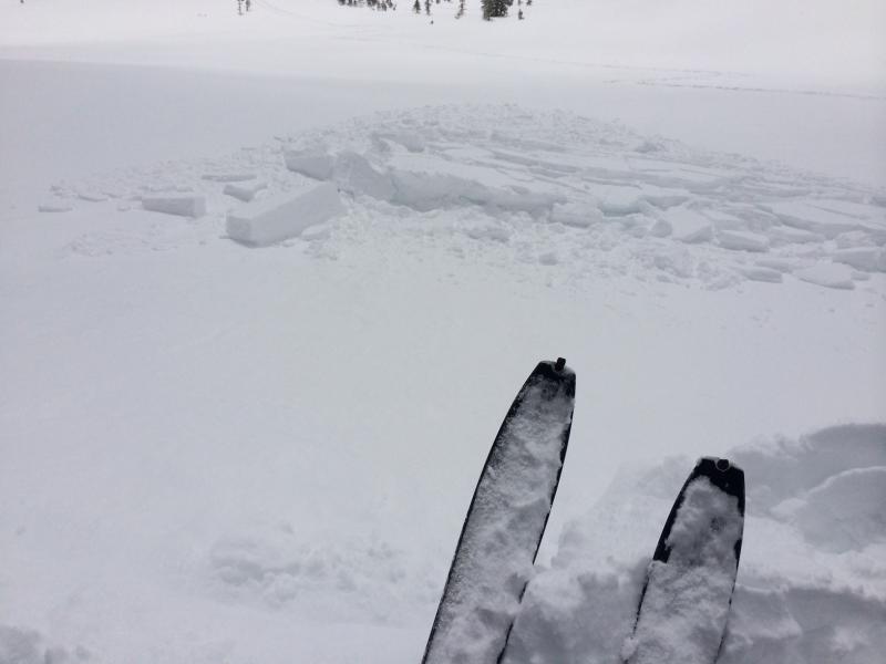
Photo of 45 cm thick and 8 meter wide wind slab triggered from a cornice kick just above Pole Line pass on a South aspect
Video is of quick hand pit showing pooled graupel just below steeper cliff bands.