Observation: Silver Fork

Observation Date
2/28/2014
Observer Name
Kobernik/Kendall/Gagne
Region
Salt Lake » Big Cottonwood Canyon » Silver Fork
Location Name or Route
Silver & Days Forks
Weather
Sky
Overcast
Precipitation
Light Snowfall
Wind Direction
Southwest
Wind Speed
Moderate
Weather Comments
Temps stayed below freezing, but felt warm in the am until the sky turned overcast by early afternoon. Winds were Moderate out of the SW, with stronger gusts along the upper elevation ridgelines. Light snowfall when exiting late afternoon.
Snow Characteristics
New Snow Depth
12"
New Snow Density
Medium
Snow Surface Conditions
Powder
Wind Crust
Melt-Freeze Crust
Damp
Snow Characteristics Comments

About 25-30 cms (10-12") storm snow with an easy-to-find density inversion just above the old snow surface. Some 4F winds drifts up to about 30 cms along the leeward ridges from SW winds, although we were also finding some cross loading along terrain features. East and South aspects were crusted by early afternoon, but North aspects still had soft snow at the surface. Didn't look at much West-facing terrain in the afternoon, but am guessing with increasing cloud cover, wind, and cooler temps, West aspects may not be crusted.

Red Flags
Red Flags
Recent Avalanches
Wind Loading
Cracking
Red Flags Comments
Widespread wind loading mostly along ridge lines with fresh wind drifts that were sensitive to ski cuts. Saw several small soft-slab avalanches release along north-facing Silver Fork headwall in the early afternoon. These seemed to be triggered by wind-loading and occurred during a spike in winds about mid-day.
Avalanche Problem #1
Problem
Persistent Weak Layer
Trend
Increasing Danger
Problem #1 Comments

The most reactive snow we were finding today were fresh wind drifts in mid and upper elevations from the Southwest winds. These were mostly on North through East aspects, although some cross-loading was occurring as well around terrain features. These were failing in a density inversion just above the old snow surface, and were mostly 20-40 cms thick (8-16") 4F-hardness. These were not wide propagations, and they seemed to need a steeper slope (35 degrees or steeper) to become reactive.

Comments

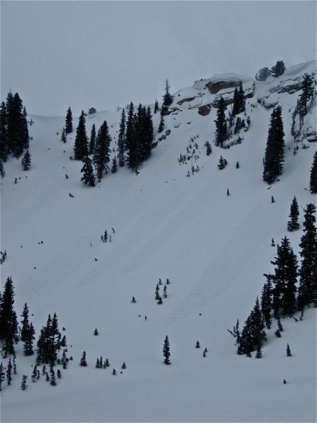
Travel today was through Silver Fork and exiting Days Fork. Quite apparent there was a density inversion down about 25-30 cms (10-12") just above the old snow surface. We were able to ski cut a few soft slabs on steeper aspects, and for the most part we were only able to get failures in this density inversion on wind-drifted slopes. Hazard today was "Manageable Considerable" - we saw natural avalanches and ski cutting did produce small soft slabs running within the new snow. Well-placed ski cuts along ridgelines and steeper rollovers were quite effective at managing and mitigating today's hazard. Saturday's hazard depends upon how much water weight and wind-loading occurs in the expected storm. Larger water amounts and stronger winds will likely make Saturday's hazard "Unmanageable" and either Considerable or High.

Narrative: Gagne Photos-Video: Kobernik

Video

Photos:

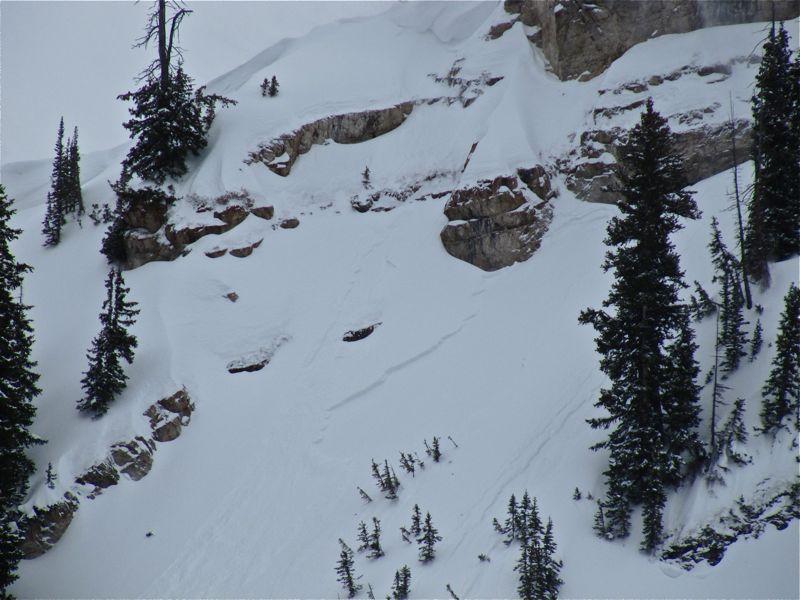
UDOT control work results, SE facing East Hellgate

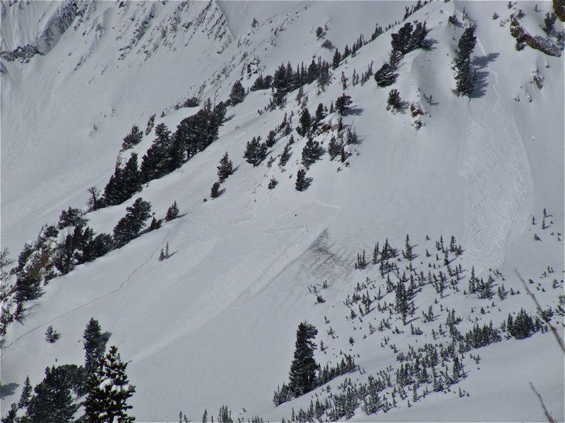
Small skier triggered soft slab - quite typical for today

Mega wind loading off the AF Twins

Naturals that released mid day

Today's Observed Danger Rating
Considerable
Tomorrows Estimated Danger Rating
Considerable