Special Avalanche Bulletin
This advisory is based on field work performed over the period of February 13-16, and weather data received on Monday, February 17. It is to be used as a guideline for back country travelers so that they can form their own danger analysis over the next several days. Unseasonably warm temperatures over the weekend caused many changes to the snow pack and conditions have turned much more spring like. Rapid warming, and warm, overnight low temperatures created a heightened period of instability over the weekend. In addition, sustained westerly winds continued to transport snow on to leeward slopes, creating dangerous wind slabs, and adding further weight and stress to buried, persistent slabs. Time and solid re-freezes will help to stabilize these conditions, but back country travelers need to maintain a heightened level of awareness.
La Sal Mountains
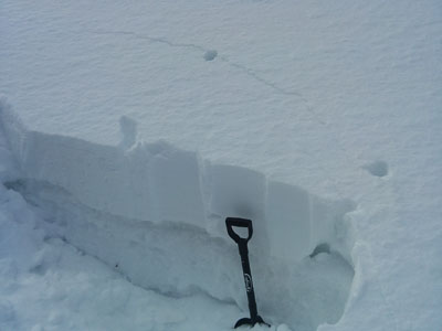
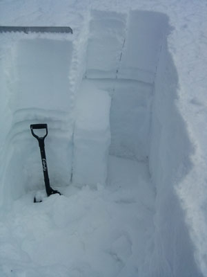
We had a good solid freeze Sunday night. Temperatures at 6:00 am were 16 degrees on Pre-Laurel Peak, 15 in Gold Basin, and 23 at the Geyser Pass Trailhead. NW winds blew strong most of the night but backed off into the 10-15 mph range by early morning. Mid and upper elevations still hold dry snow on shady slopes, but the wind has affected exposed, westerly aspects. All sunny aspects are crusted over, and the lower elevation snow pack has gone isothermal.
Winds and temperature on Pre-Laurel Peak (11,705')
Temperature and new snow totals in Gold Basin (10,050')
Total snow depth and temperature near Geyser Pass Trailhead (9850')
Abajo Mountains
Low snow conditions still remain in the Abajo Mountains. The snow pack depth averages between 18" and 36", but some sun and wind exposed slopes are showing bare ground. For more information, see this report Westerly winds on Abajo Peak blew strong Sunday night and continued to average 25 mph early Monday morning. The overnight low on Abajo Peak was 19 degrees, and 31 at Camp Jackson.
Winds and temperature on Abajo Peak (11,330')
Snow totals at Camp Jackson (8968')
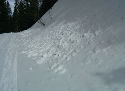
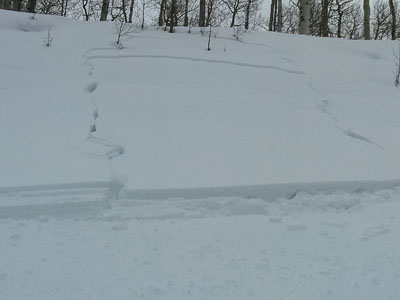
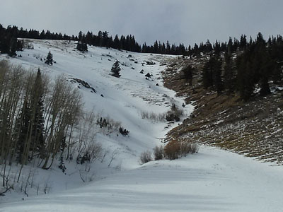
With the exception of wet, loose snow avalanches, no new major activity has been observed in over a week. I've been able to get out and look around at things and , and we did have a natural avalanche cycle the weekend of February 9-10. Many natural storm snow avalanches occurred, but a few slides managed to step down into older, buried facets. Most notable was a large slide on the Horse's Head in the Abajo Mountains, and a large slide in Upper Horse Creek in the La Sals. Click here to see some of the avalanche reports.