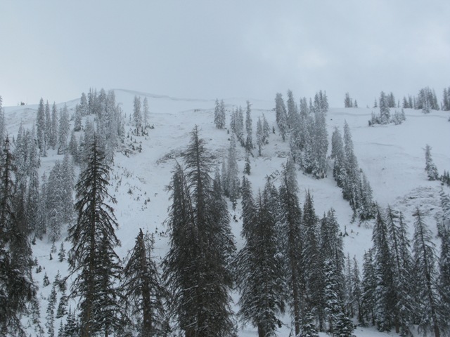
Forecast for the Uintas Area Mountains

Saturday morning, February 15, 2014
This is when most avalanche accidents occur in the western Uinta's. Poor snowpack structure, nuking winds, lots of snow and water, and yea, huge avalanches... we've got all the red flags screaming at us!
At all elevations, the avalanche danger is HIGH today. Both natural and human triggered avalanches are very likely on all steep, snow covered slopes. The danger is most pronounced on slopes facing the north half of the compass, particularly those with an easterly component to their aspect where pockets of EXTREME danger is found.
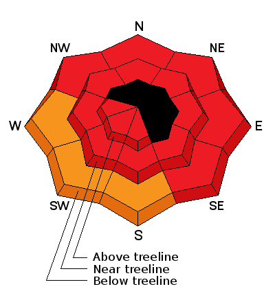
Avalanche Warning
THE AVALANCHE WARNING REMAINS IN EFFECT FOR ALL MOUNTAINS AND MOUNTAIN VALLEYS OF NORTHERN AND CENTRAL UTAH. THIS WARNING INCLUDES THE LOGAN...OGDEN...PARK CITY...SALT LAKE...PROVO... MANTI-SKYLINE SOUTH TO I-70...THE WESTERN UINTA MOUNTAINS...AND THE MOUNTAINS OF EXTREME SOUTHEAST IDAHO. DANGEROUS AVALANCHE CONDITIONS EXIST ON ALL ASPECTS AND ELEVATIONS. LARGE DESTRUCTIVE NATURAL AVALANCHES ARE OCCURRING. BACKCOUNTRY TRAVEL IS NOT RECOMMENDED.
 Weather and Snow
Short-lived high pressure is building and skies are mostly cloudy. West and southwest winds are humming along the ridgetops, blowing 25-50 mph, and temperatures are unseasonably balmy, in the mid to upper 30's. The snow surface took a bit of a hit yesterday, particularly at lower elevations where you'll find a damp start to the morning ride. But cooler temperatures and cooler heads prevail and you'll find dry, supportable conditions as you gain elevation.
Click here for current winds, temperatures, and snowfall throughout the range.
Click here for trip reports and avalanche observations.
 Recent Avalanches
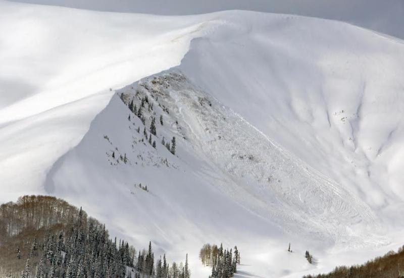
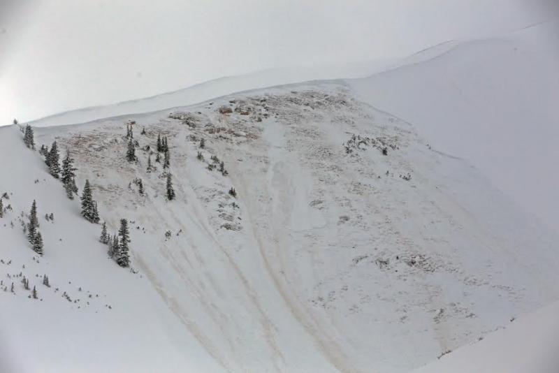
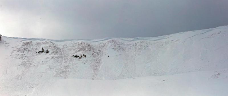
Several, very large, natural avalanches broke to the dirt Thursday in upper Weber Canyon. These bone crushing, tree snapping slides were hundreds of feet wide and up to 15' deep!
A couple of riders are lucky to be alive after unintentionally triggering this slide off Currant Creek Peak on Tuesday. Details describing the slide can be found here.
More avalanche activity is found here.
Persistent Weak Layer
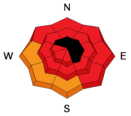
Description
It's been a crazy time on the eastern front and the snowpack is begging for a break. It's spooky out there and yesterday as Trent and I stomped around Chalk Creek, there was a creepy, walk on eggshells type of vibe. Today's forecast spike in temperatures may just seal the deal bringing the uninvited guest with the loaded gun to the card game. All the tree snapping avalanches I've seen the past few days would be unsurvivable if you got caught and buried. Given the devastating consequences of triggering a slide right now, the best way to manage an unmanageable consequence is with terrain choices. Simply stay off of and out from under steep snow covered slopes. While I suspect we'll start to turn the corner towards more stable conditions after the big weekend warm up, right now we just need to exercise some patience.
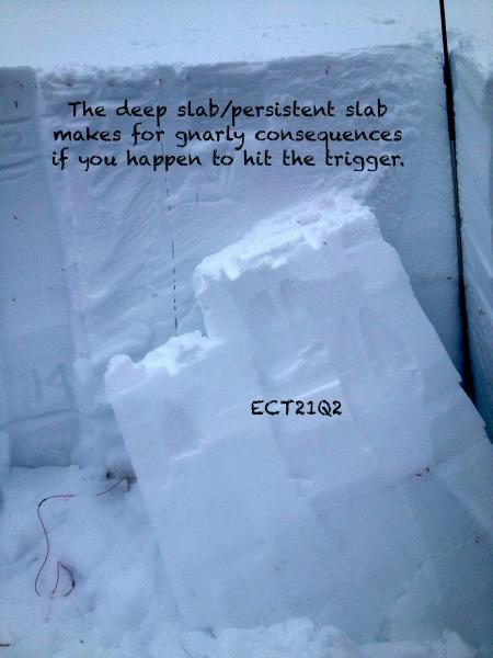
JG's pit says it all.
Cornice
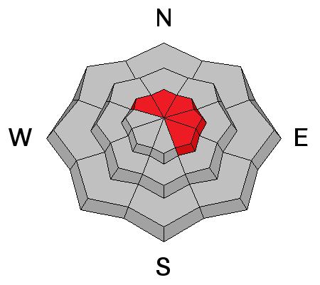
Description
Cornices have grown huge and will break back further than you might expect. You'll definitely want to give these boxcar sized monsters the respect they deserve.
Additional Information
High pressure keeps storminess north of the region today and tonight, though we should see partly to mostly cloudy skies. Westerly winds should start to die down as the day progresses, but in the meantime remain in the 25-35 mph range along the ridges. Temperatures soar into the low to mid 40's and dip into the low 30's overnight. The next storm system moves through quickly on Sunday with light snow and cooler temperatures expected. A break in the action for Monday/Tuesday, and then more storminess for the rest of week.
General Announcements
Remember your information can save lives. If you see anything we should know about, please participate in the creation of our own community avalanche advisory by submitting snow and avalanche conditions. You can call me directly at 801-231-2170, email [email protected], or email by clicking HERE
This is a great time of year to schedule a free avalanche awareness presentation for your group or club. You can contact me at 801-231-2170 or email [email protected]
Donate to your favorite non-profit –The Utah Avalanche Center. The UAC depends on contributions from users like you to support our work.
Benefit the Utah Avalanche Center when you buy or sell on ebay - set the Utah Avalanche Center as a favorite non-profit in your ebay account here and click on ebay gives when you buy or sell. You can choose to have your seller fees donated to the UAC, which doesn't cost you a penny.
Utah Avalanche Center mobile app - Get your advisory on your iPhone along with great navigation and rescue tools.
The information in this advisory is from the US Forest Service which is solely responsible for its content. This advisory describes general avalanche conditions and local variations always occur.
I will update this advisory by 7:00 AM on Sunday Feb. 16, 2014


