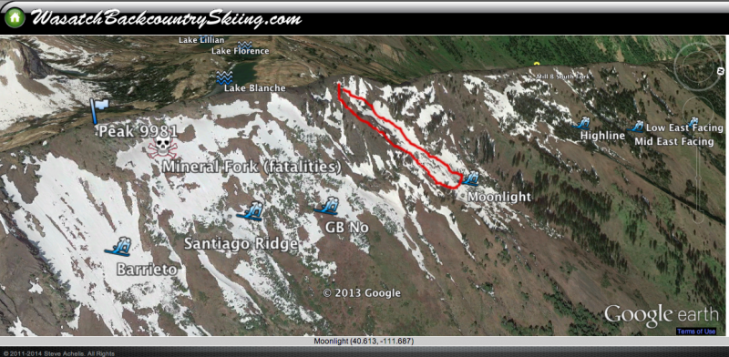
First time touring in the Wasatch in nearly two weeks, so my eyes were wide open for how the snowpack looks after the recent stormy period. Also the first time I have been in Mineral Fork this season. Overall the snowpack seems relatively stable with 30-45 cms of soft settled snow atop a poor snowpack structure.
My goals today (ok, skiing powder, but after that) were to identify potential weaknesses in the snowpack ahead of what appears to be a warm, moist stormy period.
Lots of quick pits today and the biggest concern I was identifying are facets forming between and below rain and rime crusts, now buried 30-45 cms down. The storm snow is quite soft and not a cohesive slab, but I was getting sudden collapses with compression tests in the weak faceted snow between and below these crusts. I realize the range of the crusts varies with respect to elevation and drainages throughout our range however.
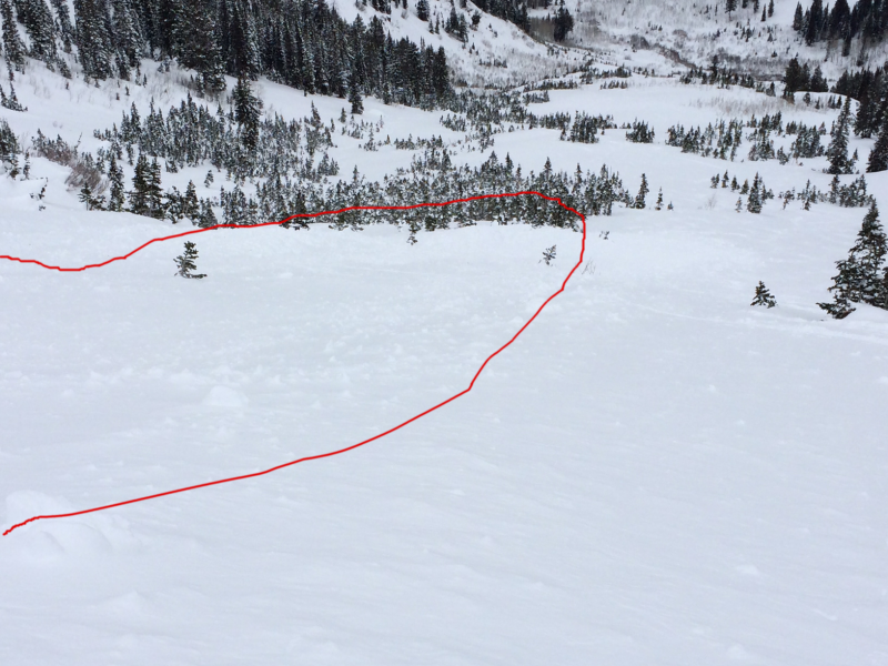
Also found debris from a class 1.5 slide which I reported in the Avalanches section of the UAC site.
In rocky areas I was finding predictably weak snow with widespread facet gardens.
Going forward, there is plenty of soft snow available for wind transport, and this soft snow is likely to form the weakest layer in our snowpack with any new loading. Beneath that, faceted snow - especially around the crusts I was identifying - forms another weak layer. Didn't look at the snow near the ground all that much, but down about 50 cms from the snow surface I am finding a relatively stout 1F or P hard slab.
Photos are from debris I noted from a slide that likely occurred on Wednesday, but details are sketchy at best. I reported this in the Avalanches section of the UAC site.