Observation Date
2/5/2014
Observer Name
Kikkert
Region
Salt Lake » Mill Creek Canyon » Wilson Fork
Location Name or Route
Wilson Fork
Weather
Sky
Clear
Wind Direction
Southwest
Wind Speed
Moderate
Weather Comments
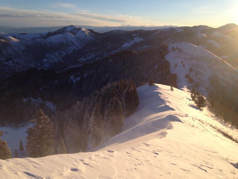
Clear and cold morning. SW winds were stronger along the upper Wilson ridgeline than expected, with gusts in the 20s. Much of the light density snow being blown around just seemed to be sublimating. However, some minor loading of the north and east facing terrain was occurring (see below).
Snow Characteristics
New Snow Depth
2"
New Snow Density
Low
Snow Surface Conditions
Powder
Snow Characteristics Comments
Tough to tell how much new in the past 24, but just seemed like a couple to three inches.
Red Flags
Red Flags
Wind Loading
Red Flags Comments
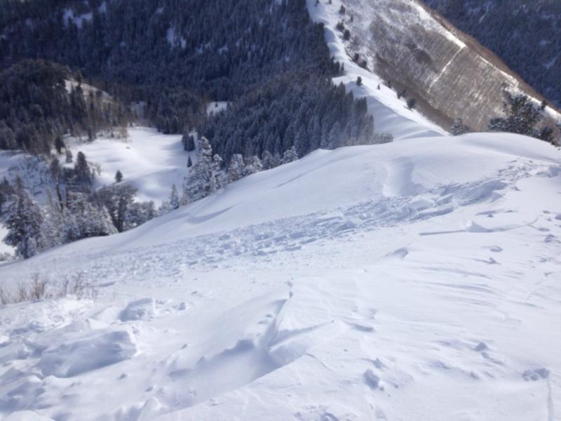
With light density snow everywhere it wasn't tough for the wind to form soft, shallow drifts on the upper elevation N and E facing terrain. The drifts were sensitive, cracking out easily just approaching them. Generally about 6 inches deep and confined to the immediate lee. Very easily managed.
Avalanche Problem #1
Problem
Persistent Weak Layer
Problem #1 Comments
As described above, very small and manageable soft slabs, running very short distances (see photo).
Avalanche Problem #2
Problem
New Snow
Problem #2 Comments
Didn't check snowpack structure above as the new light density snow has just not formed a slab yet. However, with stable snow and great conditions it's easy to forget that the stability is only due to the lack of a slab. Plenty of very weak snow everywhere in Wilson, particularly around the various crusts. The snow forecasted may finally give us the slab we have been lacking and will take a conscious effort to step things back a bit. Maybe not by Thursday, but possibly by Friday or Saturday.
Comments
Photos below of wind loading along the upper Wilson ridge, small wind slabs near the top of the ridge, and distance shot showing sluffing in Alexander Basin.
Today's Observed Danger Rating
Moderate
Tomorrows Estimated Danger Rating
Moderate