Observation: Hoyt Peak

Observation Date
12/29/2013
Observer Name
jg
Region
Uintas » Hoyt Peak
Location Name or Route
Hoyt Peak Area
Weather
Sky
Clear
Wind Speed
Calm
Weather Comments
Cold this morning with temps in the low single digits at the trailhead.
Snow Characteristics
Snow Surface Conditions
Dense Loose
Faceted Loose
Wind Crust
Rain-Rime Crust
Red Flags
Red Flags
Recent Avalanches
Cracking
Collapsing
Poor Snowpack Structure
Red Flags Comments
We got some decent audible collapses today on sub ridges and in semi-flat terrain at higher elevations. Viewed from a distance some older and newer avalanches. Although I only dug quick handpits today the structure of the snowpack has not changed and is still shallow and weak. In most places on the north half of the compass there is weak snow capped by a slab.
Avalanche Problem #1
Problem
New Snow
Comments

Traveled from 6800-10,200ft., mostly the north, northwest through west quadrant of the compass.

No pit profile today.

High up on the Hoyt ridge there were signs of recent NE winds.

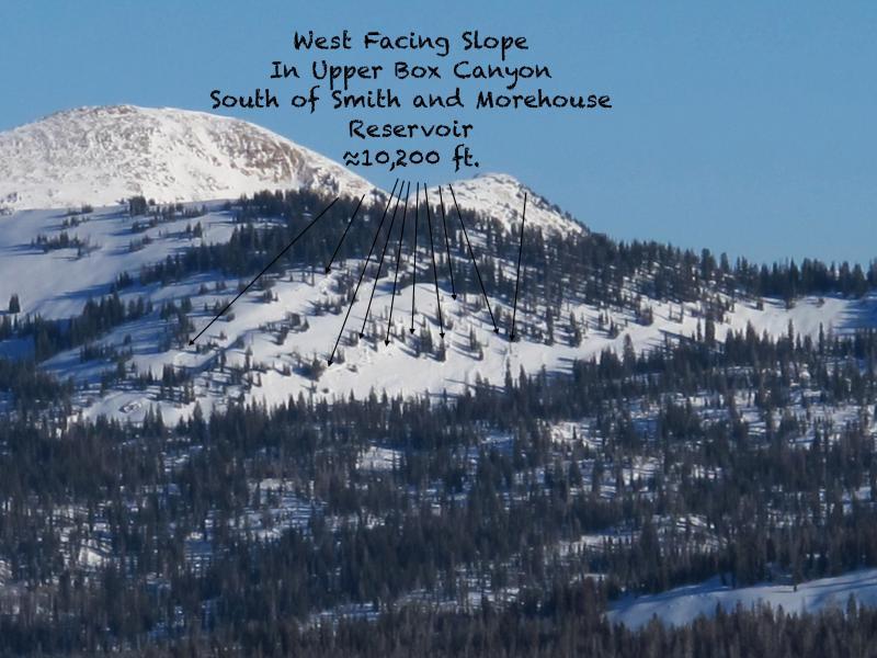
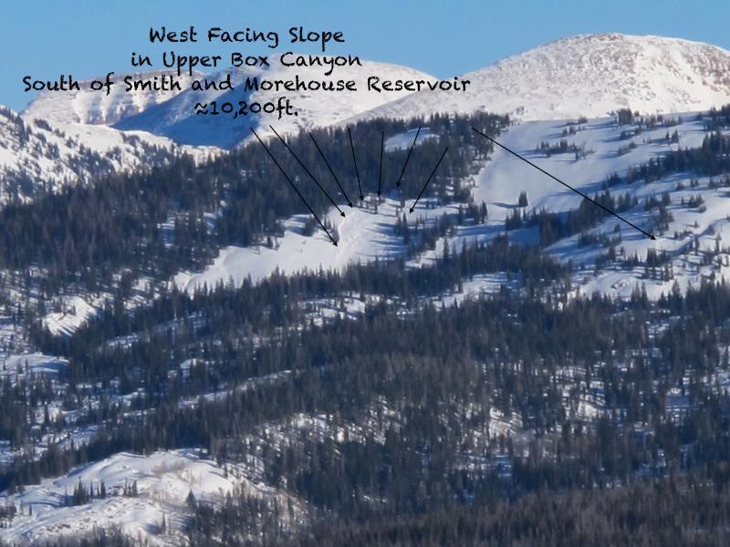
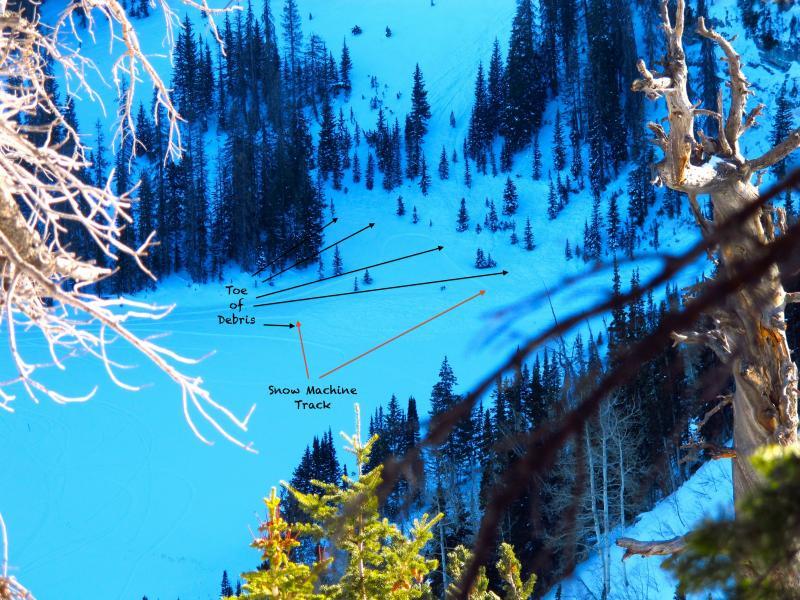
Was able to see some older and more recent avalanches in the distance. These two were in the upper Box Canyon area south of Smith and Morehouse Reservoir - west facing @ approximately 10,200 ft. I am guessing these were naturals.

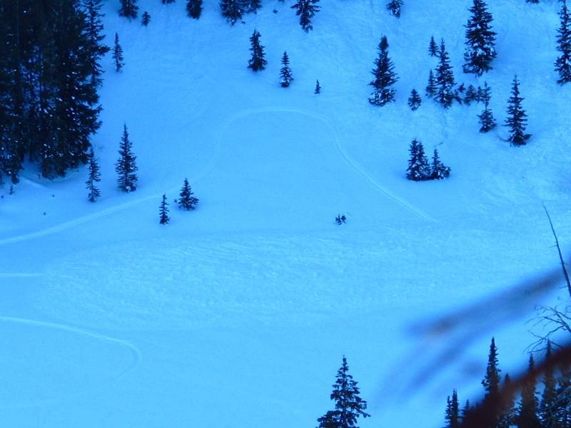
Here is an older slide off the east ridge of Hoyt Peak. NNW facing at approximately 9700 ft.

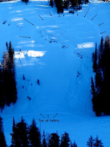
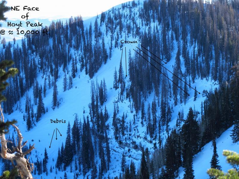
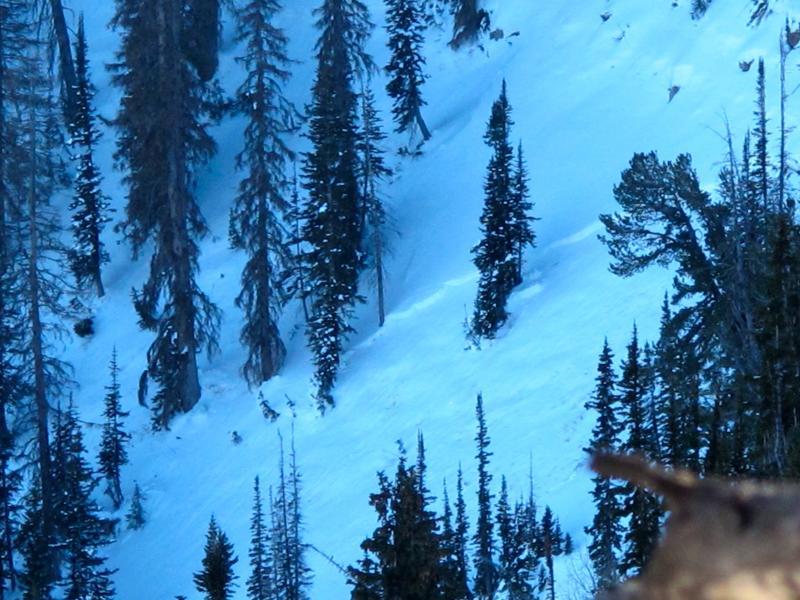
This avalanche off the NE face of Hoyt Peak proper @ approximately 10,000 ft. looked relatively new. Not sure about the trigger.

I saw a few more of what I thought were slides but I couldn't be certain. The slab is relaxing but I would continue to call the danger considerable on steep slopes ( > 35°) on the north half of the compass.

Widespread surface and near surface faceting taking place.

Today's Observed Danger Rating
Considerable
Tomorrows Estimated Danger Rating
Considerable