Observer Name
Cawley
Observation Date
Thursday, December 19, 2013
Avalanche Date
Thursday, December 19, 2013
Region
Salt Lake » Big Cottonwood Canyon » Silver Fork » Davenport Hill
Location Name or Route
Davenport Hill
Elevation
10,000'
Aspect
Northwest
Slope Angle
36°
Trigger
Skier
Trigger: additional info
Unintentionally Triggered
Avalanche Type
Soft Slab
Avalanche Problem
Persistent Weak Layer
Weak Layer
Facets
Depth
12"
Width
150'
Vertical
500'
Caught
1
Comments
Myself and one partner had just skied a run in Grizzly Gulch, and were heading west across the Cottonwood Ridge to meet some friends who were skiing West Bowl. On the way from East Pass to Davenport Hill, one natural, soft slab avalanche was noted in a steep, north facing gully just skiers left of east pass, which appeared to have run this morning; the 30' wide, ~6" deep crown, and the debris in the runout, was all covered by a few inches of new snow. Additionally, I triggered an 8" deep, 50' wide new snow, soft slab avalanche, from a safe spot on the ridge, in the next gully to the west, near the top of Davenport Hill. Both of these slides appeared to have failed beneath the new snow on yesterday's faceted snow surface.
After cresting the top of Davenport hill, the next portion of ridgeline to the west was nearly snow free on the south side of the ridge, and I judged the north side of the ridge to be "not steep enough to be a problem." My partner and I stopped for a moment, and I stated my feelings about the slope, and then walked onto it. Staying very close to the ridge, I immediately felt the sandbox effect of a weak snowpack beneath this morning's snow, and after taking a couple steps, the avalanche broke at my feet. The slab moved very slowly at first, and I was able to arrest on the bed surface, although the bed surface was so loose that I felt like I was treading water, well after the slab was off to the races below me.
Overall, the slab was an average of 10"-12" deep, with a couple portions stepping down into the late november facets, and one portion, on the eastern extremety of the slide, releasing near the ground, with the characteristic brown snow visible at the bottom of a ~three foot deep crown. When I stood up, I measured the slope angle where I stood to be 32 degrees, although other portions of the bed surface measured exactly 36 degrees. In places, this slab pulled out near the ridge on portions of ~30 degree terrain. The debris ran through dense trees below me, and well onto the flats beneath the Silver Fork Headwall. I called my friends in West Bowl who confirmed there was no one else in the area, and then called Alta Central.
This was a close call--if I had entered the slope further to the east, where it is steeper, I would have been on a deeper portion of the slab and would likely have been strained through dense trees before riding a large debris pile to the flats. It was similar to what has been, to my knowledge, my only other truly close call, in which I assumed my visual impression of a slope's steepness was correct, without having actually measured it previously, or personally seeing avalanches on the slope. In both cases, i had made a deliberate assesment of terrain and snow conditions, and judged that I was about to do the right thing. In both cases, I was in terrain I don't ski that much--not really a silver fork guy--but which I assumed could be navigated safely. At this point, I lack a good, constructive summary, or words of wisdom...

Comments
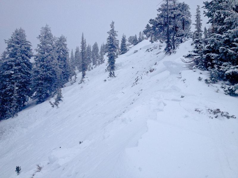
Looking east, toward the deepest portion of the crown and steepest portion of the slope. Not much snow left on this slope.

Comments
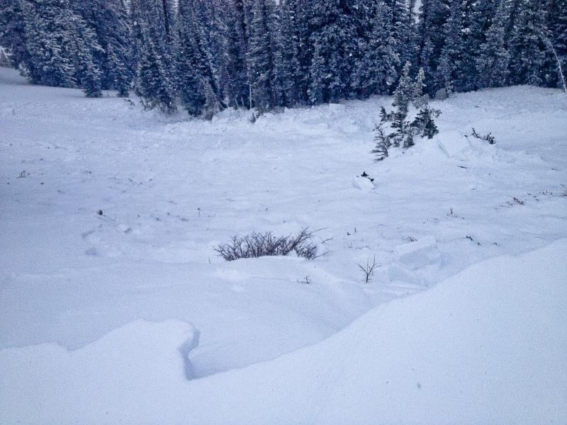
Marginal photo of the trees beneath the starting zone, and mangled, rotten bed surface; fog and light snowfall made a photo of the runout difficult...
Coordinates


