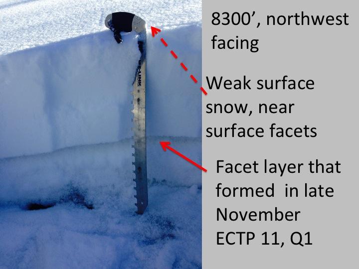
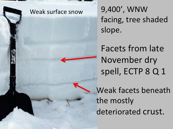
Similar snow pack on many northwest through north through easterly facing slopes. Surface snow is weak, consisting of near surface facets, with the addition of surface hoar in some locations. With new snow, this will probably be the first weak layer to fail, in shallow soft slabs and sluffs.
The mid pack facet layer formed at the end of November is a consistent weak layer I've been seeing these past 2 weeks in the Salt Lake and Ogden area mountains. It is still producing fairly easy, full propagation CTE's, Q 1's. Maybe the high end forecasted snow numbers could over load this weak layer, or even more likely it could fail as a step down, from the weight of a smaller new snow slide.


There is wide spread weak snow on west through north through easterly facing slopes, at almost all elevations that have snow cover. If we get decent snow amounts, could have more avalanches at the lower elevations than we are used to. While paths are smaller, terrain traps abound.
I also feel like an initially high rain/snow line (forecast for 7,500') could be an issue, potentially causing an early avalanche cycle. I'm wondering if rain on NSF might react similarly to rain on cold new snow?


