

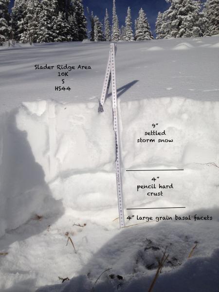
On South facing slopes, where I traveled, the storm snow fell on a mix of crusts and facets. In some places there were several crust/facets sandwiches and other places there was a stout crust sitting on top of medium grain facets. Generally speaking the storm snow fell on a melt/freeze crust and bonded well to it, although I found weak, faceted snow in all my quick pits. This pit profile is one of many different setups I found on south facing slopes. I did not travel below 9200 ' on the south half of the compass.
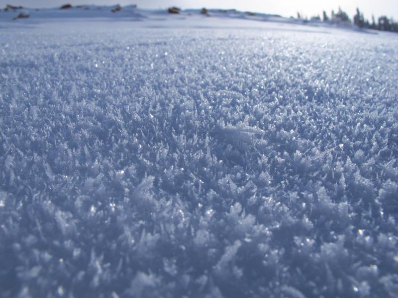
Surface and near surface faceting are occurring with the cold temps. This photo is from around 10,100 ft.
Traveled from 7400-10,200 all aspects.
Future stability will depend on upcoming storm totals and how the new snow bonds to the faceting snow surface but the deep slab instability should be a concern as more weight is added to the snow pack.
Snow on north half of the compass still show's two distinct weak layers with the storm snow/old snow interface being more reactive. Pit tests also indicate potential for step down into weak basal facets.