Have been out the past few mornings (Thursday BCC/PC ridgeline) and Grizzly Gulch today. Overall am finding results consistent with others. Storm snow appeared sensitive on Monday & Tuesday, but things have settled out since. Overall most activity appeared to be within the storm snow, or at the old snow interface. Some slides broke down into October facets (Peak 10420') but overall it seems there wasn't enough of a load to activate the buried weak layers of faceted snow. With new snow, wind, and perhaps upwards of 1" water expected over the weekend, wanted to get a sense of the strength of the buried weak layers. Looked at snow most on northerly and easterly aspects (the weakest snow and also leeward aspect from expected winds.) Working down from the snow surface, am finding:
Density change within storm snow about 15 cms (6") down from snow surface. I could easily identify this layer, but could not get clean shears with shovel tilt tests.
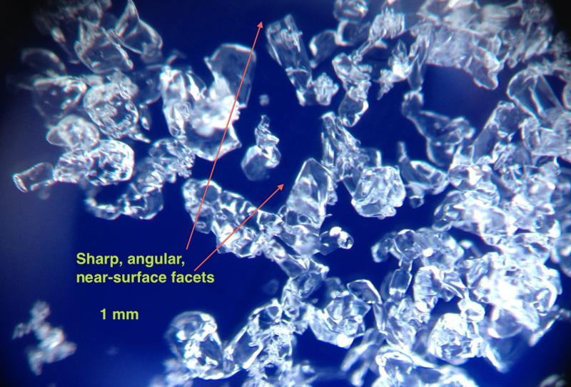
Layer of faceted snow ("Thanksgiving Facets"?) down about 30 cms. These are about 1.0 mm and cleanly angular. (Photos below.) Very easy to identify - CT 12 Q2. I suspect this layer may become active with more of a slab on top.
Facets from early November, as well as October depth hoar. Down about 60-75 cms. ECTN 22 (fractured, but no propagation.)
Overall I don't think we have had enough of a load this past week, but with storm snow and wind expected, am thinking faceted layers may become active. In particular, I am finding the faceted layer that formed over the week of Thanksgiving to be the weakest snow.
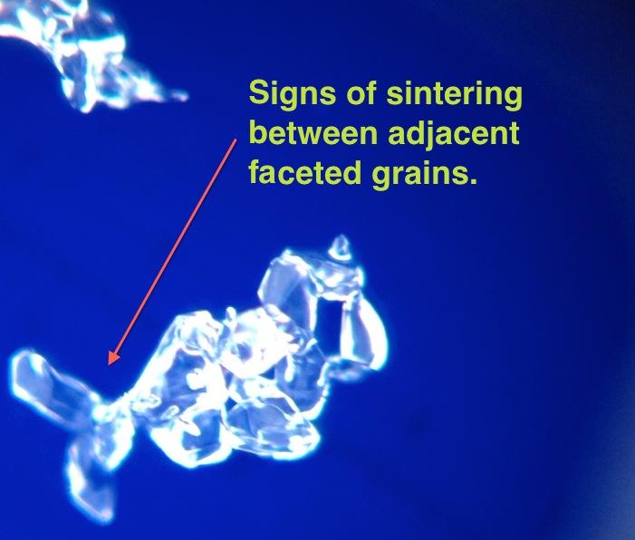
Some of the Thanksgiving faceted snow is also showing signs of sintering, but most of the snow was sharp, angular grains.
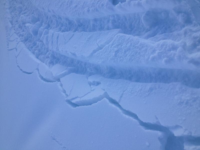
Us Wasatch winter travelers are just not that used to cold temps and how snow behaves when it is this cold. Temps have been more like what you would see in the Tetons, Montanta, or Vermont. This photo shows the cracking still being observed from the stiff, dense snow, most likely due to the cold temps. This is not wind loaded, and you typically do not get cracking like this 3 days after a storm. Fascinating stuff.