Observation Date
12/1/2013
Observer Name
Hardesty
Region
Provo » Provo Canyon » Chablis
Location Name or Route
Southern end of Timpanogos
Weather
Sky
Scattered
Wind Direction
Southwest
Wind Speed
Moderate
Snow Characteristics
Snow Surface Conditions
Faceted Loose
Wind Crust
Melt-Freeze Crust
Damp
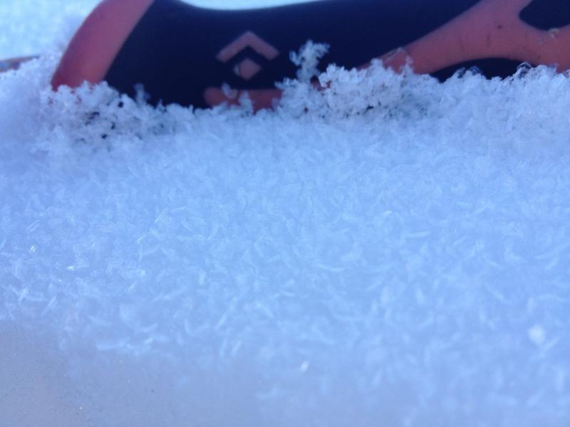
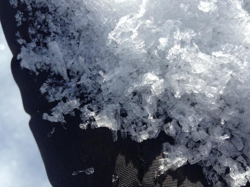
Snow Characteristics Comments
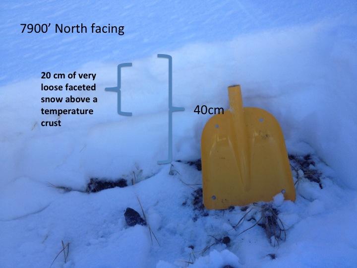
Upper elevations - melt freeze crust on sunny aspects; extensive wind damage on open exposed northerly terrain. Total depths quite variable but average ~ 2-3' at 9800'Mid elevations - melt freeze crust or dirt on sunny aspects; loose recrystallized powder and surface hoar where wind sheltered (note 3 second video of squares on a temperature crust at 7500'). Warm ambient temps by the afternoon had dampened even some of the mid-elevation SH and squares in the shady terrain. Total depths ~ 1-2' at 8000'
Photos below -
Starting zones of the East Chute and NE Chute on Elk Point above Aspen Grove
Bob's Knob - just north of Aspen Grove
Primrose Cirque (prominent ice/mixed line on upper looker's right - go up there you might find an old pin of mine)
Big Provo Hole from the top of Chablis
Red Flags
Red Flags
Poor Snowpack Structure
Red Flags Comments
Poor structure
- recrystallized snow and patches of 2mm surface hoar at low and mid elevations (see notes on warmth and affects)
- "semi-reactive" depth hoar chains beneath the Oct 28 dust layer on northerly aspects above 9500'. Full propagation ECT with over 20 taps, Quality 2 poor shear (see ppt/photo below). Imagine only a heavy load (step-down, large cornice fall, multiple snowmobiles) would bring a dormant layer back to life at this time. ********
Bottom Line - significant wind damage from 22-24 November has left us with tremendous spatial variability in regards to snow conditions in avalanche terrain. In all, I'd expect new snow/wind to bond poorly to slick hard wind slabs and weak surface snow in the shady aspects at the mid and upper elevations.
Avalanche Problem #1
Problem
New Snow
Trend
Same
Snow Profile
Aspect
Northeast
Elevation
9,800'
Video
Don't ever let anyone tell you that all an avalanche forecaster does is ski powder. My good friend and colleague UDOT Avalanche Forecaster Bill Nalli (well described elsewhere) coined the term "thicketeering" for early season Provo, uh, skiing.
Note video, below (perhaps turn volume down from wind) -
Today's Observed Danger Rating
Low
Tomorrows Estimated Danger Rating
Low
Coordinates