In the Provo mountains, high elevation winds seem to have averaged about 35 to 40 mph, with gusts into the 40s overnight. At the mid elevations, averages have been in the mid 20's, with gusts to 40. Temperatures are in the teens along the high ridges, and the 20s elsewhere and the winds will make it feel like the single digits in exposed places.
Much windier overnight in the Ogden and Salt Lake mountains. 10,000’ speeds picked it up into the 20 to 35 mph range, gusts 40s and 50s. High peaks are or had averages overnight in the 40 to 60 mph range, with gusts into the 70s.
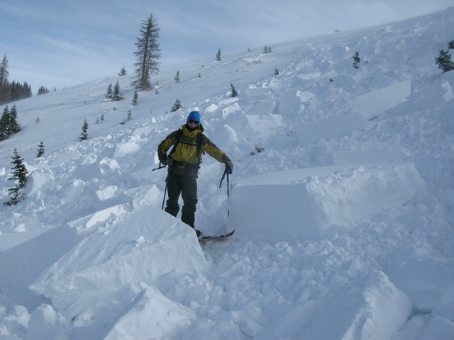
Out of the wind zone, yesterday there was still nice soft snow on very sheltered shady slopes. The snow surface is a bit of a disaster and best avoided on the upper elevation, wind hammered and drifted slopes - hard slab, breakable slab or eroded to the ground.
While there are no new observations from the mid and upper elevations of the Provo area mountains (because there's not enough snow down low to get there...) , below in the Salt Lake area forecast, which we forecast has similar conditions to the Provo mountains up high.
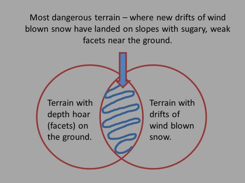
Resort avalanche reduction work produced small to medium avalanches with explosives and ski testing on the upper elevation, wind drifted, northerly facing slopes in the Cottonwoods. One small natural was also noted, and most of these were failing on the facets near the ground. Cracking and collapsing reported from both the Park City side and Ogden area mountains.