Forecast for the Uintas Area Mountains

Craig Gordon
Issued by Craig Gordon for
Saturday, November 23, 2013

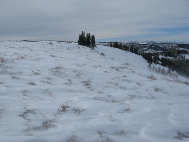
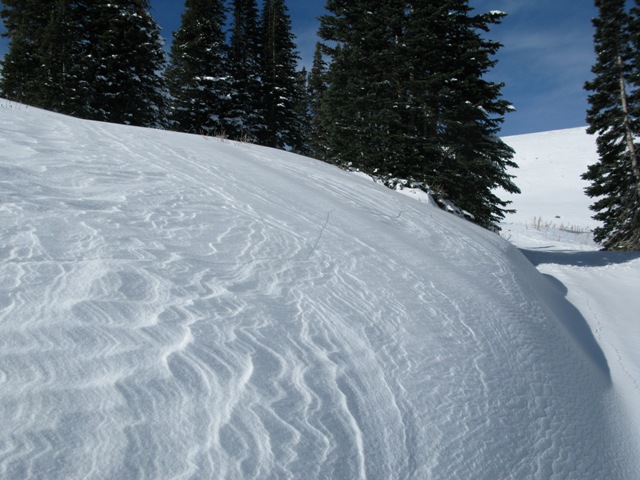
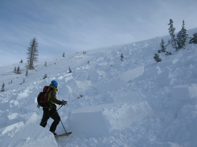
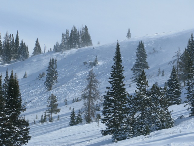
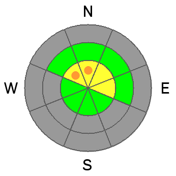
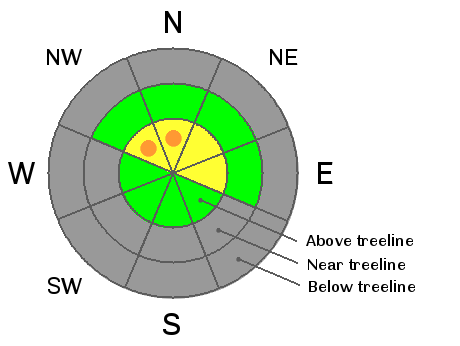
The overall avalanche danger is MODERATE today and human triggered avalanches within the fresh wind drifted snow are possible. Be aware... while isolated to a small portion of the range, pockets of CONSIDERABLE danger are found on steep, upper elevation, north and northwest facing slopes. In this type of terrain todays avalanches have the possibility of breaking to the ground, creating an unmanageable and possibly season ending situation.

Wind sheltered terrain offers a LOW avalanche danger.

Low
Moderate
Considerable
High
Extreme
Learn how to read the forecast here
Weather and Snow

As low pressure spins in New Mexico, east and northeast winds continue to plague the eastern front. For the past two days winds have blown 30-40 mph with gusts in the 50's. Currently, the wind event is affecting the southern half of the range with higher sustained winds. Under clear skies temperatures are in the low 20's. Riding and turning options are limited to grassy meadows and rock free roads.

Click here for current winds, temperatures, and snowfall throughout the range.

Winds have raked the ridges clean....

forming fat drifts like this which should be avoided today.

Recent Avalanches

Cody and I noticed this slide which broke 3' deep and 300' wide on a steep, heavily wind loaded, northwest facing slope in Wolf Creek Bowl. The avalanche occurred naturally on Friday morning as a result of the strong east winds.


As we approached the ridge the investigate the natural avalanche, we triggered this slide from about 100' away. Same characteristics, both breaking to the ground on weak October snow.

More details can be found here.

Ad
Avalanche Problem #1
New Snow
Type
Location
Likelihood
Size
Description

Winds are always the big game changer for the western Uintas, but yesterday's east winds are a bit odd for us, forming sensitive drifts in unusual locations. Some of the weakest snow in the range is found on upper elevation shady slopes, and this is exactly the kind of terrain that now has a thick, cohesive slab resting on top of the weak, sugary junk show near the ground. The sketchiest conditions are found on upper elevation, northerly facing terrain which retained snow since October. Once triggered, today's avalanches will break deeper and wider than you might expect given the early season conditions, and they'll be packing heat... easily knocking you off your skis, board, or sled and taking you for a nasty ride through rocks and stumps barely hidden under our shallow snowpack. The big ticket for today is heading to a rock free meadow where all the old snow from October melted off.

Additional Information

Winds should decrease later today, but for most of the morning they'll continue to blow out of the east and southeast with gusts in the 40's and 50's along the high exposed ridges.Temperatures climb into the low 30's before dipping into the low to mid 20's overnight. Clouds increase late in the day and we may see a flake or two before high pressure begins to build. There are no big storms in sight.

General Announcements

Remember your information can save lives. If you see anything we should know about, please participate in the creation of our own community avalanche advisory by submitting snow and avalanche conditions. You can call me directly at 801-231-2170, email [email protected], or email by clicking HERE

This is a great time of year to schedule a free avalanche awareness presentation for your group or club. You can contact me at 801-231-2170 or email [email protected]

Donate to your favorite non-profit –The Friends of the Utah Avalanche Center. The UAC depends on contributions from users like you to support our work.

The information in this advisory is from the US Forest Service which is solely responsible for its content. This advisory describes general avalanche conditions and local variations always occur.

I will update this advisory by 7:00 AM on Sunday Nov. 24, 2013