If you trigger an avalanche in the backcountry - especially if you are adjacent to a ski area – please call the following teams to alert them to the slide and whether anyone is missing or not. Rescue teams can be exposed to significant hazard when responding to avalanches, and do not want to do so when unneeded. Thanks.
Salt Lake and Park City – Alta Central (801-742-2033), Canyons Resort Dispatch (435-615-3322)
Twitter Updates for your mobile phone - DETAILS
UDOT canyon closures UDOT at (801) 975-4838
Get your advisory on your iPhone with the Utah Avalanche Center mobile app, along with great navigation and rescue tools.
Remember your information can save lives. If you see anything we should know about, please participate in the creation of our own community avalanche advisory by submitting snow and avalanche conditions. You can also call us at 801-524-5304 or 800-662-4140, email by clicking HERE, or include #utavy in your tweet or Instagram.


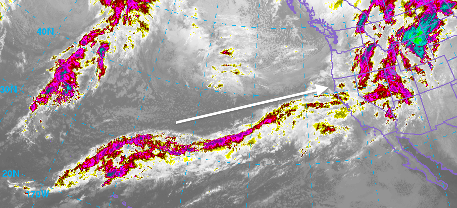
 low pressure system drifting to our south later in the week. For today, expect periods of snow with only a couple of inches of accumulation if that. Southerly winds should slow a bit more and switch more west. Temperatures will remain fairly mild with snow levels around 7000 feet. Temperatures cool slightly and periods of snow should become more numerous on Wednesday with a better chance of a few inches of accumulation. Not much but we'll take it! Things get dry later in the week.


