
Forecast for the Uintas Area Mountains

Issued by Craig Gordon for
Monday, April 15, 2013
Monday, April 15, 2013
We've wrapped up forecasting for the winter and in a few days I'll have my toes in white sand and blue Caribbean water. However, I couldn't leave without thanking a truly awesome cast of characters. First and foremost is the incredible information we get from Ted Scroggin who is the glue that holds this program together. Ted knows the Uinta's like no other and we are truly grateful to have such a high caliber forecaster on our team.... you rock man! Also, my partner in crime Trent Meisenheimer, devoted a ton of energy to this program and deserves a huge shout out. This guy is the future of avalanche forecasting and education in this state and I'm stoked he's part of our crew.
Partnerships are huge to the western Uinta advisory program and both the Heber-Kamas and Evanston Ranger Districts are instrumental in supplying field partners and in-kind support. In addition, many thanks to the Park City Powder Cats for all the snow and avalanche information and for the great professional dialog during times of heightened avalanche danger. Also, hi-end, state-of-the-art sleds make all the difference, allowing us to visit more terrain and issue more accurate advisories. We couldn't do this with out the great support from Tri-City Performance and Polaris along with Weller's Recreation and BRP/Ski-doo.
In addition, the National Weather Service helped us install two new sites this fall and have been key in helping us maintain a total of six weather stations. Many thanks to Al Martinelli, Greg Wallace, and Larry Dunn for making this happen.
And finally, thanks to all of you who helped support this program by attending our annual fundraisers and classes and by submitting snow and avalanches observations. John Garofalo, Michael Janulaitis, and Jason Boyer.... your info was top-notch this year!
Click here to view a great viddy helping to explain the great things we've accomplished with all the support form this community.
Wondering why last winter was so crazy? Click here to watch the 2011-12 Utah Winter Review... an excellent recap of last years conditions.
The past two storms have produced three very large avalanches, all breaking to the ground and failing on weak, sugary snow formed in January-
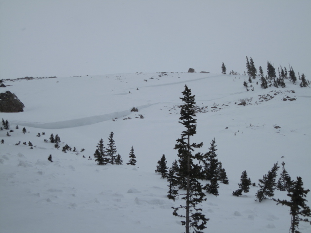
Ted visited the north side of Lofty Lake Peak yesterday and found this massive avalanche. We think this natural slide occurred sometime Wednesday April 10th, as a result of the big storm and very strong winds.
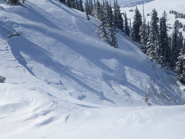
This avalanche near Cherry Hill on the North Slope was triggered on Wednesday April 10th from a weak, rocky section of terrain near the ridge.
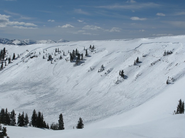
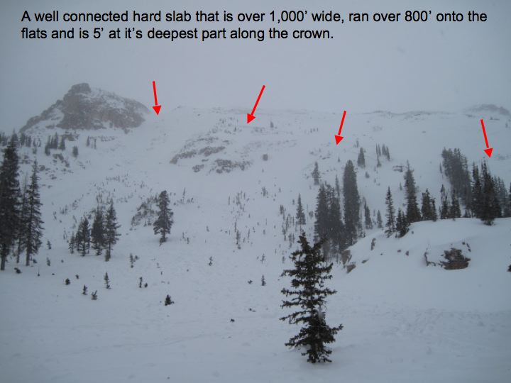
This very large natural slide in the Super Bowl occurred on the morning of April 3rd. The crown was over 1/2 mile wide and averages 30" in depth. Click here for a description explaining the slide and snowpack conditions leading to this very unusual event.
Click here for recent observations from the region.

When it snows or the winds blow, you can expect a spike in avalanche activity. The good news is.... the new storm snow tends to stabilize rather quickly this time of year. The bad news is.... we've got very weak snow near the ground and each time we've seen significant snow, water weight, wind, or rapid warming we've seen big avalanches breaking to the ground. This year is different and the cold dryspell during January sealed the deal, helping to create and then preserve a very weak layer of sugary snow. Click here for a video describing the setup.
Making conditions more sketchy is that you can ride plenty of slopes and be good to go, but if you find the right combination of strong snow overlying weak sugary snow chances are you're gonna collapse the slope and be staring down the barrel of a very dangerous slide. Our problem child hasn't gone away and steep, rocky slopes remain suspect. If you're travels take you onto a snowpack that feels punchy and you find yourself sinking into weak sugary snow, carefully evaluate the kind of terrain you're headed to and the kind of terrain you're connected to.
Wet slides and sluffs are pretty easy to manage. As the day wares on and the snow heats up, like clockwork, wet avalanches will become more widespread on steep, sunny slopes. If you're feeling like an ant under a magnifying glass... so is the snow. During the heat of the day, steer clear of terrain traps like gullies and road cuts, where even a small slide can pile up cement-like debris very deeply.
Remember your information can save lives. If you see anything we should know about, please participate in the creation of our own community avalanche advisory by submitting snow and avalanche conditions. You can call me directly at 801-231-2170, email [email protected], or email by clicking HERE
This is a great time of year to schedule a free avalanche awareness presentation for your group or club. You can contact me at 801-231-2170 or email [email protected]
Donate to your favorite non-profit –The Friends of the Utah Avalanche Center. The UAC depends on contributions from users like you to support our work.
The information in this advisory is from the US Forest Service which is solely responsible for its content. This advisory describes general avalanche conditions and local variations always occur.
See you back here when the snow flies!