

Forecast for the Ogden Area Mountains

Friday morning, April 12, 2013
With strong sun and daytime heating, the avalanche danger will rapidly rise to MODERATE for wet avalanches on almost all snow covered slopes. It will become easy for people to trigger long running, wet loose sluffs as the snow heats. There is also a MODERATE danger of triggering a wind drift on steep, upper elevation shady slopes.
 Special Announcements
No words to truly express our sorrow at the death of UDOT avalanche forecaster Craig Patterson yesterday – a friend, avalanche educator, and integral part of Utah avalanche professionals trying to unravel the mysteries of snow and avalanches, and working to keep people safe.
Craig was by himself and caught in an avalanche on Kessler Slabs, in Big Cottonwood Canyon yesterday. When he was reported missing, a search found his body on the surface of the debris. Several staff will head to the accident scene early this morning and we will create and update an accident report on line with details as we get them.
 Weather and Snow
Skies cleared of the high thin clouds early this morning, allowing temperatures to finally drop below freezing around 4 am at the mid and low elevation stations in the Ogden area mountains. The upper elevations have had a better refreeze, and are in themid 20s this morning. The westerly winds are averaging less than 10 mph, except for the high peaks which have averages in the 15 to 20 mph range.
The snow is no match for the high April sun - the surface snow heated and dampened on just about every aspect and elevation yesterday, so breakable crusts will be widespread this morning. A few last remnants of dry snow may exist on steeper, high elevation northerly facing slopes.
 Recent Avalanches
No new avalanches reported from the Ogden area mountains. In the Cottonwoods, which received more snow this past week, early in the day, control work released winds slabs on east and northeast facing slopes with both ski cuts and explosives, and a few natural avalanches were noted. As the day heated, both skier released and natural wet avalanches occurred, on all aspects, especially at the mid and lower elevations. I estimate the fatal Kessler avalanche to be on a northeast facing slope, at approximately 9,000’.
Photo by Bill Hunt of wind drift, Ogden area mountains.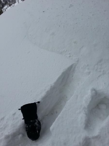

Wet Snow
Description
The strong, high sun will rapidly heat the snow today on almost all aspects and elevations, including the northerly facing slopes. The snow surface will first become damp, then wet and slushy. Once wet sluffs start moving, they can pick up snow all the way down the slope, and run long distances with debris piles larger than one would expect. Start early and finish early today. Have an exit plan to get back to the trailhead that avoids steep slopes and terrain traps such as gullies and road banks.
Persistent Weak Layer
Description
A few lingering wind slabs may exist along the high ridge lines in the Ogden area mountina.s A few fresh wind drifts may be deposited by today’s westerly winds along the high ridges. These drifts will be dense, and may be hard. As always, stay off of any steep wind drifted slopes..
Additional Information
High pressure will bring clear, sunny skies, warm temperatures and light westerly winds to the mountains today. Only the highest peaks will have wind speeds averaging in the 20 to 30 mph range. Elsewhere, winds will average less than 15 mph. Temperatures will warm into the upper 20s at along the high ridges, and into the low to mid 40s at 8000’.
Tonight, clouds will start to increase and Saturday will be partly cloudy, and slightly warmer with gusty southwesterly winds. A small shot of snow is possible Saturday afternoon or evening. Another stronger, colder storm will bring snow starting Sunday night or Monday.
General Announcements
If you trigger an avalanche in the backcountry - especially if you are adjacent to a ski area – please call the following teams to alert them to the slide and whether anyone is missing or not. Rescue teams can be exposed to significant hazard when responding to avalanches, and do not want to do so when unneeded. Thanks.
Salt Lake and Park City – Alta Central (801-742-2033), Canyons Resort Dispatch (435-615-3322)
Ogden – Snowbasin Patrol Dispatch (801-620-1017)
Powder Mountain Ski Patrol Dispatch (801-745-3772 ex 123)
Provo – Sundance Patrol Dispatch (801-223-4150)
Dawn Patrol Forecast Hotline, updated by 05:30: 888-999-4019 option 8.
Twitter Updates for your mobile phone - DETAILS
Daily observations are frequently posted by 10 pm each evening.
Subscribe to the daily avalanche advisory e-mail click HERE.
UDOT canyon closures UDOT at (801) 975-4838
Wasatch Powderbird Guides does daily updates about where they'll be operating on this blog http://powderbird.blogspot.com/ .
Remember your information can save lives. If you see anything we should know about, please participate in the creation of our own community avalanche advisory by submitting snow and avalanche conditions. You can also call us at 801-524-5304 or 800-662-4140, email by clicking HERE, or include #utavy in your tweet.
Donate to your favorite non-profit –The Friends of the Utah Avalanche Center. The UAC depends on contributions from users like you to support our work.
For a print version of this advisory click HERE.

This advisory is produced by the U.S. Forest Service, which is solely responsible for its content. It describes only general avalanche conditions and local variations always exist. Specific terrain and route finding decisions should always be based on skills learned in a field-based avalanche class.