

Forecast for the Logan Area Mountains

Sunday morning, April 7, 2013
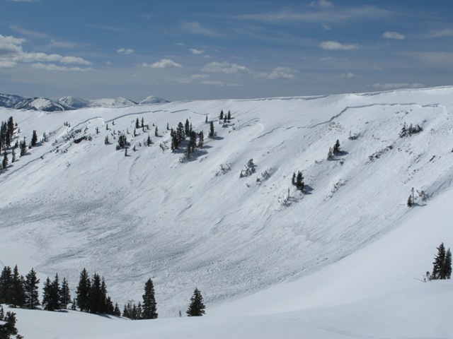
Heightened avalanche conditions exist in the backcountry, and there is a MODERATE (level 2) danger of wind slab avalanches in drifted terrain. Additional new snow and intensifying southwest winds will cause an increasing danger today. You could trigger 1 to 2-foot-deep wind slabs and/or cornice falls in drifted upper elevation terrain. Wet avalanches are possible in some areas during midday warmth. Evaluate the snow and terrain carefully, avoid steep drifted terrain and melt softened saturated snow, and continue to follow safe travel protocols.
 Special Announcements
iPhone & iPad users: With help from Backcountry.com & Garafa, LLC, we now have a free mobile app that combines the best of the UAC advisories, observations, and weather summaries with National Weather Service products & UDOT road updates. This puts the tools you need for planning your day and your run in one handy mobile package. Check it out, tell your friends, and let us know what you think.http://utahavalanchecenter.
 Weather and Snow
The Tony Grove Snotel at 8400' reports around 6" inches of new snow, containing 6/10ths of an inch of water in the last 24 hrs, bringing the 48-hour total up to an inch of water in something like 11 inches of fresh snow. With 53"of total snow, the station now contains 56% of average water for the date. The CSI Logan Peak weather station at 9700' reports 25 degrees with southwest winds averaging close to 20 mph. You'll find several inches of new snow at upper elevations capping slowly solidifying wet snow.. Expect more new snow, increasing southwest winds, and a good deal of on going drifting in the mountains today.
 Recent Avalanches
No new avalanches were reported recently in the Logan Area.....
But, a very large natural heat related persistent slab avalanche occurred in the midday heat on Wednesday in the Western Uintas. Graig Gordon and Ted Scoggin of the Utah Avalanche Center visited the site Thursday and report something like a 3/4-mile wide and four-foot deep monster....
Here's a link to our updated Avalanche List.

Persistent Weak Layer
Description
With close to a foot of new snow and an inch of water equivalent in the past 48 hrs, there is plenty of fresh snow for intensifying southwest winds to drift around at upper elevations. I'm expecting several addition inches of accumulation and increasing southwest winds today, and triggered wind slab avalanches in the 1 to 2-foot-deep range are quite possible in drifted terrain. Watch for and avoid stiffer snow and fresh drifts on the lee of major ridges and in and around terrain features like sub-ridges, rock bands, and gullies. Freshly built-up cornices are also a concern, as they might break further back than you expect and could trigger wind slab avalanches on slopes below.
Wet Snow
Description
Gradual cooling and cloud cover this weekend paused the meltdown and helped to solidify the soft and saturated snow.. Even though the danger is dropping with the temperatures, wet avalanches remain possible after an extended warm spell and rain this morning at lower and mid elevations. Pockets of heightened avalanche conditions exist in steep terrain. With midday temperatures forecast close to 40 degrees at upper elevations again, an early departure from the mountains will be a good call. You should continue to avoid all steep terrain where you sink or punch down into saturated snow.
Additional Information
Better pull the goggles out of the closet, wax up the boards, or oil up the sled. The season is waning, but it looks like a powder day today, and there's a few more on the plate this week. A moist westerly flow will bring more snow to upper elevations today, with 3 to 7 inches of additional accumulation and strengthening southwest winds forecast. Expect 9000' temperatures to climb to near 40 degrees again and 15 to 20 mph southwest winds increasing to 20 to 30 mph in the afternoon. A cold Pacific storm will move into the region tonight, and significant additional snowfall (up to around 2') is possible through tomorrow night along with much cooler temperatures... Snowy weather will continue through Tuesday, with short-lived clearing and a bit of a warm-up on Wednesday...
Check out the Logan Mountain Weather page...
General Announcements
For a printer friendly version of this advisory click HERE
Remember your information from the backcountry can save lives. If you see or trigger an avalanche, or see anything else we should know about, please send us your snow and avalanche observations. You can also call us at 801-524-5304 or email by clicking HERE. In the Logan Area you can contact Toby Weed directly at 435-757-7578.
I will update this advisory on Monday, Wednesday, Friday, and Saturday mornings by around 7:30...
This advisory is produced by the U.S.D.A. Forest Service, which is solely responsible for its content. It describes only general avalanche conditions and local variations always exist.