

Forecast for the Uintas Area Mountains

Wednesday morning, April 3, 2013
While not widespread, pockets of CONSIDERABLE danger will be found at and above treeline and human triggered avalanches are likely on steep wind drifted slopes, especially those facing the north half of the compass
The danger of wet avalanches is generally LOW this morning, but will rapidly rise to MODERATE and human triggered wet slides and sluffs will be possible. Carefully plan your exits and get off of and out from under steep slopes during the heat of the day
 Special Announcements
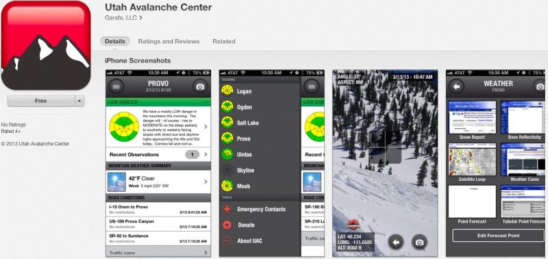
iPhone & iPad users: With help from Backcountry.com & Garafa, LLC, we now have a free mobile app that combines the best of the UAC advisories, observations, and weather summaries with National Weather Service products & UDOT road updates. This puts the tools you need for planning your day and your run in one handy mobile package. Check it out, tell your friends, and let us know what you think. http://utahavalanchecenter.org/apps
 Weather and Snow
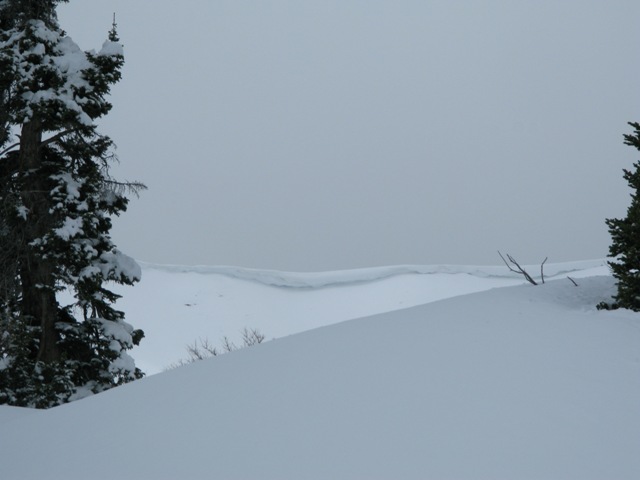
Wow... what a great storm for the western Uinta's. The North Slope did particularly well with 12"-16" of new snow and about 1.5" of H2O. Further to the south both Mirror Lake and Trial Lake received 10" of snow, but the south half of the range didn't get invited to the party and just 3" of new snow fell. As the storm moved south and east yesterday, northeast winds blew into the 40's and 50's, but mellowed out late last night and are currently blowing 15-25 mph along the high peaks. Skies cleared out overnight, but temperatures remained rather balmy only bottoming out in the high 20's, where they sit this morning. Most of the storm snow got shrink wrapped yesterday, though dry snow will still be found on high elevation north facing terrain.
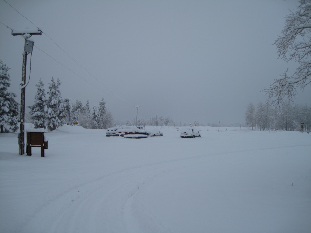
April showers... bring spring powder! The North Slope got pounded Monday night with over a foot of snow.
Recent observations can be found here.
Wondering why last winter was so crazy? Click here to watch the 2011-12 Utah Winter Review... an excellent recap of last years conditions.
 Recent Avalanches
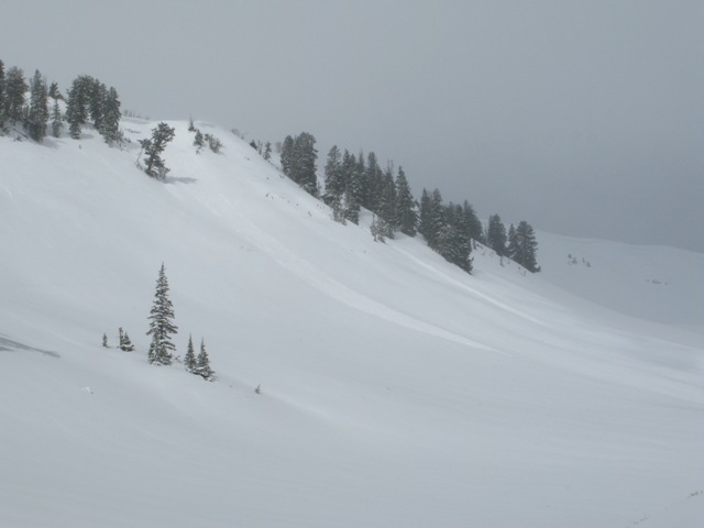
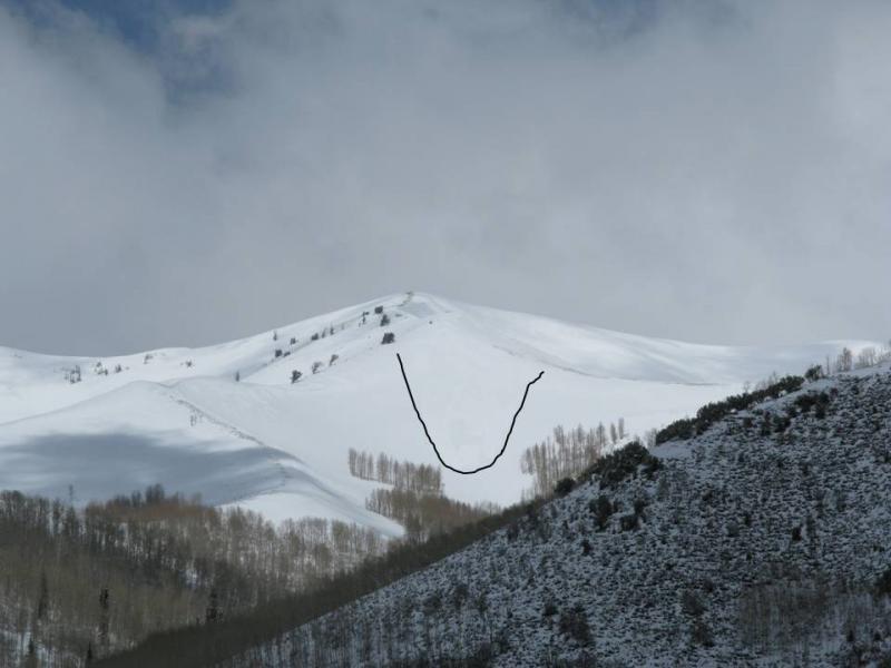
We were in upper Weber Canyon yesterday grabbing weather stations and spotted a couple soft slabs failing within the new storm snow. The bottom picture was taken from quite a distance and I had to draw in the slide boundaries. None the less it was a decent piece of snow breaking about 150' wide and would be big enough to ruin your day.
Click here for recent observations from the region.

Persistent Weak Layer
Description
Most lower and mid elevation terrain got baked by yesterday's intermittent sun, but high elevation slopes remained cold and creamy. Today however, the high country will get a taste of strong spring sunshine and as a result, the snow will settle and become more of a cohesive slab. The new storm snow may be a little stubborn to trigger at first, but once moving, todays avalanches can gouge into weak layers of saturated snow buried deeper in the snowpack, producing a much larger slide than you might've expected. Best way to avoid a cement mixer-like avalanche is to steer clear of steep, wind loaded slopes, especially if they appear fat and rounded.
Wet Snow
Description
The sun is powerful this time of year, easily baking nearly every aspect and elevation. As the day wares on and the snow heats up, like clockwork, the pack becomes damp and wet slides and sluffs will become more widespread on steep slopes. During the heat of the day, you'll want to avoid terrain traps like gullies and road cuts, where even a small slide can pile up bone snapping debris very deeply.
Cornice
Description
Winds have been all over the place and cornices continue to grow and sag under their own weight. As they heat up the next few days they'll become more tender and have the possibility to break back further than you might expect.
Additional Information
High pressure is building and it'll be a beautiful day in the mountains. Today you can expect sunny skies, northerly winds blowing 10-20 mph, and temperatures soaring into the upper 40's. Overnight lows dip into the upper 20's. Clouds increase late Thursday as a quick hitting system slides through the region overnight, delivering 3"-6" of snow. An unsettled pattern is on tap for the weekend.
General Announcements
Remember your information can save lives. If you see anything we should know about, please participate in the creation of our own community avalanche advisory by submitting snow and avalanche conditions. You can call me directly at 801-231-2170, email [email protected], or email by clicking HERE
This is a great time of year to schedule a free avalanche awareness presentation for your group or club. You can contact me at 801-231-2170 or email [email protected]
Donate to your favorite non-profit –The Friends of the Utah Avalanche Center. The UAC depends on contributions from users like you to support our work.
The information in this advisory is from the US Forest Service which is solely responsible for its content. This advisory describes general avalanche conditions and local variations always occur.
The information in this advisory expires 24 hours after the date and time posted, but will be updated by 7:00 AM Saturday April 6th.