


Forecast for the Salt Lake Area Mountains

Saturday morning, March 30, 2013
A mostly Low danger this morning will rapidly rise to MODERATE WITH POCKETS OF CONSIDERABLE with daytime heating. Natural and human triggered slides will become likely during the heat of the day. Again, the Bottom line is to get off of and out from underneath steeper slopes by the time they've become wet, unconsolidated and unstable (and not limited to the sunny aspects). The danger may be more pronounced in the Park City, Ogden, and Provo area mountains as they've suffered warmer temps over the last three days...
 Special Announcements
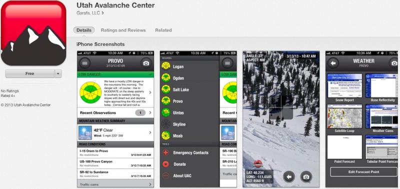
iPhone & iPad users: With help from Backcountry.com & Garafa, LLC, we now have a free mobile app that combines the best of the UAC advisories, observations, and weather summaries with National Weather Service products & UDOT road updates. This puts the tools you need for planning your day and your run in one handy mobile package. Check it out, tell your friends, and let us know what you think. http://utahavalanchecenter.org/apps
 Weather and Snow
Well it's a sign of spring when there are more cars at the Gate Buttress for rock climbing in Little Cottonwood Canyon than at the backcountry trailheads. It's also a sign of spring when there are tons of surveys and blog entries from us at the UAC -
- Slope Steepness Blog by Toby Weed, our forecaster in Logan
- 3d Danger Rose Prototype by Brett Kobernik
- Avalanche Route Ratings by Drew Hardesty
- Twitter Updates for your mobile phone - DETAILS - become part of the real-time avalanche community by adding info to #utavy
- Help the avalanche centers improve avalanche danger communication via mapping. A grad student from Western Washington University has a survey. Your input is vital! http://myweb.students.wwu.edu/~kaneb2/avy-survey/
Skies are clear to partly cloudy with similar overnight lows in the upper 20s to low 30s. Well noted are the well-above freezing temps (upper 30s to low 40s) below roughly 8500' in the Park City, Ogden, and Provo area mountains for the 3rd night in a row. Winds are generally light and westerly. The last vestiges of leftover dense powder can still be found on straight north above 10,000'; otherwise it's a collection of quasi-corn, breakable crust, mashed potatoes and isothermal snow.
 Recent Avalanches
No significant activity reported yesterday except for some larger rollerballs and a few wet sluffs on steep slopes as they heated up. More glide cracks are appearing as well. There were not many people in the backcountry yesterday.
Wet Snow
Description
It's the 3rd night in a row of a poor refreeze in the Park City, Provo, and Ogden area mountains below about 8500'. To be sure, clear skies will foster a superficial refreeze due to long-wave radiational cooling, but it'll be a wolf-in-sheep's-clothing. Many areas are still transitioning from a winter to spring snowpack...and can tend to produce wet slides while the plumbing and piping sorts its self out in the snowpack to allow for the free water to work its way out and not pool along layers and interfaces.
A spike in water flow is forecasted for some streams by the Colorado River Basin Forecast Center. (They are co-located with us at the National Weather Service downtown.) Mark Saurer, part of the Park City Mountain Resort snow safety, put together one of the more interesting research papers in awhile and presented his findings last September in Anchorage. He was looking at the correlation between forecasted spikes in water flows along the creeks and drainages with wet avalanche activity in the mountains.

While the temperatures are roughly the same, I'm expecting more insolation - that is more energy added to the snowpack over time due to less cloud cover and more sun. This translates to more melting and free water. At a certain point, a little water is ok, a lot is not. Take two plastic cards, dampen the interface between them and voile! they stick together. Now try a gallon and yep, it's just a mess. Much the same with the snowpack.
To be sure, our first significant wet cycle of the year occurred on the 14th/15th of this month and I'm not forecasting another cycle; still, wet snow forecasting confidence has a lot to be desired. The idea is by noting little weather parameters from home and then ground truthing them from the field and making simple observations you tend to stack the odds in your favor. Yellow flags -
- If you're sinking in past your boot tops or augering in with your sled
- Can you easily punch your ski pole or probe to the ground - or worse yet, stepping off your ski/board/sled and punch through to the ground into wet snow
- Are you able to easily get wet snow to sluff with little effort on moderate to steep slopes?
Bottom line is to get off of and out from underneath steeper sunny slopes by the time they've become wet, unconsolidated and unstable. Avoid being in or above steep walled gullies or other terrain traps that funnel snow into deeper piles of wet cement.
Wind Drifted Snow
Description
Glide avalanches and cornice failure become increasingly likely in the spring. Notorious glide avalanche terrain includes Stairs Gulch, Broads Fork and Mill B South of Big Cottonwood Canyon and have resulted in a double fatality in - I believe - spring of '99 in Stairs Gulch and a significant accident and broken leg earlier this year (in Broads Fork). Check out Glide Avalanches in our Encyclopedia and watch the avalanche rip-out.
Additional Information
Should be clear to partly cloudy today with less potential for convective showers. Temperatures should rise from freezing this morning to the mid 50s at the 8000 foot level and around 40 along the ridges again. Winds will be light from the west to northwest. A weak cutoff Low affects the area late Sunday through the first part of the week and may produce 3-7" of snow....
General Announcements
Go to http://www.backcountry.com/utah-avalanche-center to get EVEN MORE DISCOUNTED tickets from our partners at Beaver Mountain and Sundance. All proceeds benefit the Utah Avalanche Center.
If you trigger an avalanche in the backcountry - especially if you are adjacent to a ski area – please call the following teams to alert them to the slide and whether anyone is missing or not. Rescue teams can be exposed to significant hazard when responding to avalanches, and do not want to do so when unneeded. Thanks.
Salt Lake and Park City – Alta Central (801-742-2033), Canyons Resort Dispatch (435-615-3322)
Ogden – Snowbasin Patrol Dispatch (801-620-1017)
Powder Mountain Ski Patrol Dispatch (801-745-3772 ex 123)
Provo – Sundance Patrol Dispatch (801-223-4150)
Dawn Patrol Forecast Hotline, updated by 05:30: 888-999-4019 option 8.
Twitter Updates for your mobile phone - DETAILS
Daily observations are frequently posted by 10 pm each evening.
Subscribe to the daily avalanche advisory e-mail click HERE.
UDOT canyon closures UDOT at (801) 975-4838
Wasatch Powderbird Guides does daily updates about where they'll be operating on this blog http://powderbird.blogspot.com/ .
Remember your information can save lives. If you see anything we should know about, please participate in the creation of our own community avalanche advisory by submitting snow and avalanche conditions. You can also call us at 801-524-5304 or 800-662-4140, email by clicking HERE, or include #utavy in your tweet.
Donate to your favorite non-profit –The Friends of the Utah Avalanche Center. The UAC depends on contributions from users like you to support our work.
For a print version of this advisory click HERE.
This advisory is produced by the U.S. Forest Service, which is solely responsible for its content. It describes only general avalanche conditions and local variations always exist. Specific terrain and route finding decisions should always be based on skills learned in a field-based avalanche class.