

Forecast for the Uintas Area Mountains

Sunday morning, March 24, 2013
In the wind zone at and above treeline the avalanche danger is MODERATE and human triggered avalanches are possible on steep, mid and upper elevation, wind drifted slopes.
Out of the wind and on low angle slopes with no steep terrain above or adjacent to where you're riding, you'll find a LOW avalanche danger.
 Special Announcements
We're having some communication issues with our ridgetop wind sensors. We'll visit the sites this week, get it figured out, and keep you posted when they're up and running again.... thanks for your patience.
 Weather and Snow
High pressure is nudging into the region and skies are mostly clear. West-northwest winds are blowing 15-25 mph along the ridges with a few gusts in the mid 30's along the high peaks. It's crisp out there this morning as temperatures crashed into negative territory overnight. Currently, temperatures are right around zero at the trailheads and hovering near -8 degrees at the upper elevations. This is the time of year when the Uintas come on and today shouldn't disappoint. On a go-anywhere base, riding and turning conditions are about as good as they get.
Recent observations can be found here.
Wondering why last winter was so crazy? Click here to watch the 2011-12 Utah Winter Review... an excellent recap of last years conditions.
 Recent Avalanches
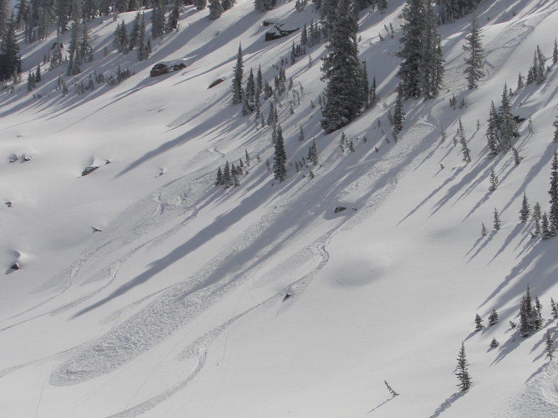
Long running sluffs and shallow soft slabs predictably breaking within the new storm snow were observed yesterday in steep, wind drifted terrain throughout the region. Michael J sent in this great image clearly illustrating our current set up.
Click here for recent observations from the region.

Persistent Weak Layer
Description
This weeks series of storms helped turn the Uintas from zero to hero and the snowpack is relatively well behaved. While most of our wind drift issues have probably settled out quite a bit since yesterday, there may still be a deeper pocket or two lurking out there that can break a bit wider than you might expect. Remember- all this new snow is resting on a variety of hard, slick bed surfaces. If you're getting into unforgiving, steep, sustained terrain, today's avalanches may have the potential to run a little farther than you might anticipate.
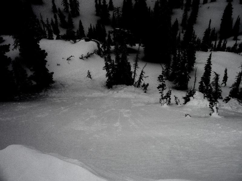
A chunk of cornice dropped on the slope below pulled out a medium sized soft slab that could've ruined your day if you got slammed into the trees below. Thanks again to Michael J for the great images of his trip yesterday.
Cornice
Description
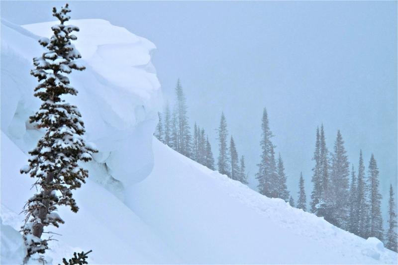
Cornices continue to grow and may break back a little further than you might expect. Probably best to steer clear of these unpredictable pieces of snow.
Additional Information
A cold northwest flow over the region with enough moisture for an occasional flurry or two is on tap for the area today. Northwest winds blow in the 20's and 30's along the ridges and will tend to decrease as the day wares on. High temperatures only climb into the low 20's before bottoming out in the single digits overnight. A westerly flow early in the week signals a warming trend and also a weak storm grazing the region late Tuesday for a few inches of new snow. Skies clear for midweek and then it looks like another good shot of snow for late Saturday and Sunday.
General Announcements
Remember your information can save lives. If you see anything we should know about, please participate in the creation of our own community avalanche advisory by submitting snow and avalanche conditions. You can call me directly at 801-231-2170, email [email protected], or email by clicking HERE
This is a great time of year to schedule a free avalanche awareness presentation for your group or club. You can contact me at 801-231-2170 or email [email protected]
Donate to your favorite non-profit –The Friends of the Utah Avalanche Center. The UAC depends on contributions from users like you to support our work.
The information in this advisory is from the US Forest Service which is solely responsible for its content. This advisory describes general avalanche conditions and local variations always occur.
The information in this advisory expires 24 hours after the date and time posted, but will be updated by 7:00 AM Wednesday March 27th.