

Forecast for the Ogden Area Mountains

Saturday morning, March 23, 2013
The avalanche danger is MODERATE on all steep slopes, especially those with drifts of wind-blown snow. Both new snow slides and wind drifts can be triggered, with drifts most widespread on northeast, east and southeast facing slopes at mid and upper elevations. Cornices are sensitive and breaking back further than expected. Any period of sun will make the snow sensitive and damp snow sluffs easy to trigger on steep slopes. Test the stability on test slopes, lower angle slopes and using slope cuts before diving into a steep slope.
 Special Announcements
Little Cottonwood Canyon Road is closed for avalanche control work this morning. The areas north of the road between Gate B and Grizzly Gulch will be closed to all backcountry users beginning at 400 am and hope to reopen around 8 or 9 am.
 Weather and Snow
It’s going to be a smoking powder day for much of northern Utah, as snow continued overnight, topping off a week’s worth of small storms with 5% fluff.
- Upper Cottonwoods – 4 to 8” overnight, with week storm totals of 20 to 28 inches
- Park City side – 3 to 4” overnight, with the week storm totals of 12 to 18 inches
- Ogden mountains - 3-5” overnight, with the week storm totals 12 to 18 inches
- Provo mountains received their first snow of the week overnight, about 3 inches.
It’s full on winter conditions, with single digits to slow teens in the Ogden area mountains. The northwesterly winds have decreased, and are in the 10 to 20 mph range, with gusts in the 20s.
 Recent Avalanches
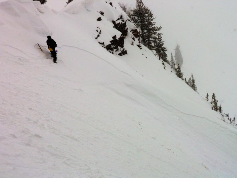
Yesterday, the newest snow was sensitive, especially during periods of heavy snowfall or when the winds picked up. In the Cottonwoods, there were a few small naturals in the backcountry, and more widespread, easily triggered shallow soft slabs, the largest reported in Banana Days, 10" deep by 100' wide. Resort control work included new snow sluffs and soft slabs up to size D2 – large enough to injure or bury a person. In the Park City and Ogden area mountains, only sluffing of the new snow was reported. Cardiff Fork

Persistent Weak Layer
Description
The northwesterly winds picked up yesterday afternoon, and continued to blow in the 15 to 20 mph range with gusts to 30 for much of the night. High peaks were gusting in the 50s. With lots of snow available for transport, there are significant areas of wind drifted snow, now hidden beneath the overnight snow. These drifts will be sensitive to people, but are predictable and should be easy to avoid. They will be most widespread on high elevation northeast, east and southeasterly facing slopes and cracking of the snow is a red flag warning that you are in an area of sensitive wind drifts. Also watch for drifts off ridgelines around sub ridges, mid slope break overs and the sides of gullies, at both upper and mid elevations.
CORNICES go hand in hand with wind slabs, and will be very sensitive today. They can be triggered from a distance or break back further than expected, so give them a wide berth. As you travel ridge lines, be very careful not to inadvertently release a cornice on any people below you.
New Snow
Description
Even out of wind affected terrain, the sheer volume of new snow could be unstable. On steep slopes, people could release shallow soft slabs and sluffs, large enough to catch and carry a person. The new snow will be especially sensitive during any periods of intense snowfall or increased winds, which are most likely to occur this morning.
Wet Snow
Description
It’s strange to talk about wet slides when temperatures are in the single digits, but it’s past the equinox and the sun is strong. If the sun does pop out where you are, the new snow could become damp and sensitive on steep, sunny slopes, and sluffs easily triggered. Periods of thin clouds with the heat from the sun coming through could make the snow equally sensitive on a variety of aspects and lower elevations.
Additional Information
The very cold, northwest flow has triggered lake effect snow bands, which should continue to bring snow showers to the Cottonwoods through mid-day. 2 to 4” of additional snow possible for the Cottonwoods, elsewhere look for partly cloudy skies, with no additional snow expected. Highs today will be near 20 at 8,000’ but remain in the single digits at 10,000’. Other than gusts associated with squalls, the northwesterly winds should be in the 5 to 15 mph range, gusting in the low 20s. The high ridge lines will have snow drifting averages to 20 mph, with gusts in the 30s.
After a cold Sunday, a gradual warming trend is expected early in the week, with a chance of light showers on Tuesday.
General Announcements
Go to http://www.backcountry.com/utah-avalanche-center to get tickets from our partners at Beaver Mountain, Canyons, Sundance, and Wolf Mountain. All proceeds benefit the Utah Avalanche Center.
If you trigger an avalanche in the backcountry - especially if you are adjacent to a ski area – please call the following teams to alert them to the slide and whether anyone is missing or not. Rescue teams can be exposed to significant hazard when responding to avalanches, and do not want to do so when unneeded. Thanks.
Salt Lake and Park City – Alta Central (801-742-2033), Canyons Resort Dispatch (435-615-3322)
Ogden – Snowbasin Patrol Dispatch (801-620-1017)
Powder Mountain Ski Patrol Dispatch (801-745-3772 ex 123)
Provo – Sundance Patrol Dispatch (801-223-4150)
Dawn Patrol Forecast Hotline, updated by 05:30: 888-999-4019 option 8.
Twitter Updates for your mobile phone - DETAILS
Daily observations are frequently posted by 10 pm each evening.
Subscribe to the daily avalanche advisory e-mail click HERE.
UDOT canyon closures UDOT at (801) 975-4838Wasatch Powderbird Guides does daily updates about where they'll be operating on this bloghttp://powderbird.blogspot.com/ .Remember your information can save lives. If you see anything we should know about, please participate in the creation of our own community avalanche advisory by submitting snow and avalanche conditions. You can also call us at 801-524-5304 or 800-662-4140, email by clicking HERE, or include #utavy in your tweet.
Donate to your favorite non-profit –The Friends of the Utah Avalanche Center. The UAC depends on contributions from users like you to support our work.
For a print version of this advisory click HERE.
This advisory is produced by the U.S. Forest Service, which is solely responsible for its content. It describes only general avalanche conditions and local variations always exist. Specific terrain and route finding decisions should always be based on skills learned in a field-based avalanche class.