Observation: Monitors

Observation Date
3/21/2013
Observer Name
Evelyn
Region
Salt Lake
Location Name or Route
Willows/Park City Ridge Line
Weather
Sky
Broken
Precipitation
Light Snowfall
Wind Direction
Northwest
Wind Speed
Moderate
Weather Comments
Snow squalls, especially during the morning, decreasing in intensity throughout the day. Clouds decreased to mostly sunny by mid afternoon. Northwesterly winds up to moderate speeds and gusty along the ridge lines, still transporting snow.
Snow Characteristics
New Snow Density
Medium
Snow Surface Conditions
Powder
Wind Crust
Snow Characteristics Comments

4 to 10" of right side up new snow since Monday. Some areas totally wind stripped to old crusts, drifts up to 2 feet deep along the ridge lines. Sizeable new snow cornices. Afternoon sun instantly made the new snow damp, and I expect at least south through westerly facing slopes to be crusted tomorrow.

Red Flags
Red Flags
Recent Avalanches
Wind Loading
Cracking
Red Flags Comments
Slopes still loading through early afternoon. Poor initial visability, but as it got better, could make out several new snow slides that were already partially snowed in - probably triggered by natural cornice fall or the high precipitation rates. Wind drifts up to 2 feet deep. Cracking was within the new snow, not at the new/old snow surface. I'd expect most of today's wind drifts to settle out by tomorrow, but there could be a new batch tomorrow.
Avalanche Problem #1
Problem #1 Comments

Comments

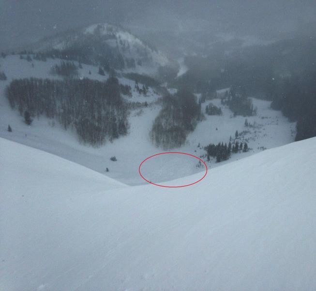
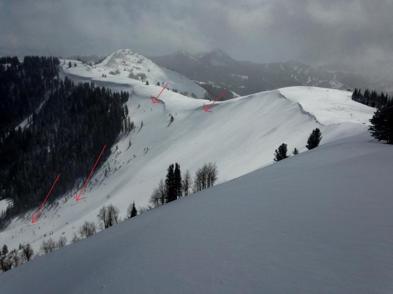
Hard to see, but debris from slides in West Monitor and South Monitor. Recent skier triggered slides were shallow and narrower, but still running fairly far.

Forecaster note - Michael Janulaitius who travels in this area more often noted that these slides were old wet slides from last Friday's heat up, covered with new snow. Observation here.

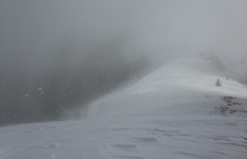
Last photo of wind still transporting snow.