Went up Toledo Bowl from Alta early this morning with hopes of skiing softening surfaces. Was a bit concerned with relatively warm temps from overnight, but was hoping it was clear enough to allow a refreeze due to radiational cooling. Was surprised to find a solid refreeze of the snow surface up to our highest point of 10,500'. In fact, we had to wait until 0945 for the east aspect to soften sufficiently. Working the compass, we skied surprisingly good velvet-like snow surfaces throughout the morning until skiing out at 1100.
On solar aspects, was finding:
- E/SE: Supportable surface at most 2-4 cms thick (about an inch) that became punchy once it warmed. Quick hand pits underneath the refrozen surface in fact showed some dry snow above a crust 15 cms down.
- S - SW: Supportable surface 4-8 cms thick (2-3") with damp grains underneath.
I did not travel on any northerly aspects today, but looking into Holy Toledo the snow surface didn't appear to have dampened much the previous day.
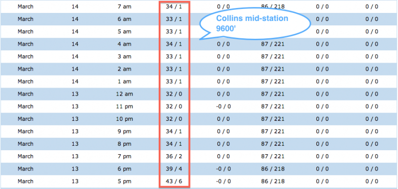
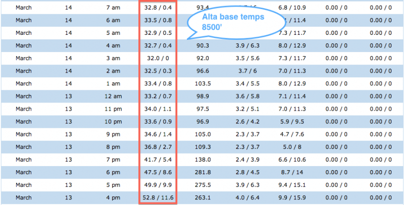
Photos below show screenshots from wx stations at Alta: Top of Collins, Mid-Collins, and Alta base. It is obvious there was a slight temperature inversion as temps warmed with elevation. And even though temps remained above freezing, there was apparently enough radiational cooling for the snow surface to refreeze.
Danger was Low this morning, but timing is everything and you really have to pay attention to overnight temperatures as well as any cloud cover.