icon-add
Observation
Menu
×
Menu
Forecasts
Logan
Ogden
Salt Lake
Provo
Uintas
Skyline
Moab
Abajos
Weather
Archives
How to read the forecast
Observations & Avalanches
Submit Observation
Observations Explorer
All Observations
Avalanches
Fatalities
Weather
Place Names Map
Archives
Education
Avalanche Class List
UAC Class List
Online Classes
Resources and Tutorials
Avalanche Awareness
Develop Skills
Events
Store
About
Contact
Who we are
Core Values
Staff
Board of Directors
Past Forecasters
Sponsors
Annual Reports
Sign In
Blog
Donate / Join
Search
Forecasts
Logan
Ogden
Salt Lake
Provo
Uintas
Skyline
Moab
Abajos
Weather
Archives
How to read the forecast
Observations & Avalanches
Submit Observation
Observations Explorer
All Observations
Avalanches
Fatalities
Weather
Place Names Map
Archives
Education
Avalanche Class List
UAC Class List
Online Classes
Resources and Tutorials
Avalanche Awareness
Develop Skills
Events
Store
About
Contact
Who we are
Core Values
Staff
Board of Directors
Past Forecasters
Sponsors
Annual Reports
Sign In
Blog
Menu
Search
icon-add
Observation
Donate / Join
Submit Observation
Observations Explorer
All Observations
Avalanches
Fatalities
Weather
Place Names Map
Archives
Submit Observation
Observations Explorer
All Observations
Avalanches
Fatalities
Weather
Place Names Map
Archives
Observation: Provo
Observation Date
3/13/2013
Observer Name
Primomo/Nalli
Region
Provo
Location Name or Route
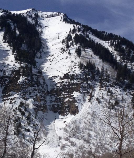
Slide Canyon, Timp
Red Flags
Red Flags
Recent Avalanches
Rapid Warming
Poor Snowpack Structure
Red Flags Comments
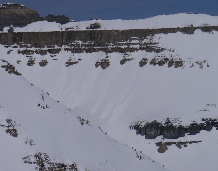
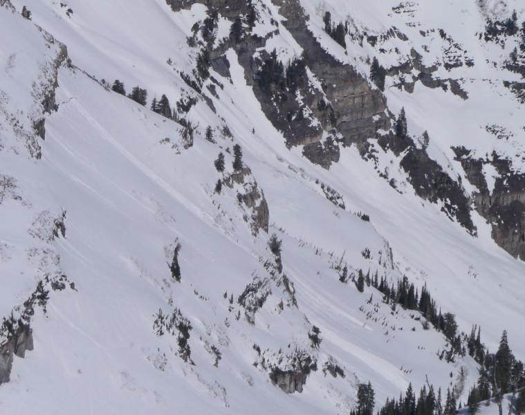
The snowpack is in the process of transitioning from a dry to a wet regime on all but high N. Percolation channels have been found recently on E-S-W draining free water to the ground. Also noticed many new glide cracks starting to form in unusual places as well as the usual places.
Avalanche Problem #1
Problem
Wet Snow
Trend
Increasing Danger
Problem #1 Comments
Widespread WL cycle on NE-SE aspects to D2 (terrain dependant), running long and gouging into older layers on NE and E below 8500ft. These were starting as high as 10500ft on SE w/ski initiation.
Avalanche Problem #2
Problem
New Snow
Trend
Increasing Danger
Problem #2 Comments
The question is: Will the upper or mid-pack faceted layers (mid February and early January, respectively) that have remained dormant for so long begin to act up during this transition?
Snow Profile
Aspect
Southeast
Elevation
9,900'
Slope Angle
35°
Coordinates