

Forecast for the Uintas Area Mountains

Wednesday morning, February 27, 2013
At and above treeline the avalanche danger is CONSIDERABLE and human triggered avalanches are likely on steep, wind drifted, leeward slopes, especially those with an easterly component to their aspect. Once triggered, avalanches have the possibility to break into deeper buried weak layers, producing a dangerously unmanageable avalanche.
Mid elevation terrain offers a MODERATE avalanche danger and human triggered avalanches are possible on steep wind drifted slopes.
If you're looking for LOW avalanche danger, head to mid and low elevation wind sheltered terrain or carve turns on flat meadows with no steep slopes above or adjacent to where you're riding.
 Special Announcements
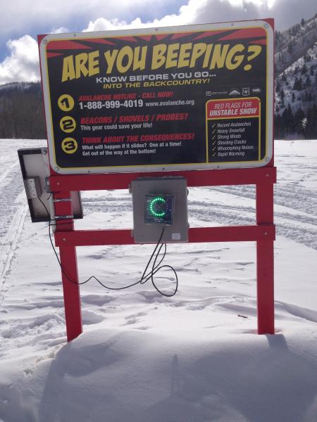
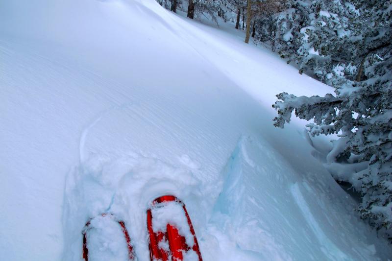
The beacon checker at Nobletts Trailhead is repaired and good to go.
Our entire Uinta weather station network is up and running. A link to real-time wind, snow, and temperature data can be found here.
This monumental achievement couldn't have happened without the joint efforts from the National Weather Service, The Heber-Kamas and Evanston Ranger Districts, Park City Powder Cats, and all the great work by Ted, Trent, Cody, and Al. Thanks to everyone... this is awesome!
 Weather and Snow
Under a big, bright, beautiful moon, skies are clear and temperatures crashed below zero overnight at most locations. After a blustery day Tuesday, winds have mellowed to less than 15 mph along the ridges. Since Sunday, 4" of very light density snow has fallen and while most of our exposed upper elevation terrain is a bit wind jacked, the riding conditions are excellent in sheltered, shady terrain.
Recent observations can be found here.
Wondering why last winter was so crazy? Click here to watch the 2011-12 Utah Winter Review... an excellent recap of last years conditions.
 Recent Avalanches
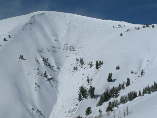
This large natural slide occurred midday Sunday on a southeast aspect in Upper Weber Canyon as a result of the strong Northwest winds.
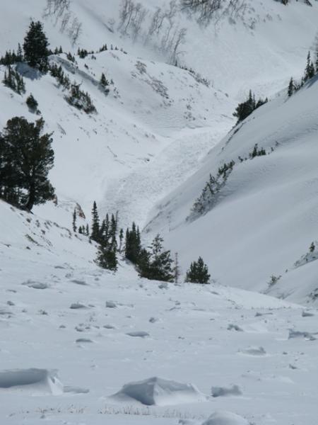
The avalanche was 2.5' deep, 1000' wide, and ran about 1000' vertically into a nasty terrain trap. The slide broke on the January facets and quickly stepped down to sugary snow near the ground... yikes!
Click here for recent observations from the region.

Persistent Weak Layer
Description
Man... it's been a windy winter. The past few days were no different as west and northwest winds blew steadily along the ridges, averaging in the 20's and 30's with gusts in the low 40's. For the Uinta's, this is the perfect wind speed threshold that moves lots of snow around, depositing it on leeward slopes, forming an evenly distributed slab. With plenty of light density snow to work with, fresh drifts sensitive to the additional weight of a rider are today's most obvious avalanche concern. While todays wind slabs might not be quite as reactive as the past few days, they still have the possibility to break deeper and wider than you might expect. Steep, wind drifted slopes, especially those with an easterly component to their aspect should be considered suspect, particularly if they appear fat and rounded or sound hollow like a drum. Gathering information as you travel today. Tweak some small test slopes and road cuts and see how they're reacting before charging into big, committing terrain..
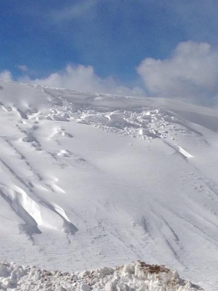
Even the trailhead parking lot can give you clues to the avalanche conditions. Winds were howling while I was at Nobletts yesterday working on the beacon checker. In a matter of about 15 minutes this piece of cornice broke off on a wind loaded slope located to the west of the parking lot. Great info to tell me leeward slopes are rapidly loading.
Shooting cracks in front of your skis, board, or sled are a huge clue to wind loaded slopes and unstable snow.
New Snow
Description
Winds continue to change the landscape on the eastern front and they're starting to overload weak snow formed during the January dryspell. The January facets appear to be this seasons problem child. While they're comfortable in their own skin in some locations, in others they're like a teenager trying to figure themselves out. Sure they kinda know who they are, but fly off the handle pretty easily once provoked.
Strong snow on weak snow... it's what the Uinta's are famous for. Unfortunately, it's also this combination that leads to tricky avalanche conditions. The strong snow will allow us to get well out onto the slope before it fails and we trigger a deep, dangerous slide. A wild card in the deck is the possibility of triggering a slide mid slope or on your approach from the bottom. Best way to combat this condition is with terrain management. Tone down you're objectives a notch or two and consider the consequences of triggering a slide.
Additional Information
This morning we can expect mostly sunny skies, with a few clouds drifting into the region late in the day. Temperatures climb into the mid 20's before dipping to near zero overnight. West and northwest winds remain well behaved, with gusts in the upper 20's along the high peaks. Thursday should be about the same, with Friday and Saturday offering much warmer temperatures. Another storm system works into the region late Sunday.
General Announcements
Remember your information can save lives. If you see anything we should know about, please participate in the creation of our own community avalanche advisory by submitting snow and avalanche conditions. You can call me directly at 801-231-2170, email [email protected], or email by clicking HERE
This is a great time of year to schedule a free avalanche awareness presentation for your group or club. You can contact me at 801-231-2170 or email [email protected]
Donate to your favorite non-profit –The Friends of the Utah Avalanche Center. The UAC depends on contributions from users like you to support our work.
The information in this advisory is from the US Forest Service which is solely responsible for its content. This advisory describes general avalanche conditions and local variations always occur.
The information in this advisory expires 24 hours after the date and time posted, but will be updated by 7:00 AM Saturday March 2nd.