

Forecast for the Uintas Area Mountains

Saturday morning, February 23, 2013
Above treeline, I expect the avalanche danger to rise to HIGH. Both human triggered and natural avalanches will become likely on steep, wind drifted, leeward slopes, especially those facing the north half of the compass. With additional snow and wind forecast, avalanches have the possibility to break into deeper buried weak layers, producing dangerous avalanche conditions.
At mid elevations you'll find a CONSIDERABLE danger and human triggered avalanches are probable on steep, leeward slopes.
If you're looking for LOW avalanche danger, head to mid and low elevation south facing terrain or carve turns on flat meadows with no steep slopes above or adjacent to where you're riding.
Special Avalanche Bulletin
Dangerous backcountry avalanche conditions are expected over the weekend. Natural and human triggered slides breaking up to four feet deep are likely on steep wind drifted slopes.
 Special Announcements
Our entire Uinta weather station network is up and running. A link to real-time wind, snow, and temperature data can be found here.
This monumental achievement couldn't have happened without the joint efforts from the National Weather Service, The Heber-Kamas and Evanston Ranger Districts, Park City Powder Cats, and all the great work by Ted, Trent, Cody, and Al. Thanks to everyone... this is awesome!
 Weather and Snow
West and southwest winds arrived a little later to the party than I anticipated, but they showed up around 5:00 last night and have been blowing steadily in the 20's and 30's. Light snow is falling with just about an inch so far. Temperatures are in mid teens at most locations and in the single digits along the high ridges. The expected strong winds will have their way with all the light fluffy snow, but you'll be able to still find excellent riding and turning conditions in wind sheltered mid and low elevation terrain.
Recent observations can be found here.
Wondering why last winter was so crazy? Click here to watch the 2011-12 Utah Winter Review... an excellent recap of last years conditions.
 Recent Avalanches
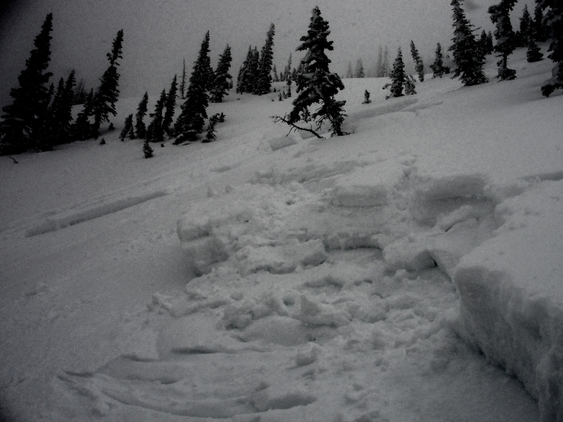
On Thursday, this hard slab on The Duke, located above Upper Setting Road was triggered low on slope and broke to the weak January facets. A northwest aspect at 10, 400' the slide was about a foot and half deep, 150' wide, and ran for 300' vertical. Many thanks to Michael J for all the killer info this year and for this great observation.
Click here for recent observations from the region.

Persistent Weak Layer
Description
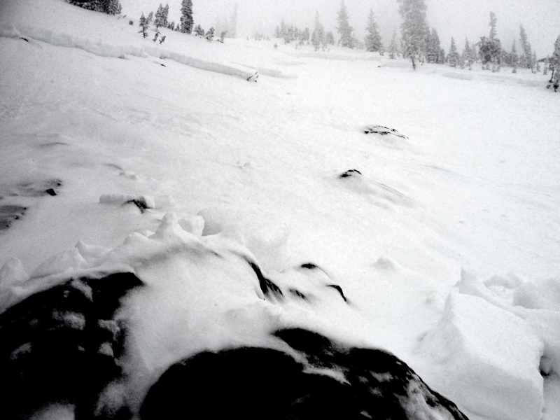
Winds are beginning to pick up ahead of a strong cold front slated to swing through the state in the next couple of hours. There's no shortage of light density snow to blow around and it won't take much wind to whip up a fresh batch of wind drifts. Slabs will quickly grow in size and depth as the winds increase throughout the day. Fat, rounded pillows of snow are your biggest clue to wind loaded terrain. Look for and avoid these especially on steep leeward slopes facing the north half of the compass. Avalanche conditions will become increasingly tricky today and slides will break wider and deeper than you might anticipate.
New Snow
Description
Today's wind and snow will form a dense, cohesive slab making the snow feel strong and solid under our track, board, or skis. Problem is, all this additional weight will overload our problem child, the January facets, now buried several feet from the snow surface. Strong snow on weak snow is a tricky combination and it's these type of snow conditions that allow us to get well out onto the slope before it fails and we trigger a deep, dangerous slide.
Adding a tricky variable to the mix is that some of our weakest snow is found mid slope, making us particularly vulnerable when climbing from the bottom or when we're low on the slope. Not every steep northerly facing slope is going to avalanche and that'll give us a false sense of snow stability. Remember- all we need to find is a weak spot in the snowpack and kick the legs out from under the slab. Best way to avoid getting tricked is to manage your terrain choices.
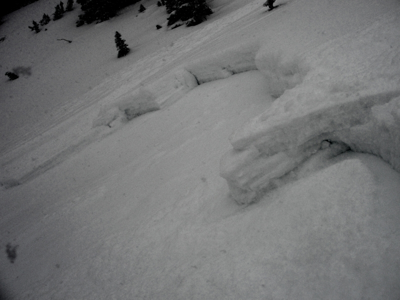
More images from Thursday's slide on The Duke. Our snowpack is relatively thin for mid February and you can clearly see this slide broke to weak snow, especially near and around rocks low on the slope.
Additional Information
Southwest winds will continue to ramp up this morning ahead of a strong cold front slated to reach the region later this morning. Winds will nuke into the 50's and 60's before switching to the northwest and diminishing with the storms arrival. A foot of snow by Sunday morning still seems a good bet. Temperatures fall throughout the day, dipping to near zero overnight. A cold, northerly flow is on tap for Sunday with another storm slated for late Monday into Tuesday.
General Announcements
Remember your information can save lives. If you see anything we should know about, please participate in the creation of our own community avalanche advisory by submitting snow and avalanche conditions. You can call me directly at 801-231-2170, email [email protected], or email by clicking HERE
This is a great time of year to schedule a free avalanche awareness presentation for your group or club. You can contact me at 801-231-2170 or email [email protected]
Donate to your favorite non-profit –The Friends of the Utah Avalanche Center. The UAC depends on contributions from users like you to support our work.
The information in this advisory is from the US Forest Service which is solely responsible for its content. This advisory describes general avalanche conditions and local variations always occur.
The information in this advisory expires 24 hours after the date and time posted, but will be updated by 7:00 AM Sunday February 24th.