

Forecast for the Uintas Area Mountains

Wednesday morning, February 20, 2013
A MODERATE avalanche danger is found on steep, wind drifted mid and upper elevation terrain and human triggered avalanches are possible on leeward slopes facing the north half of the compass.
In addition, there's a MODERATE danger of triggering an avalanche that breaks into deeper buried weak layers, particularly on steep shady slopes.
LOW avalanche danger is found on low angle, wind sheltered terrain, where there are no steep slopes above or adjacent to where you're riding.
 Special Announcements
Our entire Uinta weather station network is up and running. A link to real-time wind, snow, and temperature data can be found here.
This monumental achievement couldn't have happened without the joint efforts from the National Weather Service, The Heber-Kamas and Evanston Ranger Districts, Park City Powder Cats, and all the great work by Ted, Trent, Cody, and Al. Thanks to everyone... this is awesome!
 Weather and Snow
Clouds began streaming into the region late yesterday, ahead of a storm that'll creep north into the area throughout the day. Currently, temperatures are in the low 20's and southeast winds are blowing 20-30 mph along the ridges. Sunny slopes are crusty and exposed upper elevation terrain is hit or miss. However, while soft settled snow is becoming more of a rarity, it can still be found on sheltered shady terrain.
Recent observations can be found here.
Wondering why last winter was so crazy? Click here to watch the 2011-12 Utah Winter Review... an excellent recap of last years conditions.
 Recent Avalanches
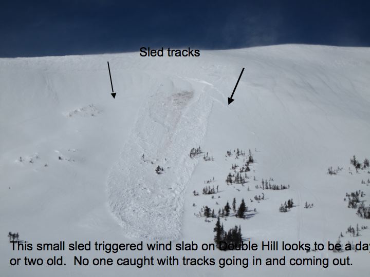
Ted found this day old sled triggered slab on Double Hill, a heavily wind loaded Northeast facing slope.
Click here for recent observations from the region.

Persistent Weak Layer
Description
Winds have been all over the place the past few days and yesterday was no exception. Averaging in the 30's and gusting into the 40's and 50's, yesterday's south and southwest winds had no problem finding loose snow and rapidly forming sensitive slabs along the leeward side of mid and upper elevation ridges. Late in the day winds switched to the southeast, loading a whole host of west facing terrain we're not accustomed to seeing. In either case, today's drifts will be sensitive to the additional weight of a rider and they'll break a bit wider and deeper than you might expect. In addition, they'll be packing a punch and can easily ruin your day by slamming you into a group of trees or carrying you over a cliff band in steep unforgiving terrain. You're best defense is a good offense... look for and avoid fat, rounded pillows of snow, particularly if they sound hollow like a drum.
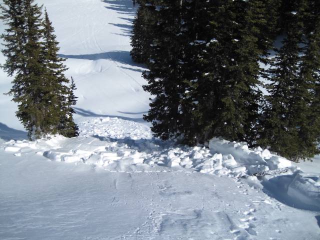
Not overly deep, but this slide triggered earlier this week could've easily slammed you into this group of trees, instantly ending a good season of riding.
New Snow
Description
While not particularly widespread, avalanches continue to break to the weak January facets, particularly on steep, shady, north facing slopes. Adding a tricky variable to the mix is that some of our weakest snow is found mid slope, making us particularly vulnerable when climbing from the bottom. Not every steep northerly facing slope is going to avalanche and that'll give us a false sense of snow stability. Remember- all we need to find is a weak spot in the snowpack and kick the legs out from under the slab. Best way to avoid getting tricked is to manage your terrain choices.
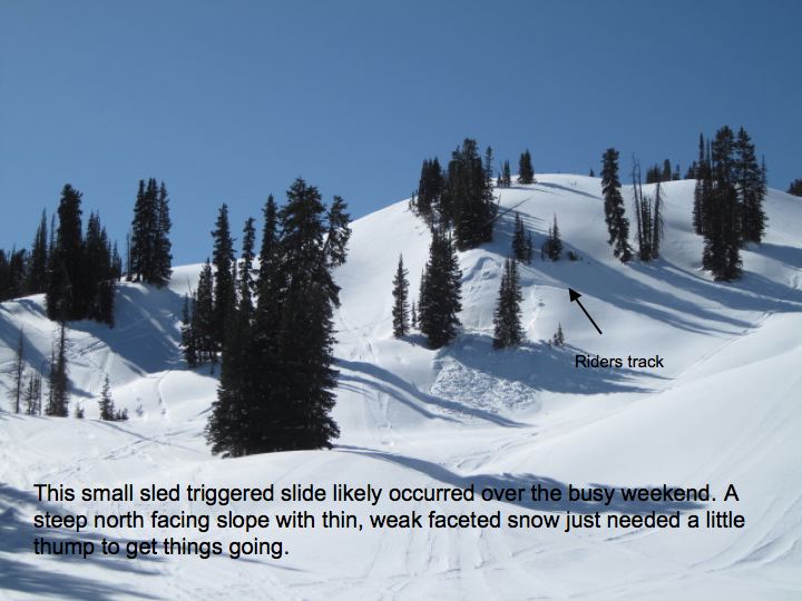
This was another triggered slide from a day or two ago on Moffit Peak. Ted estimated it to be 2' deep x 50' wide x 100' vertical. This is 38 degree slope is a northeast aspect at 10,000' in elevation.
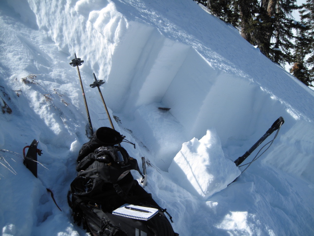
Our snowpack is relatively thin for mid February. This is at the crown of the Moffit slide where Ted's compression and ECT scores were 20 and 21 taps from the shoulder with Q1 shears. This means it's going to take a bit of a thump, but has enough energy to break wider than you might expect.
Additional Information
The next storm is mainly a south and central Utah event, but we might get lucky late today as the system nudges northward. I'm cautiously optimistic we'll see 4"-8" of new snow by Thursday morning. In the meantime, look for most cloudy skies with southeast winds in the 20's and 30's along the high peaks. Temperatures climb just a few degrees, topping out in the mid to upper 20's before winds switch to the northwest and usher in cooler air late in the day. Another weak system brings a round of light snow to the region on Thursday. A break is slated for Friday, then a colder, wetter storm is on tap for late Saturday.
General Announcements
Remember your information can save lives. If you see anything we should know about, please participate in the creation of our own community avalanche advisory by submitting snow and avalanche conditions. You can call me directly at 801-231-2170, email [email protected], or email by clicking HERE
This is a great time of year to schedule a free avalanche awareness presentation for your group or club. You can contact me at 801-231-2170 or email [email protected]
Donate to your favorite non-profit –The Friends of the Utah Avalanche Center. The UAC depends on contributions from users like you to support our work.
The information in this advisory is from the US Forest Service which is solely responsible for its content. This advisory describes general avalanche conditions and local variations always occur.
The information in this advisory expires 24 hours after the date and time posted, but will be updated by 7:00 AM Saturday February 23rd.