Observation: 10420

Observation Date
2/18/2013
Observer Name
Bruce Tremper
Region
Salt Lake
Location Name or Route
Peak 10,420 at head of Big Cottonwood Canyon
Weather
Sky
Few
Wind Speed
Light
Weather Comments
Clear, calm day with increasing high clouds. Temepratures remaining cold from yesterday's cold front.
Snow Characteristics
New Snow Depth
2"
New Snow Density
Low
Snow Surface Conditions
Powder
Faceted Loose
Wind Crust
Melt-Freeze Crust
Snow Characteristics Comments

About 2 inches of light snow fell yesterday with the cold front passage. Quite a bit of wind blew above 10,000' but it did not seem to dip below that elevation. I found the same pattern in White Pine yesterday. The riding conditions are still quite good on the wind and sun sheltered slopes, which you will find mostly on the northerly facing slopes at mid elevations. Most popular slopes are quite tracked up. The sunny aspects have a sun crust with lots of wind damage up high in the wind exposed ridges above 10,000'

Red Flags
Red Flags
Wind Loading
Red Flags Comments
Wind loading was the only red flag in this area.
Avalanche Problem #1
Problem
Persistent Weak Layer
Problem #1 Comments

Thes main problem today was the wind slabs formed from yesterday's strong winds with the passage of the cold front. They blew quite hard from the northwest and created fairly widespread wind erosion and deposition in the upper elevation wind exposed terrain. Most of the wind damage occurred above 10,000' with very little wind at lower elevations. These wind drifts are mostly hard and I could get many of them to crack under my weight.

The wind slabs are not only a problem today but with the expected strong winds from the south forecast for tomorrow, we will be in for a whole new round of wind slabs, this time from southerly winds instead of the northwesterly winds from yesterday. If it ain't one thing it's the other. If tomorrow's winds get into the lower elevation terrain, there is a lot of loose, snow on the snow surface to blow around, especially on the mid elevation, northerly facing terrain. With tomorrow's wind, I would expect that the wind slab problems will actually be worse down off the ridges. Yesterday's wind already blew the snow around so there is much less snow available for transport.

Avalanches require both a slab and a weak layer. If tomorrow's winds get into the mid elevation northerly terrain, we will have both ingredients. As always, avoid steep slopes with recent wind deposits.
Comments

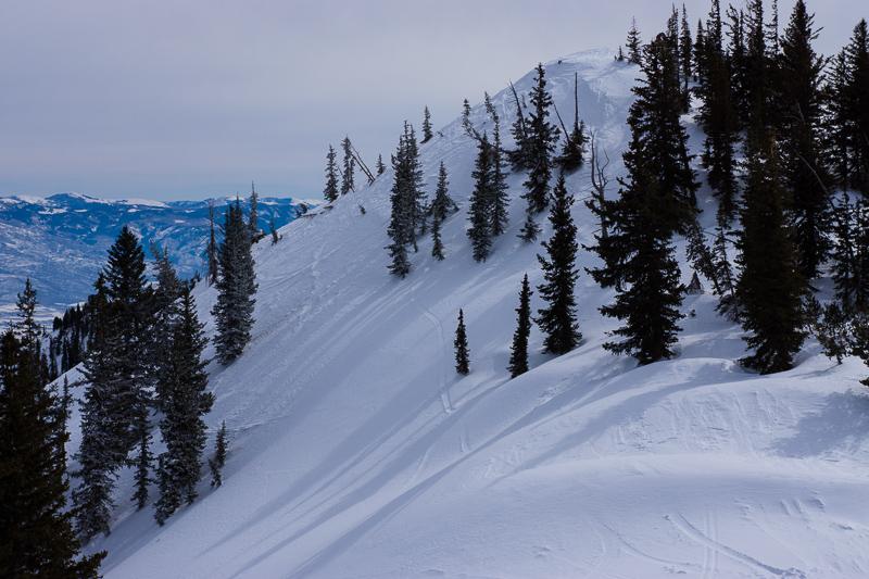
Here you can see the recent wind drifts that cover up the old snowmobile tracks near the summit of 10,420.

The video is a short summary of the current snowpack, plus, a short tutorial on recognizing wind slabs and wind loading. This will be a good skill to learn because we have strong winds forecast for Tuesday and more wind and snow for the weekend.

Video