Forecast for the Skyline Area Mountains

Brett Kobernik
Issued by Brett Kobernik for
Saturday, January 26, 2013

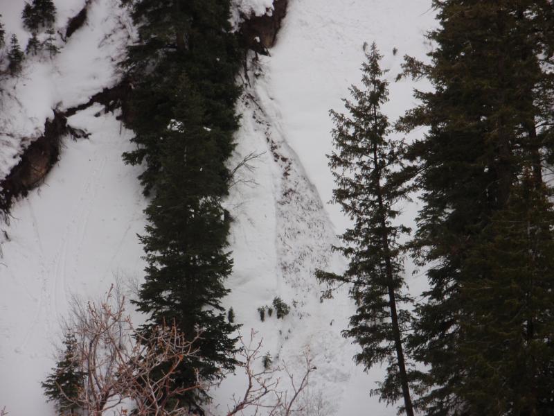
There is a MODERATE danger for wet slides below about 8,500’ on and beneath steep slopes. There is also an isolated chance you might find an area where you could trigger something that breaks into older weak sugary snow.

Low
Moderate
Considerable
High
Extreme
Learn how to read the forecast here
Weather and Snow

Warm weather heads today's advisory. As the valley temperature inversion has been pushed out, we've had very mild temperatures into the 30s along the ridges and 40s in the lower elevations. Ridgetop winds have been light to moderate along the ridges from the southwest. The snowpack has become wet and saturated all the way through up to around 8700 feet and I found the snow surface to be damp to at least 9700 feet. I visited Oak Creek out of Spring City and rode to the Skyline on Friday. I found quite similar observations as our good friend Steve Cote who always suplies us with great info. Click HERE for Steve's observation.

Recent Avalanches

There has been wet loose snow avalanche activity below around 8000 feet from the rapid warming over the last few days. Luckily, most of this activity is in obscure areas where people tend not to recreate. While the snow remains very wet and saturated down low, I don't think that we'll see any more natural avalanches like this but you may still be able to trigger them.

Ad
Avalanche Problem #1
Wet Snow
Type
Location
Likelihood
Size
Description

The initial shock of the warm temperatures at the mid and lower elevations is losing its impact, and the widespread natural wet avalanche cycle is probably over. However, wet sluffs will still be easy to trigger in the soggy snow on steep, shady slopes at the low and mid elevations.

Avoid all gullies and creek beds below about 8,500’, and avoid avalanche run outs by knowing what is above you. Think about the low elevation terrain you travel though at the beginning and end of you backcountry trip.

Avalanche Problem #2
New Snow
Type
Location
Likelihood
Size
Description

The next biggest concern is finding an area especially with a recent drift of wind blown snow that might crack out into buried weak snow. This concern is mainly in sheltered areas where the winds haven't hammered the snowpack into layers and layers of strong stiff snow. Poke down through the surface occasionally to see if the snow is loose and granular or stiff and hard. The areas with granular snow are the suspect areas.

Additional Information

We'll see cloudy skies and snow showers during the day with perhaps a few inches of accumulation. Winds should remain light to moderate from the southwest. Ridgetop temperatures will be near 30. A larger storm with an associated cold front will move through Sunday into Monday that should give us another decent shot of snow and cool temperatures off a bunch on Monday. The weather will remain somewhat unsettled in a northwest flow into next week with more light snow possible.

General Announcements

Remember your information can save lives. If you see anything we should know about, please participate in the creation of our own community avalanche advisory by submitting snow and avalanche conditions. You can call me directly at 801-231-2170, email [email protected], or email by clicking HERE

This is a great time of year to schedule a free avalanche awareness presentation for your group or club. You can contact me at 801-231-2170 or email [email protected]

Donate to your favorite non-profit –The Friends of the Utah Avalanche Center. The UAC depends on contributions from users like you to support our work.

The information in this advisory is from the US Forest Service which is solely responsible for its content. This advisory describes general avalanche conditions and local variations always occur.

This advisory will be updated by 7:00 AM Saturday January 26th.