icon-add
Observation
Menu
×
Menu
Forecasts
Logan
Ogden
Salt Lake
Provo
Uintas
Skyline
Moab
Abajos
Weather
Archives
How to read the forecast
Observations & Avalanches
Submit Observation
Observations Explorer
All Observations
Avalanches
Fatalities
Weather
Place Names Map
Archives
Education
Avalanche Class List
UAC Class List
Online Classes
Resources and Tutorials
Avalanche Awareness
Develop Skills
Events
Store
About
Contact
Who we are
Core Values
Staff
Board of Directors
Past Forecasters
Sponsors
Annual Reports
Sign In
Blog
Donate / Join
Search
Forecasts
Logan
Ogden
Salt Lake
Provo
Uintas
Skyline
Moab
Abajos
Weather
Archives
How to read the forecast
Observations & Avalanches
Submit Observation
Observations Explorer
All Observations
Avalanches
Fatalities
Weather
Place Names Map
Archives
Education
Avalanche Class List
UAC Class List
Online Classes
Resources and Tutorials
Avalanche Awareness
Develop Skills
Events
Store
About
Contact
Who we are
Core Values
Staff
Board of Directors
Past Forecasters
Sponsors
Annual Reports
Sign In
Blog
Menu
Search
icon-add
Observation
Donate / Join
Submit Observation
Observations Explorer
All Observations
Avalanches
Fatalities
Weather
Place Names Map
Archives
Submit Observation
Observations Explorer
All Observations
Avalanches
Fatalities
Weather
Place Names Map
Archives
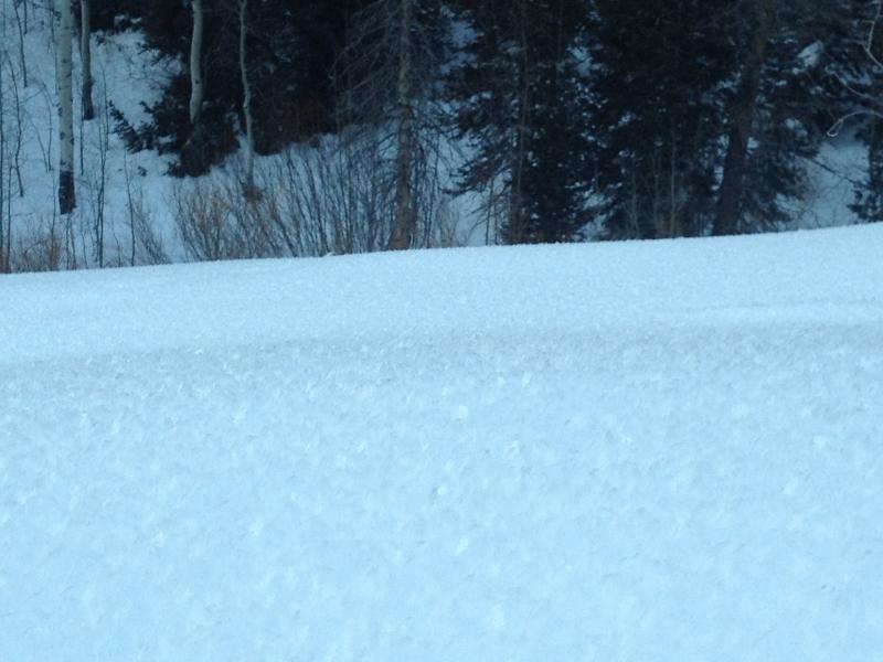
Observation: Mill Creek Canyon
Observation Date
1/24/2013
Observer Name
Jeremy Coleman
Region
Salt Lake
Location Name or Route
Little Water, Big water, Soldier fork
Weather
Sky
Obscured
Precipitation
Moderate Snowfall
Wind Direction
Southwest
Wind Speed
Moderate
Weather Comments
Heavy wet snow falling on damp settled snow surface as well as burying surface hoar. North east facing slopes getting wind loaded.
Snow Characteristics
New Snow Depth
2"
New Snow Density
High
Snow Surface Conditions
Dense Loose
Damp
Snow Characteristics Comments
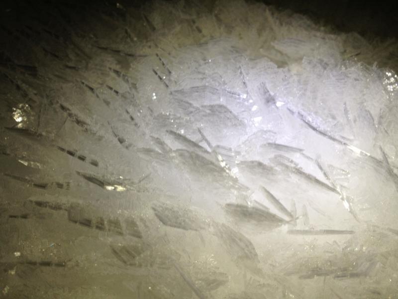
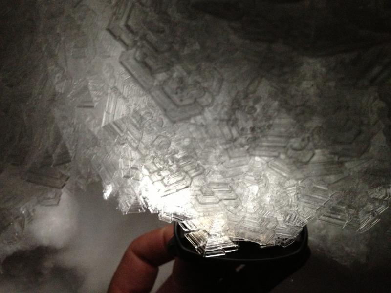
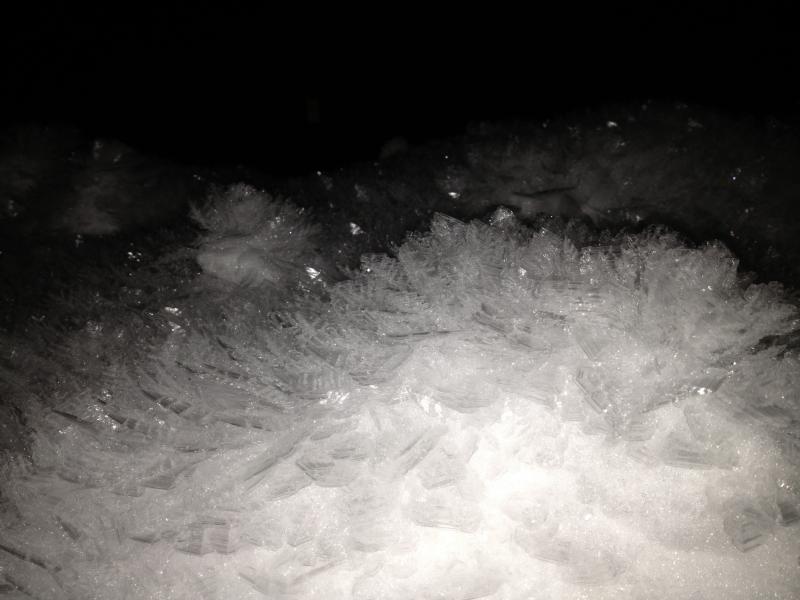
Above 8100 feet elevation damp settled powder. Below 8100 feet large surface hoar, some as large as baseball cards.
Red Flags
Red Flags
Wind Loading
Collapsing
Rapid Warming
Poor Snowpack Structure
Red Flags Comments
30 to 40 miles an hour wind from the southwest loading north the north east facing slopes. One collapse noted near the top of Big Water Gulch. 6 to 8 inches of settled powder transitioning from fist to four-finger to one finger slab the above a four-inch layer of fist hardness fassets. Snow pits yielded variable results with this layer, some propagating, some not with anywhere from 4 to 11 taps with Q2 quality shears. No failures noted on the deeper layers of facets. Little water pits dug in the 9200 foot range 38° slope angle north facing through north east facing slopes snow depth was about 120 cm at this location. The soldier fork pits dug around 8800 foot level Northeast facing soldier Fork 37° slope angle snow depth barely 90 cm at this location. Bottom line this persistent facet layer should prove very active with the next larger storm cycle.
Comments
Attached are some photos of the surface hoar taken on the night of January 23 in Millcreek Canyon.