

Forecast for the Uintas Area Mountains

Sunday morning, January 13, 2013
Terrain to avoid- Steep, rocky, upper elevation slopes where human triggered avalanches breaking near the ground are still possible.
A MODERATE avalanche danger exists and human triggered avalanches within the new storm snow are possible on steep, wind drifted at all elevations.
LOW avalanche danger is found in wind sheltered terrain.
 Special Announcements
We still have a few slots open. Please join us on Thursday evening, 1/24 and Saturday, 1/26 for a day of learning avalanche and advanced riding skills with Craig & Trent from the Utah Avalanche Center and Dan Gardiner and the Boondockers crew. Details and sign up here
 Weather and Snow
A moist northerly flow over the region gave us an additional inch or two of new snow yesterday and ushered in some of the coldest air we've experienced in years. Under mostly cloudy skies this morning, temperatures are averaging -15 degrees across the range with both Hayden Fork and Lily Lake registering -21 degrees. Northwesterly winds picked up around 2:00 this morning and are blowing 15-20 mph along the ridges... wind chill is in the -40 degree category. Looking past the brutal temperatures the good news is the riding is quite good and our recent weather laid down about a foot of new snow.
Recent observations can be found here.
Wondering why last winter was so crazy? Click here to watch the 2011-12 Utah Winter Review... an excellent recap of last years conditions.
 Recent Avalanches
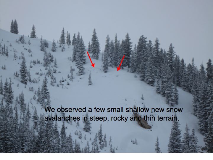
On Friday, Ted found this fresh slide on Gold Hill. Sluffing and sensitive, yet shallow wind drifts were reported in steep, leeward terrain yesterday.

Persistent Weak Layer
Description
Northwest winds ramped up this morning and they'll have no problem whipping up a fresh batch of soft slabs. Reports from steep leeward terrain yesterday indicate sluffing in the new snow and wind drifts predictably breaking at or below your skis, board, or sled.... super manageable. Not so manageable is the unpredictable nature of larger slides breaking in mid and lower elevation terrain and drainages where the snowpack is slightly weaker and may therefore be a bit more reactive to your additional weight. This is the type of terrain where we usually go to play it safe and this theory might actually work against us. Not much has changed since Friday when there were numerous reports of widespread cracking and collapsing. The culprit is Tuesday's rime crust... it's supporting the weight of all the new snow and there's weak facets underneath. Don't let your guard down on steep slopes near the trailheads as you're headed to the big, upper elevation terrain .
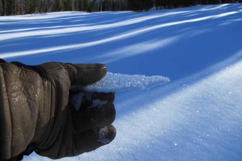
Tuesday's rime crust is capping a layer of weak sugary near surface facets. And yes, that's a thin layer of surface hoar on top of the crust... yikes!
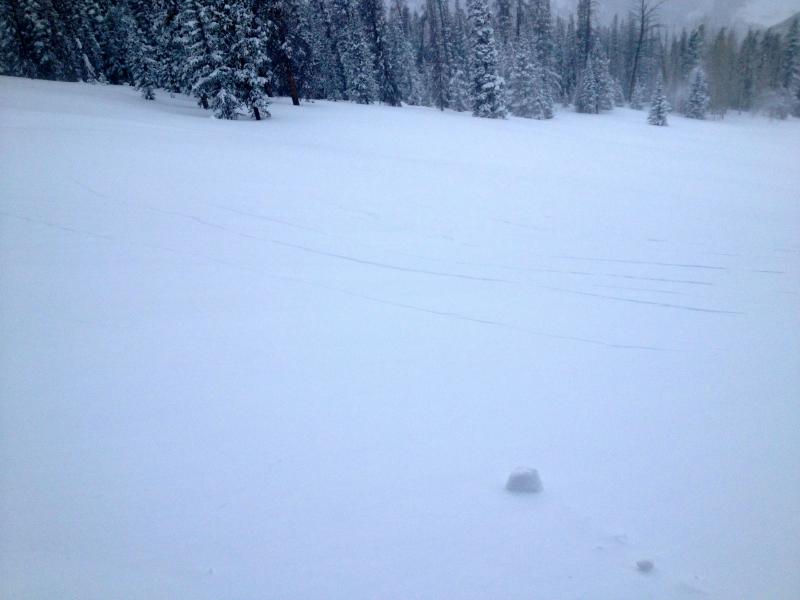
With a foot of new snow on top, there's plenty of cracking and collapsing or whoomphing sounds. Thanks JG for the great pics!
New Snow
Description
You'd have to go out of your way to trigger an avalanche that breaks into old snow near ground today. However, if your travels take you into steep, complex terrain today, stop for a moment and carefully assess the snowpack and think about the consequences of triggering an avalanche.
Additional Information
The coldest air of the season will sink into the region today giving us a few more inches of snow. It'll remain quite cold with highs struggling to reach zero degrees. North and northwest winds won't be particularly strong, just in the 10-20 mph range, but that'll surely add insult to injury. Overnight lows crash to -15 degrees. Partly cloudy skies are on tap for Monday and Tuesday with slow warming expected. As the ridge begins to build midweek we should much more palatable weather with sunny skies, light winds, and temperatures rebounding to above average.
General Announcements
Remember your information can save lives. If you see anything we should know about, please participate in the creation of our own community avalanche advisory by submitting snow and avalanche conditions. You can call me directly at 801-231-2170, email [email protected], or email by clicking HERE
This is a great time of year to schedule a free avalanche awareness presentation for your group or club. You can contact me at 801-231-2170 or email [email protected]
Donate to your favorite non-profit –The Friends of the Utah Avalanche Center. The UAC depends on contributions from users like you to support our work.
The information in this advisory is from the US Forest Service which is solely responsible for its content. This advisory describes general avalanche conditions and local variations always occur.
The information in this advisory expires 24 hours after the date and time posted, but will be updated by 7:00 AM Wednesday January 16th.