Forecast for the Provo Area Mountains

Evelyn Lees
Issued by Evelyn Lees for
Saturday, December 29, 2012

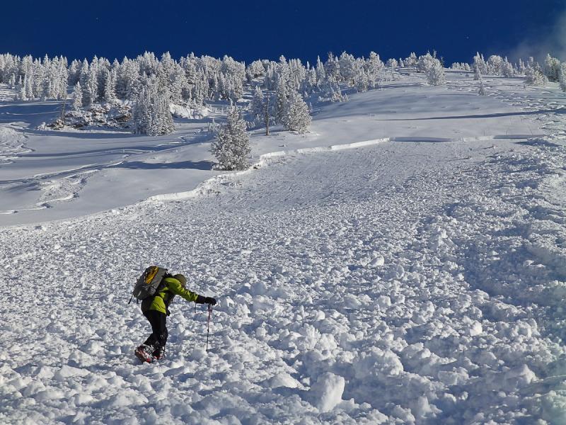
Just because it’s a beautiful powder day and you’re having a great time with your friends, it doesn’t mean you can’t get caught in an avalanche.

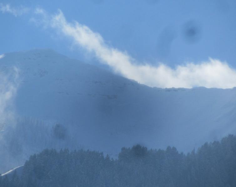
In the Provo area mountians, steep slopes facing northwest through east have Pockets of CONSIDERABLE avalanche danger on mid and upper elevation slopes, for triggering a deep slide. New snow sluffs can be large and run long distances in the steep terrain on Timpanogos and the Cascade ridge line. Watch for and avoid fresh drifts of wind-blown snow as the winds pick up along the higher ridgelines later this afternoon.

Remember, time is on your side – there are days of opportunity to get onto the steep slopes - start out with the acres of untracked low and moderate angle slopes, and give the snow more time to settle and strengthen.

Low
Moderate
Considerable
High
Extreme
Learn how to read the forecast here
Special Announcements

Thanks so much to all those who have donate to the UAC this year! Most of our funding comes from donations and events and your support keeps the forecasts and education going. If you have not yet made a 2012 contribution, you have a few more days...

There is still space available for the Snowbird Freeride Avalanche Summit, an avalanche skills class aimed at Big Mtn Freeriders, aimed at addressing safety issues related to steep lines, remote locations, and filming. Jan 6-8 2012. Details at http://utahavalanchecenter.org/2013-snowbird-freeride-avalanche-summit.

Weather and Snow

5 days of storms have left 2 to 3 feet of top quality powder in the northern Utah mountains - evenly draped on all aspects over a supportable base, with just enough settlement that low to moderate angle slopes ride well. With skies finally clearing, it’s intensely beautiful, and riding, snowshoeing and snowmobiling conditions are about as good as it gets. Temperatures are in the single digits to mid-teens, and the southerly winds are very light, with only a few of the highest peaks averaging even 15 mph.

Recent Avalanches

There were 5 human triggered avalanches reported yesterday.

A recent natural in upper Bunnels along the Cascade ridgeline was observed, probably from the 27th.

  • 3 were skier/boarder released new snow soft slabs, 1-2 feet deep, less than 100' wide. (Square Top, Lake Mary’s Chutes and Claytons)
  • 2 slides were remotely triggered – the largest on Gobblers - 2' x 175', new snow sliding on a hard, old wind slab, and an intentionally triggered slide in Alexander Chutes – 18” deep by 50’ wide, running on old faceted snow near the ground, this slope has probably slid before.
  • A very large hard slab was triggered with explosives, on an east facing slope on the Park City side, 1 to 4” deep by 400’ wide, failing near the ground.

Gobblers:

Ad
Avalanche Problem #1
New Snow
Type
Location
Likelihood
Size
Description

There are still a few monsters in the basement – the most dangerous slide a person could trigger today would be on a mid-pack weakness (crusts and facets) or the ground. These are the slides you can trigger from a distance, that may break out above you and where tracks on a slope are not a definitive sign of stability. Shallow Snowpack Areas are where these weak layers are most pronounced, and where the weight of a person or machine can be felt through the snow by the weak layer. Collapsing or being able to push your ski pole in right to the ground are not good signs.

Avalanche Problem #2
Persistent Weak Layer
Type
Location
Likelihood
Size
Description

On most slopes, the new snow will be fairly well behaved this morning, with predictable human triggered sluffs and perhaps a new snow soft slab on steep slopes. But even a soft snow avalanche can travel fast, and be dangerous if you are caught and carried into trees.

However, all this low density snow is just waiting for a breeze to blow it around. The southerly winds will gradually increase along the ridge lines as the day goes on, and the drifts will be most wide spread on the northerly facing slopes. Avoid these fresh, soft drifts on steep slopes.

Additional Information

A gorgeous day – clear to partly cloudy skies, with temperatures warming into the mid-20s at 8,000’, and the mid-teens at 10,000’. The southerly winds will gradually increase along the highest ridgelines, into with averages in the 15 to 20 mph range and gusts to 30 this afternoon. A few flurries with a trace of snow possible tonight, followed by several day sf cool temperatures and light winds.