Forecast for the Skyline Area Mountains

Craig Gordon
Issued by Craig Gordon for
Wednesday, December 26, 2012

Terrain to avoid- steep, rocky terrain where a solid feeling slab overlies thin, weak snow. The avalanche danger is CONSIDERABLE and dangerous human triggered avalanches are likely.

A MODERATE avalanche danger exists in mid elevation terrain and human triggered avalanches are possible on steep wind drifted slopes.

LOW avalanche danger is found on low angle, low elevation, wind sheltered slopes.

Low
Moderate
Considerable
High
Extreme
Learn how to read the forecast here
Special Announcements

The advisory expires 24 hours after the date and time posted, but will be updated by 7:00 AM Saturday December 29th.

It's never too late to give that special someone (or yourself) an avalanche class for the holidays. A couple of clicks and you are done - no standing in line or shipping. Check out the Snowmobile Avalanche and Riding Skills Workshop... an avy class designed by riders for riders. Click here for more details.

Weather and Snow

Light snow is falling on the Skyline this morning with about an inch so far. Temperatures are in the low teens and southeasterly winds picked up early this morning and are blowing 20-30 mph along the high ridges. Riding in the low angle, open meadows will be epically deep.... and the safest place to be today!

Recent Avalanches

No significant avalanche activity to report, but this big slide last Friday was triggered from hundreds of feet away. Breaking to the ground, this is the type of avalanche dragon we're dealing with on the Skyline.

Click here to see a great video describing the slide below.

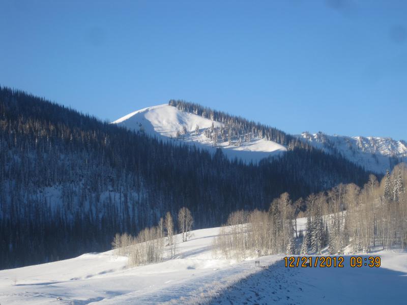
From Miller Flat trailhead looking up at the Phone Shot as we prepared for our field day.

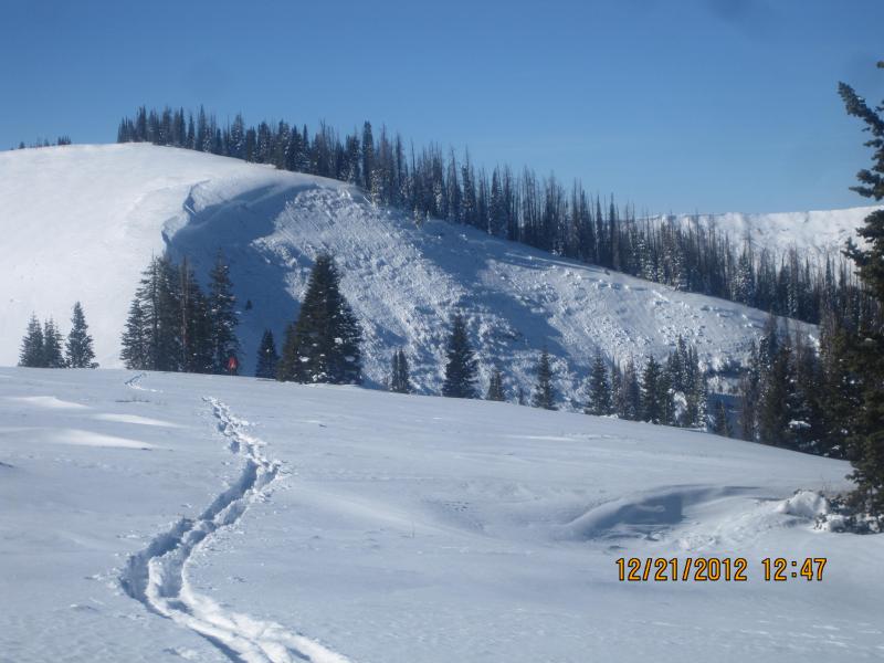
Darce took this picture as we raced to the top of the slope to make sure no one was caught or buried. Fortunately neither was the case.

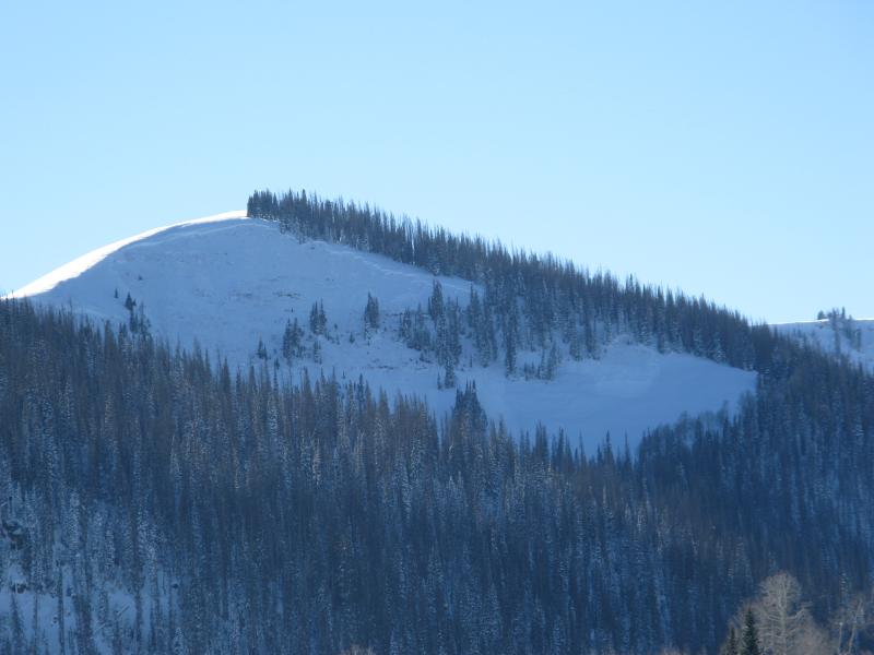
After the dust settled, I snapped this pic of Phone Shot on our way home. This gives you a great perspective of just how wide and deep avalanches are breaking.

Ad
Avalanche Problem #1
Persistent Weak Layer
Type
Location
Likelihood
Size
Description

A weak and complex snowpack exists on the Skyline and avalanche conditions are deceptively tricky. Hiding the nefarious avalanche dragon is all the deep, light snow that keeps stacking up. However, to ride safely we've gotta be snowpack ninjas and think not only about the snow we're riding in, but also the snow we're riding on. Late last week, riders were able to trigger avalanches from a distance and on relatively flat terrain. This type of avalanche condition just doesn't go away in a few days... it lingers for long periods of time. Today's avalanches have the potential to break wide and deep, taking out the entire seasons snowpack, producing a very dangerous slide.

Avalanche Problem #2
Persistent Weak Layer
Type
Location
Likelihood
Size
Description

This mornings gusty winds and new snow will whip up a fresh batch of wind drifts along the leeward side of upper elevation ridges. This mornings soft slabs are manageable, predictably breaking around your skis, board, or sled. As the day wares on and snow stacks up, avalanches triggered within the new snow have the potential to break into deeper buried weak layers as they crash down onto the slope below. This chain of events would quickly turn a manageable avalanche into something you didn't bargain for. Best to play it safe and avoid steep, wind drifted slopes.

Additional Information

It looks like an active couple of days for the Skyline. Snow should begin to ramp up later today with close to a foot expected by tomorrow morning. Southerly winds gust into the 30's and 40's along the ridges early this morning, but should turn westerly and decrease throughout the day. Temperatures rise into the 20's and overnight lows dip into the low teens. Another system slides into the area Thursday with similar snow amounts anticipated. High pressure builds Friday through the upcoming weekend

General Announcements

Remember your information can save lives. If you see anything we should know about, please participate in the creation of our own community avalanche advisory by submitting snow and avalanche conditions. You can call me directly at 801-231-2170, email [email protected], or email by clicking HERE

This is a great time of year to schedule a free avalanche awareness presentation for your group or club. You can contact me at 801-231-2170 or email [email protected]

Donate to your favorite non-profit –The Friends of the Utah Avalanche Center. The UAC depends on contributions from users like you to support our work.

The information in this advisory is from the US Forest Service which is solely responsible for its content. This advisory describes general avalanche conditions and local variations always occur.

The advisory expires 24 hours after the date and time posted, but will be updated by 7:00 AM Saturday December 29th.