Forecast for the Skyline Area Mountains

Craig Gordon
Issued by Craig Gordon for
Sunday, December 23, 2012

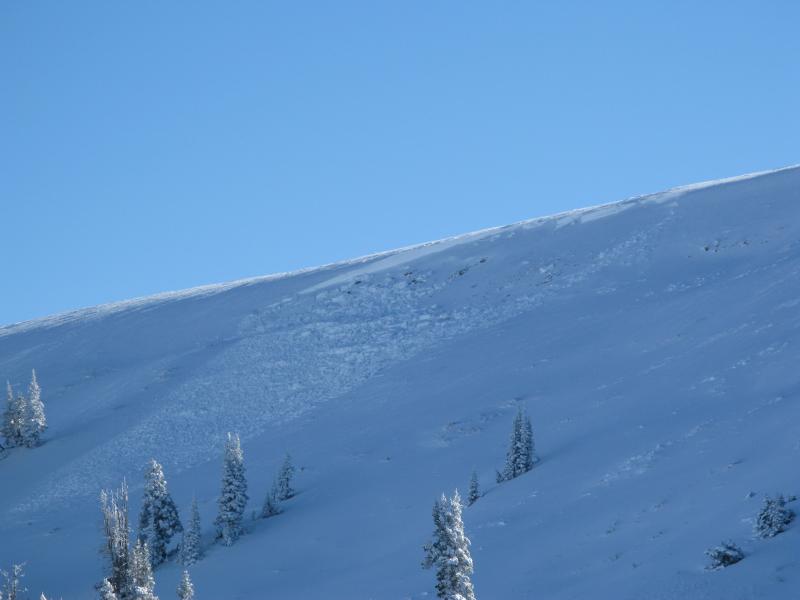
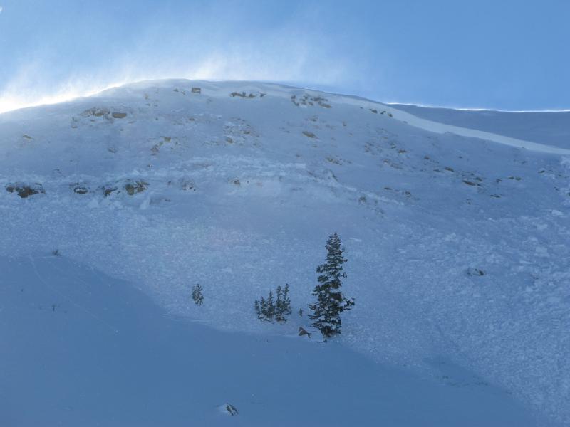
Terrain to avoid- steep, rocky terrain where a solid feeling slab overlies thin, weak snow. The avalanche danger is CONSIDERABLE and dangerous human triggered avalanches are likely.

A MODERATE avalanche danger exists in mid elevation terrain and human triggered avalanches are possible on steep wind drifted slopes.

LOW avalanche danger is found on low angle, wind sheltered slopes.

Low
Moderate
Considerable
High
Extreme
Learn how to read the forecast here
Special Announcements

The advisory expires 24 hours after the date and time posted, but will be updated by 7:00 AM Saturday December 29th.

Weather and Snow

This morning, skies are cloudy and there's a stray flurry or two in the air. Temperatures are in the mid 20's. Westerly winds gusted into the low 30's last night, but backed off early this morning and are in the mid teens. Recent winds have formed some funky snow conditions in upper elevation windward terrain, but in wind sheltered meadows the riding is deep and creamy.

Recent Avalanches

On Friday we came across this big avalanche which was remotely triggered from hundreds of feet away. Breaking to the ground, this is the type of avalanche dragon we're dealing with this weekend.

Click here to see a great video describing the slide below.

From Miller Flat trailhead looking up at the Phone Shot as we prepared for our field day.

Darce took this picture as we raced to the top of the slope to make sure no one was caught or buried. Fortunately neither was the case.

After the dust settled, I snapped this pic of Phone Shot on our way home. This gives you a great perspective of just how wide and deep avalanches are breaking.

Ad
Avalanche Problem #1
Persistent Weak Layer
Type
Location
Likelihood
Size
Description

A weak and complex snowpack exists on the Skyline and avalanche conditions are deceptively tricky. Last Tuesday's big storm essentially tripled our total snow depth and the snowpack is reeling, trying desperately to adjust to all this added weight. The past few days have been crazy and riders are able to trigger avalanches from a distance and on relatively flat terrain. This type of avalanche condition just doesn't go away in a few days... it lingers for long periods of time. Not much has changed overnight and once triggered, today's avalanches have the potential to break wide and deep, taking out the entire seasons snowpack, producing a very dangerous slide. Even if you're carving in low angle meadows make sure there's no steep slopes above or adjacent to where you're riding.

Avalanche Problem #2
Persistent Weak Layer
Type
Location
Likelihood
Size
Description

Winds have helped complicate the avalanche danger and are forming yet another layer of slab to our already sketchy snowpack. Today you'll want to avoid steep slopes facing the north half of the compass, especially those with recent deposits of wind drifted snow. Avalanches triggered in the fresh wind drifts can easily break deeper and wider than you might expect.

Additional Information

A weakening weather system moves across the region late this morning giving us a few scattered snow flurries and high temperatures in the mid to upper 20's. Winds should turn more southwesterly and remain pretty mellow with averages in the teens and gusts in the 30's along the high ridges. A stronger and colder system moves into the region late tonight, continuing through Monday night. The heaviest period of snow appears to be Monday morning into the early evening. We might be able to squeeze 6"-8" of new snow out of this system for Christmas.

General Announcements

Remember your information can save lives. If you see anything we should know about, please participate in the creation of our own community avalanche advisory by submitting snow and avalanche conditions. You can call me directly at 801-231-2170, email [email protected], or email by clicking HERE

This is a great time of year to schedule a free avalanche awareness presentation for your group or club. You can contact me at 801-231-2170 or email [email protected]

Donate to your favorite non-profit –The Friends of the Utah Avalanche Center. The UAC depends on contributions from users like you to support our work.

The information in this advisory is from the US Forest Service which is solely responsible for its content. This advisory describes general avalanche conditions and local variations always occur.

The advisory expires 24 hours after the date and time posted, but will be updated by 7:00 AM Saturday December 29th.