UDOT PLANNED AVALANCHE CLOSURES!!

Observation: Moab

Observation Date
12/20/2012
Observer Name
Max Forgensi
Region
Moab
Location Name or Route
Pre-Laurel Ridge, Coyote Chute
Weather
Sky
Clear
Weather Comments
Very calm day in the high country with good visibility.
Snow Characteristics
New Snow Depth
8"
Snow Surface Conditions
Powder
Wind Crust
Snow Characteristics Comments
8" was from Tuesday's 12/18 storm. Wind affected on ridge lines. Good powder in sheltered locations.
Red Flags
Red Flags
Recent Avalanches
Wind Loading
Collapsing
Poor Snowpack Structure
Red Flags Comments
Avalanche activity located as follows in the Gold Basin Drainage. Exxon's Right: N aspect, 11,400' SS-N-R1D2-I Tuk Shoulder: NE aspect, 11,500' SS-N-R1D2-I TUK NO: NE aspect, 11,500' SS-N-R3D2-I (see picture) Tuk No: West aspect, 11,500' (cross loaded) SS-N-R1D2-I Neil's Chute, Horse Creek: N aspect, 11,400' SS-N-R3D2-I-Stepped down to ground. Dory Canyon: NE aspect 11,300' SS-N-R2D2-I
Avalanche Problem #1
Problem
Persistent Weak Layer
Trend
Same
Problem #1 Comments
Wind slabs from recent storm under unaffected storm snow from the end of Tuesday's event. Widespread on wind-loaded or cross-loaded locations. Poor snow pack structure, fair strength, energy in the Q1/Q2 arena.
Snow Profile
Aspect
North
Elevation
11,400'
Slope Angle
24°
Comments
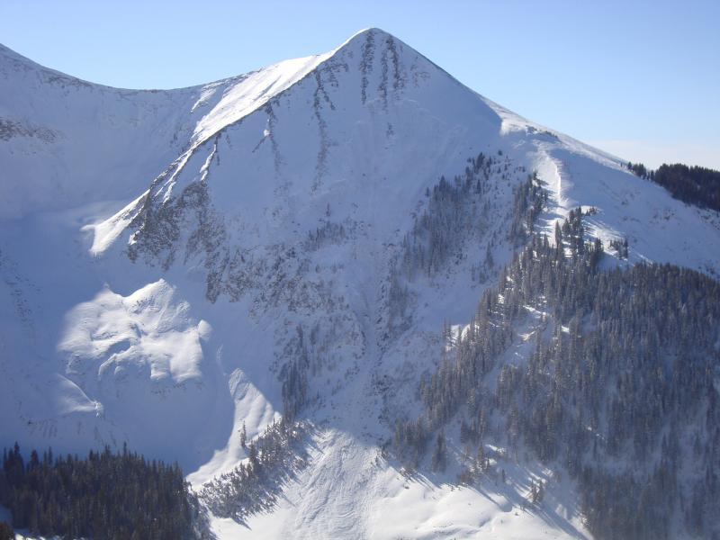
Here's a picture of the Tuk No slide R3D2. Good clean out for tours into Gold Basin. Lots of pockets available to trigger.
Coordinates