

Forecast for the Uintas Area Mountains

Tuesday morning, December 18, 2012
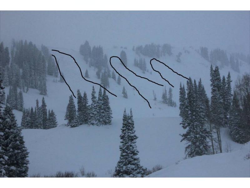
Terrain to avoid- mid and upper elevation leeward slopes facing the north half of the compass The avalanche danger is CONSIDERABLE on steep wind loaded slopes and dangerous human triggered avalanches are probable.
If you're looking for LOW avalanche danger head to low elevation, wind sheltered sheltered terrain.
Avalanche Warning
An Avalanche Warning is in effect for the western Uinta Mountains. Recent strong winds coupled with heavy snow will lead to dangerous human triggered avalanche today.
Avalanche Watch
 Weather and Snow
Holy cow... what a storm for the eastern front! An enhanced swath of precip focused on the terrain from Trial Lake to Currant Creek dumping close to 16" of snow in the past 24 hours. Most other areas received 6"-8" of snow. Winds raged into the 60's and 70's yesterday, dying down around 6:00 pm and are currently blowing out of the northwest at 10-20 mph. Today you can expect over-the-head and over-the-hood riding and turning conditions.
Recent observations can be found here.
Wondering why last winter was so crazy? Click here to watch the 2011-12 Utah Winter Review... an excellent recap of last years conditions.
 Recent Avalanches
A couple of natural slides were reported in Upper Weber Canyon. It appears they occurred during the height of the raging winds. Averaging 2'-3' feet and about 100-150' wide, these slides were breaking into the mid pack weaknesses formed during the late November dry spell.
Plenty of loud booming collapses are being reported, particularly in regions where the snowpack remains thin and shallow.

New Snow
Description
Visibility was limited yesterday and conditions were brutal along the high ridges, so not many people were out. However, the slides reported to us in Upper Weber Canyon tell a very distinct tale... strong snow overlies a layer of weak, sugary facets now buried in the mid portion of our snowpack. While we're probably turning the corner on natural avalanche activity, now the tricky part starts as we head out to play on the snow. Unless you're willing to take a few minutes to dig into the snow and investigate, avalanche conditions may seem manageable on the surface. Unfortunately, this type of composition feels strong under our skis, board, or sled, and allows to get well out onto steep slopes before they avalanche.
Persistent Weak Layer
Description
Once initiated, today's shallow slabs can quickly get out of hand, breaking into deeper buried weak layers as they crash down onto the slope below and they'll be packing a punch.
Additional Information
Today we'll see snow showers with a few additional inches possible. Northwest winds remain well behaved and in the 10-20 mph range. Temperatures drop throughout the day, skies begin to clear and overnight lows should be near -10 degrees.
General Announcements
Remember your information can save lives. If you see anything we should know about, please participate in the creation of our own community avalanche advisory by submitting snow and avalanche conditions. You can call me directly at 801-231-2170, email [email protected], or email by clicking HERE
This is a great time of year to schedule a free avalanche awareness presentation for your group or club. You can contact me at 801-231-2170 or email [email protected]
Donate to your favorite non-profit –The Friends of the Utah Avalanche Center. The UAC depends on contributions from users like you to support our work.
The information in this advisory is from the US Forest Service which is solely responsible for its content. This advisory describes general avalanche conditions and local variations always occur.
The information in this advisory expires 24 hours after the date and time posted, but will be updated by 7:00 AM Wednesday December 19th.