

Forecast for the Uintas Area Mountains

Wednesday morning, December 5, 2012
Terrain to avoid- steep, upper elevation, north facing slopes above treeline where you'll find a MODERATE avalanche danger. Fresh wind drifts will be reactive to the weight of a rider, breaking wider than you might expect. It's shallow out there and triggering even a small slide could take you for a season ending ride through rocks, stumps, and trees.
LOW avalanche danger exists on wind sheltered slopes.
 Special Announcements
Mirror Lake Highway is closed and plowing is done for the season. Wolf Creek Pass remains open, but don't let the easy access to nearby terrain lull you into a false sense of security. Be prepared for your own self rescue. Wear and know how to use a beacon, shovel, and probe.
 Weather and Snow
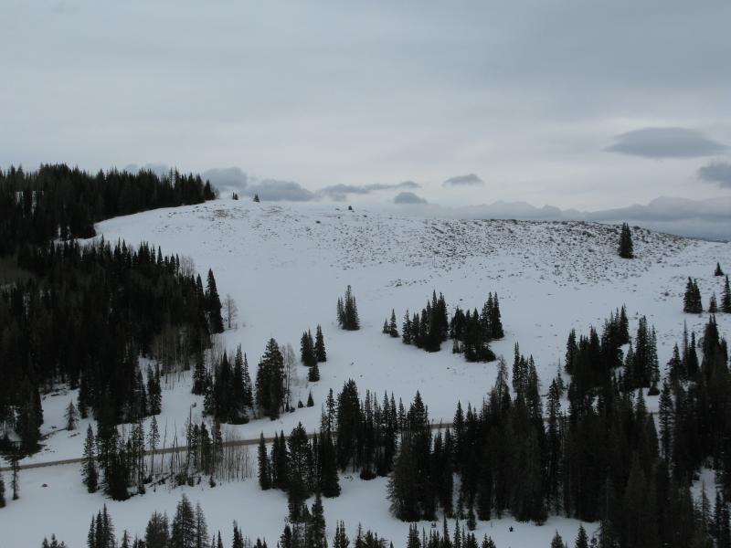
Skies are overcast and temperatures remain insanely mild under the influence of a moist southwest flow. Currently, it's in the upper 30's at 10,000' and near freezing at the trailheads. Southwest winds are obnoxious, blowing 25-35 mph along the ridges and gusting into the 50's and 60's along the high peaks. Today you'll find the best riding in mid elevation, wind sheltered, north facing terrain. Click here to check out our trip report from yesterday.

Sunday's wind channeled through terrain features creating wavy gravy surfaces in unusual locations.
South facing terrain remains pretty brushy even at the upper elevations.
Recent snow and avalanche observations can be found here.
Wondering why last winter was so crazy? Click here to watch the 2011-12 Utah Winter Review... an excellent recap of last years conditions.
 Recent Avalanches
No new avalanche activity to report.

Persistent Weak Layer
Description
Strong winds continue to form dense, hard wind slabs on steep, upper elevation north facing terrain. Yesterday, Ted and I were finding the fresh drifts stubborn and rather lifeless, but thought if you went hunting for an avalanche you could probably find one in the wind zone. Best to continue avoiding steep upper elevation slopes facing the north half of the compass, especially those where the snow surface looks fat and rounded or sounds hollow like a drum. Fortunately we have options and can avoid steep wind drifted terrain and still have a blast today. The softest snow and best riding will be found out of the wind at mid elevations.
Additional Information
Today look for mostly cloudy skies with snow developing late in the day through tonight. It's not a big storm, but we should see 3"-6" by Thursday morning. West and southwest winds continue to blow into the 30's and 40's along the high peaks. It'll be balmy with temperatures remaining in the mid to upper 30's today, dipping into the upper 20's overnight. Another weak system slides through the region Thursday and Thursday night with a break on Friday. A stronger system brings significantly colder air to the area over the weekend, but it's probably gonna be on the dry side and not a big snow producer.
General Announcements
Remember your information can save lives. If you see anything we should know about, please participate in the creation of our own community avalanche advisory by submitting snow and avalanche conditions. You can call me directly at 801-231-2170, email [email protected], or email by clicking HERE
This is a great time of year to schedule a free avalanche awareness presentation for your group or club. You can contact me at 801-231-2170 or email [email protected]
Donate to your favorite non-profit –The Friends of the Utah Avalanche Center. The UAC depends on contributions from users like you to support our work.
The information in this advisory is from the US Forest Service which is solely responsible for its content. This advisory describes general avalanche conditions and local variations always occur.
The information in this advisory expires 24 hours after the date and time posted, but will be updated by 7:00 AM Saturday December 8th.