Forecast for the Skyline Area Mountains

Craig Gordon
Issued by Craig Gordon for
Saturday, November 24, 2012

Terrain to avoid- steep, upper elevation wind loaded terrain where you could trigger an avalanche that could take you for a nasty ride. While isolated and limited to a small portion of the terrain, the consequences could be season ending.

In general you'll find a LOW avalanche danger in a vast majority of the terrain along the Skyline this weekend.

Low
Moderate
Considerable
High
Extreme
Learn how to read the forecast here
Special Announcements

The Manti-Skyline advisory program continues to function because of the very generous contributions you've made at our annual fundraisers along with the support from our non-profit Friends of the Utah Avalanche Center. Thanks to all of you for helping keep this vital resource up and running! We will be updating this weekend advisory by 7:0 AM each Saturday morning.

Weather and Snow

Skies are clear with temperatures in the low 30's. West and southwest winds began ramping up around 2:00 this morning and have been steadily blowing 15-25 mph along the high ridges. Last weekends rain at lower elevations and a recent bout of warm temperatures has had it's way with our snowpack. The Skyline remains thin and riding conditions are hit and miss, though soft settled powder can be found in upper elevation, wind sheltered, shady terrain.

Steve and Darce were out on the Skyline Summit yesterday and posted this great observation. We're having some issues on our end with the video, so you'll need to cut and paste into another browser.

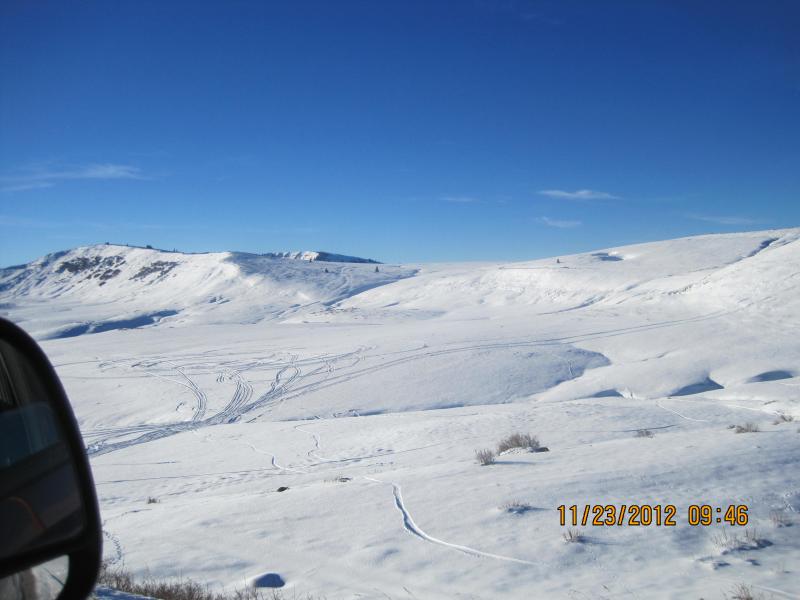
Low angle slopes near the summit offer the best coverage this weekend.

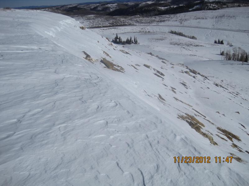
Overall though a lot of our terrain remains thin and rocky.

Recent Avalanches

No avalanche activity to report though Steve did get a slope to collapse yesterday on his second lap up the hill.

Ad
Avalanche Problem #1
Persistent Weak Layer
Type
Location
Likelihood
Size
Description

While there's not much snow available to transport, this morning's wind probably found enough loose snow to blow around and form a few fresh wind drifts. In general these will be isolated to high elevation, leeward terrain surrounding the Skyline. I don't think today's wind slabs will be overly sensitive, but if you got strained through rocks and trees in even a small slide it would be a season ending game changer. Best to avoid steep wind drifted slopes this weekend, especially if they appear fat and rounded or sound hollow like a drum.

Additional Information

High pressure homesteads over the region for the upcoming week. We can expect sunny skies, high temperatures climbing into the low 40's, and westerly winds blowing 15-25 mph along the ridges. A weak brush by slides to the east of the region on Sunday and we may see some clouds and wind, otherwise dry conditions prevail through the week. There's a hint for a pattern change late in the week suggesting snowy, unsettled conditions for next weekend.

General Announcements

Remember your information can save lives. If you see anything we should know about, please participate in the creation of our own community avalanche advisory by submitting snow and avalanche conditions. You can call me directly at 801-231-2170, email [email protected], or email by clicking HERE

This is a great time of year to schedule a free avalanche awareness presentation for your group or club. You can contact me at 801-231-2170 or email [email protected]

Donate to your favorite non-profit –The Friends of the Utah Avalanche Center. The UAC depends on contributions from users like you to support our work.

The information in this advisory expires 24 hours after the date and time posted, but will be updated by 7:00 AM Saturday December 1st.